
| Memorials | : | 20 |
| Location | : | Carling, Parry Sound District, Canada |
| Website | : | www.carling.ca/wp-content/uploads/7-Cemetery-By-law-2014-31.pdf. |
| Coordinate | : | 45.4265060, -80.1940630 |
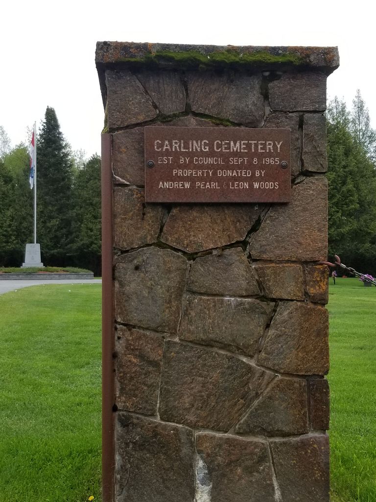
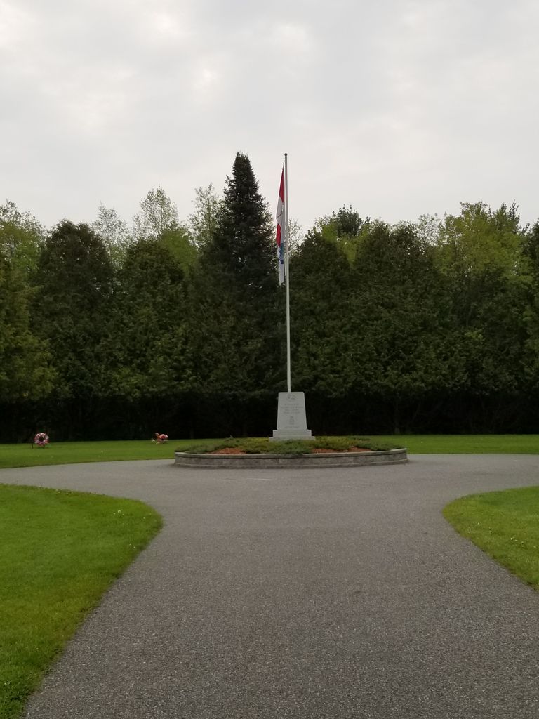
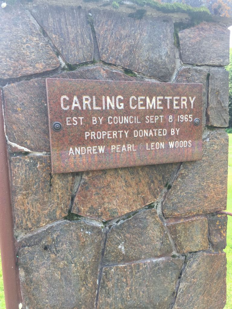
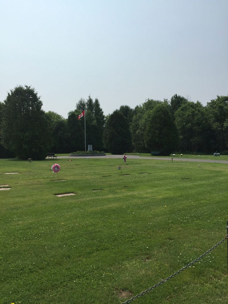
| Description | : | The Carling Cemetery is located on the south side of the road at 206 Highway 559. The cemetery is owned and maintained by the Township of Carling, which welcomes visitors to the site between 8 am and sunset daily. The cemetery is not maintained during winter months (November 16th to May 14th), and may be inaccessible at this time. Pets and recreational vehicles, including bicycles, are not allowed within the cemetery grounds. |
frequently asked questions (FAQ):
-
Where is Carling Cemetery?
Carling Cemetery is located at Highway 559 Carling, Parry Sound District ,Ontario ,Canada.
-
Carling Cemetery cemetery's updated grave count on graveviews.com?
20 memorials
-
Where are the coordinates of the Carling Cemetery?
Latitude: 45.4265060
Longitude: -80.1940630
Nearby Cemetories:
1. Nobel United Church Cemetery
Nobel, Parry Sound District, Canada
Coordinate: 45.4049470, -80.0661660
2. Wasauksing First Nation New
Parry Island First Nation, Parry Sound District, Canada
Coordinate: 45.3226360, -80.0679300
3. Hillcrest Cemetery
Parry Sound, Parry Sound District, Canada
Coordinate: 45.3541700, -80.0239200
4. Wasauksing First Nation Cemetery
Parry Island First Nation, Parry Sound District, Canada
Coordinate: 45.3100700, -80.0832530
5. Islanders Around Bateau Family Memorials
Georgian Bay, Muskoka District Municipality, Canada
Coordinate: 45.3020418, -80.2926485
6. Sylvan Acres Cemetery
Waubamik, Parry Sound District, Canada
Coordinate: 45.4527300, -79.9746500
7. Thompson Cemetery
McKellar, Parry Sound District, Canada
Coordinate: 45.4885510, -79.9353680
8. Hurdville Cemetery
Hurdville, Parry Sound District, Canada
Coordinate: 45.4330280, -79.9133890
9. United Church Cemetery
McKellar, Parry Sound District, Canada
Coordinate: 45.5074400, -79.9176600
10. Foley Memorial Cemetery
Foley, Parry Sound District, Canada
Coordinate: 45.3034000, -79.9471600
11. St. Stephen's Cemetery
Broadbent, Parry Sound District, Canada
Coordinate: 45.4668500, -79.8290250
12. Dunchurch-Fairholme Cemetery
Dunchurch, Parry Sound District, Canada
Coordinate: 45.5963989, -79.9045702
13. Christie Memorial Cemetery
Orrville, Parry Sound District, Canada
Coordinate: 45.3761830, -79.8124070
14. Maple Island Cemetery
Maple Island, Parry Sound District, Canada
Coordinate: 45.6994100, -79.8725300
15. Seguin Falls Cemetery
Seguin Falls, Parry Sound District, Canada
Coordinate: 45.4362495, -79.6823644
16. Dorothy Meyers Burial Site
Moon River, Muskoka District Municipality, Canada
Coordinate: 45.1111704, -79.9387148
17. Dufferin Methodist Cemetery
Spence, Parry Sound District, Canada
Coordinate: 45.4846896, -79.6830158
18. Humphrey-Conger Union Cemetery
Seguin, Parry Sound District, Canada
Coordinate: 45.1937120, -79.7893240
19. Ahmic Harbour Cemetery
Ahmic Harbour, Parry Sound District, Canada
Coordinate: 45.6623383, -79.7782211
20. Rosseau Anglican Church of The Redeemer Cemetery
Seguin, Parry Sound District, Canada
Coordinate: 45.2807900, -79.6780750
21. Humphrey-Rosseau Union Cemetery
Rosseau, Parry Sound District, Canada
Coordinate: 45.2653530, -79.6509330
22. Britt and Area Community Cemetery
Parry Sound District, Canada
Coordinate: 45.7732630, -80.5688640
23. MacTier Union Cemetery
MacTier, Muskoka District Municipality, Canada
Coordinate: 45.1178500, -79.7577800
24. Foot's Bay Cemetery
Muskoka, Muskoka District Municipality, Canada
Coordinate: 45.1179700, -79.7574300