
| Memorials | : | 0 |
| Location | : | Deep Gap, Watauga County, USA |
| Coordinate | : | 36.2258200, -81.5147500 |
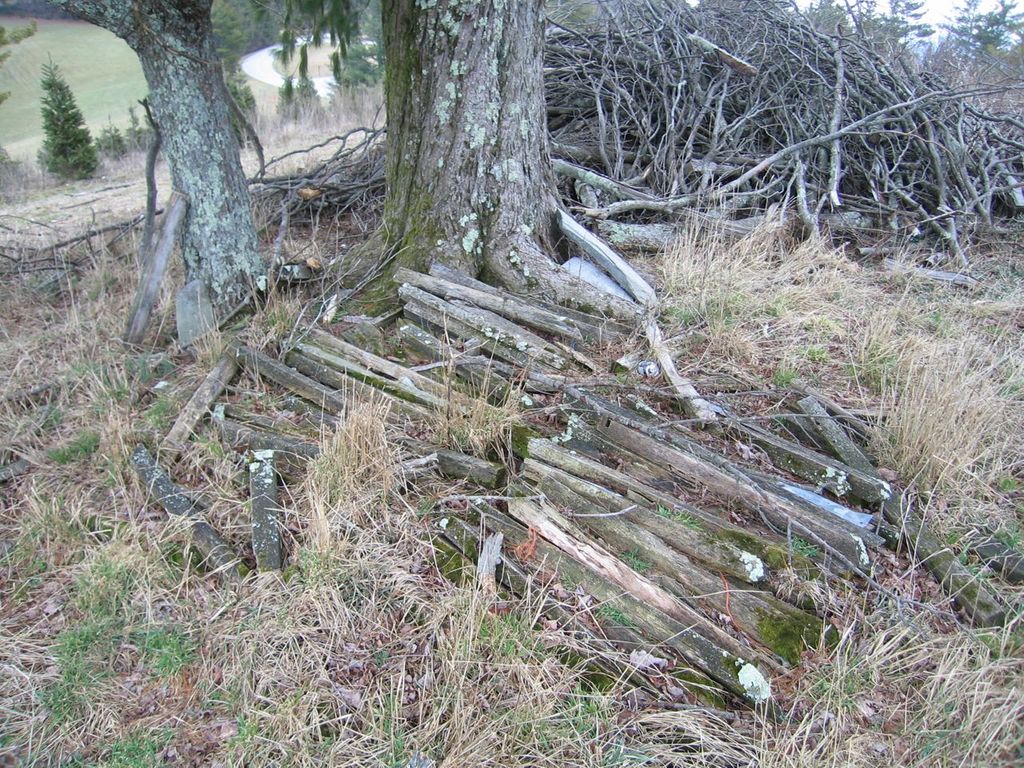
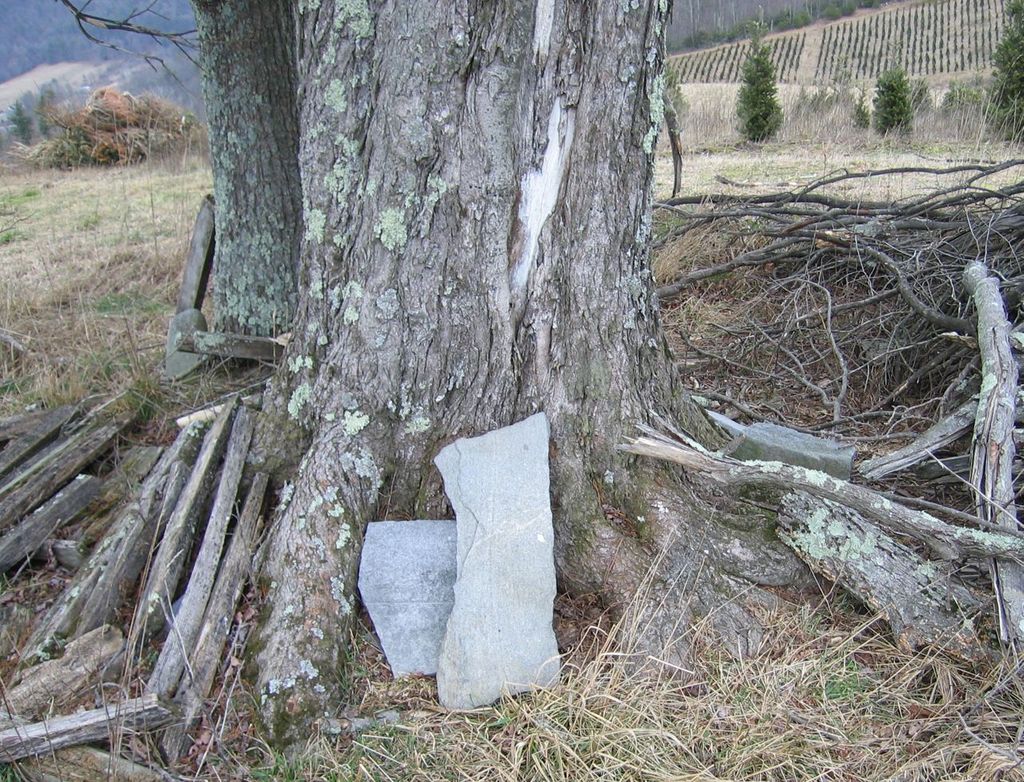
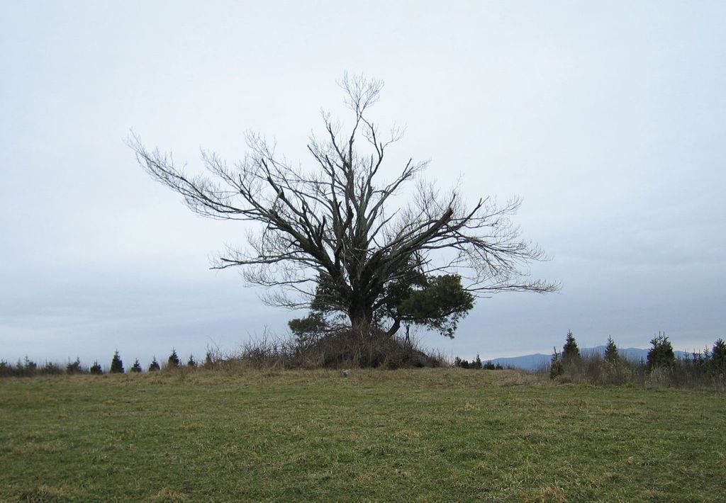
| Description | : | Heading North from Boone/Blowing Rock, NC go to Mile Marker 278 on the Blue Ridge Parkway. Cemetery is on left approximately 150 feet from the road under a very large tree. Although this cemetery does appear on TOPO maps, as of Jan. 2012 there is very little remaining. No engraved markers were found and only two unengraved markers stacked against the tree. The fence posts had been piled up. The interments included here are based on a 1978 survey of the cemetery. Notes from the survey indicate that all of this information was extremely difficult to read and may be in error. (Solomon... Read More |
frequently asked questions (FAQ):
-
Where is Carroll Gap Cemetery?
Carroll Gap Cemetery is located at Deep Gap, Watauga County ,North Carolina ,USA.
-
Carroll Gap Cemetery cemetery's updated grave count on graveviews.com?
0 memorials
-
Where are the coordinates of the Carroll Gap Cemetery?
Latitude: 36.2258200
Longitude: -81.5147500
Nearby Cemetories:
1. Calvin Miller Family Cemetery
Deep Gap, Watauga County, USA
Coordinate: 36.2179500, -81.5055200
2. Sanders Cemetery
Deep Gap, Watauga County, USA
Coordinate: 36.2263600, -81.5295800
3. Corner Stone Baptist Church Cemetery
Deep Gap, Watauga County, USA
Coordinate: 36.2231660, -81.5331350
4. Trinity Baptist Church Cemetery
Deep Gap, Watauga County, USA
Coordinate: 36.2375060, -81.5277400
5. Watson Family Cemetery
Deep Gap, Watauga County, USA
Coordinate: 36.2406300, -81.5244000
6. Samuel Greer Family Cemetery
Laxon, Watauga County, USA
Coordinate: 36.2302700, -81.5353100
7. Mount Paran Baptist Church Cemetery
Watauga County, USA
Coordinate: 36.2050000, -81.5049900
8. Church Family Cemetery
Watauga County, USA
Coordinate: 36.2371700, -81.4905400
9. Idol Family Cemetery
Watauga County, USA
Coordinate: 36.2487380, -81.5300720
10. Old Gap Creek Church Cemetery
Boone, Watauga County, USA
Coordinate: 36.2504500, -81.5035500
11. Stony Fork Baptist Church Cemetery
Deep Gap, Watauga County, USA
Coordinate: 36.2117710, -81.4872210
12. Laurel Springs Cemetery
Deep Gap, Watauga County, USA
Coordinate: 36.2352300, -81.5484670
13. Hallie & Melvin Trivette Hill
Deep Gap, Watauga County, USA
Coordinate: 36.2211000, -81.4770400
14. David Greene Family Cemetery
Deep Gap, Watauga County, USA
Coordinate: 36.2107900, -81.4807570
15. Solomon Greene
Boone, Watauga County, USA
Coordinate: 36.2157310, -81.4738740
16. Greene Family Cemetery
Brownwood, Ashe County, USA
Coordinate: 36.2622900, -81.5168400
17. Powers-Miller Family Cemetery
Brownwood, Ashe County, USA
Coordinate: 36.2614300, -81.5029600
18. Waters Family Cemetery
Brownwood, Ashe County, USA
Coordinate: 36.2636000, -81.5180600
19. Alfred Miller Cemetery
Deep Gap, Watauga County, USA
Coordinate: 36.2045340, -81.4737160
20. Simmons Family Cemetery
Deep Gap, Watauga County, USA
Coordinate: 36.2038612, -81.5598068
21. John Alexander Miller Family Cemetery
Watauga County, USA
Coordinate: 36.2613000, -81.5441400
22. Watson Family Cemetery
Deep Gap, Watauga County, USA
Coordinate: 36.1835500, -81.5245900
23. Hardin-Day Cemetery
Boone, Watauga County, USA
Coordinate: 36.2390800, -81.5656800
24. Watson Cemetery
Brownwood, Ashe County, USA
Coordinate: 36.2662500, -81.5358500