
| Memorials | : | 0 |
| Location | : | Weston, Platte County, USA |
| Coordinate | : | 39.4928700, -94.9797600 |
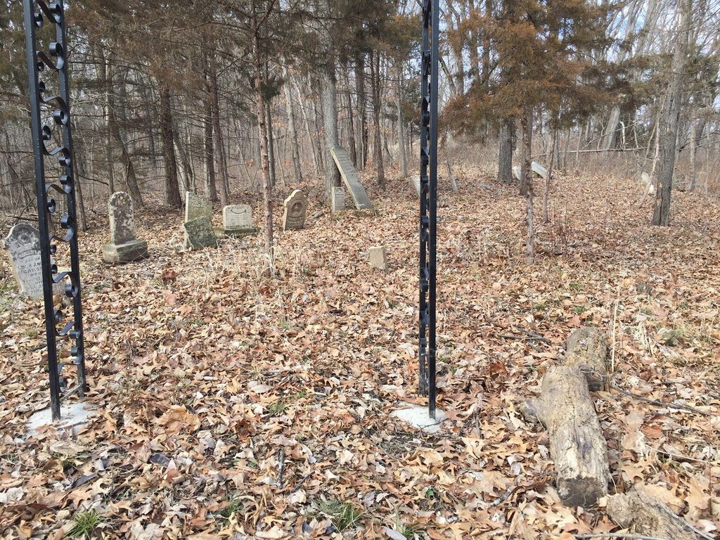
| Description | : | The Carson family was from Ireland, and first came to Platte County in 1846 (in the midst of the Potato Famine). Members of the Carson family owned this property from 1851-1883. John H. Carson brought his family, parents, and a single woman who was likely his sister. He sold Bibles for the Tract Society, and according to Paxton’s Annals of Platte County, he fell dead while delivering a Bible to a purchaser, with the half-uttered sentence, “I must do all the good I can while---.” Members of the Carson, Prather/Prater, Brill (all related) and Rambo families are all buried in... Read More |
frequently asked questions (FAQ):
-
Where is Carson Family Cemetery?
Carson Family Cemetery is located at Driskell Lane Weston, Platte County ,Missouri ,USA.
-
Carson Family Cemetery cemetery's updated grave count on graveviews.com?
0 memorials
-
Where are the coordinates of the Carson Family Cemetery?
Latitude: 39.4928700
Longitude: -94.9797600
Nearby Cemetories:
1. Iatan Cemetery
Iatan, Platte County, USA
Coordinate: 39.4776192, -94.9844818
2. Alexander-McAdow Cemetery
Platte County, USA
Coordinate: 39.4861400, -94.9593600
3. Bellis Cemetery
Platte County, USA
Coordinate: 39.5142400, -94.9933800
4. Mount Bethel Cemetery
Platte County, USA
Coordinate: 39.4968300, -94.9478226
5. Conard Memorial Park
Bean Lake Station, Platte County, USA
Coordinate: 39.5089637, -95.0088959
6. Bean Family Cemetery
Bean Lake Station, Platte County, USA
Coordinate: 39.5108200, -95.0100900
7. Blythe Family Cemetery
Platte County, USA
Coordinate: 39.5226500, -94.9832800
8. Cook Cemetery
Iatan, Platte County, USA
Coordinate: 39.4716100, -94.9522100
9. Moore Cemetery
Platte County, USA
Coordinate: 39.4928400, -94.9378200
10. Dyer Cemetery
Platte County, USA
Coordinate: 39.4734200, -94.9431400
11. Hutson Cemetery
Platte County, USA
Coordinate: 39.5297500, -95.0000700
12. Risk Cemetery
Weston, Platte County, USA
Coordinate: 39.4680700, -94.9375700
13. Foley Cemetery
Sugar Lake, Buchanan County, USA
Coordinate: 39.5333000, -94.9905800
14. Ross Cemetery
Weston, Platte County, USA
Coordinate: 39.5119200, -94.9298200
15. Coleman Cemetery
Platte County, USA
Coordinate: 39.5241200, -95.0180500
16. Graves Cemetery
Platte County, USA
Coordinate: 39.4601200, -94.9430700
17. Newby-Layton Cemetery
Weston, Platte County, USA
Coordinate: 39.4796400, -94.9193400
18. James Ellison Family Cemetery
De Kalb, Buchanan County, USA
Coordinate: 39.5340347, -94.9381027
19. Ellison Cemetery
Mock Corner, Buchanan County, USA
Coordinate: 39.5341400, -94.9380500
20. Kirkpatrick Cemetery
Platte County, USA
Coordinate: 39.4526100, -94.9362000
21. Johnson and Bloomer Cemetery (Defunct)
Port Williams, Atchison County, USA
Coordinate: 39.4585700, -95.0341900
22. Bluma Cemetery (Defunct)
Port Williams, Atchison County, USA
Coordinate: 39.4557900, -95.0393200
23. Hightower and Cook Cemetery
Port Williams, Atchison County, USA
Coordinate: 39.4573100, -95.0421900
24. Sapp Cemetery
Oak Mills, Atchison County, USA
Coordinate: 39.4431000, -95.0233002