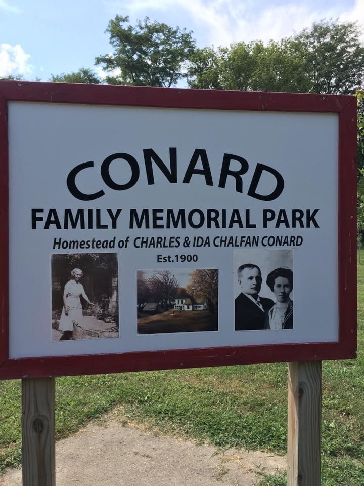
| Memorials | : | 0 |
| Location | : | Bean Lake Station, Platte County, USA |
| Coordinate | : | 39.5089637, -95.0088959 |
| Description | : | Conard Memorial Park is a park dedicated to Charles C. Conard and his wife Ida Jane Chalfan Conard. Charles built a house here in 1902 for his new bride and they raised a family of six children. The land has been turned into a gathering place for the descendants of the Conard family for family reunions and other activities. Some of the descendants have requested their ashes be placed here. |
frequently asked questions (FAQ):
-
Where is Conard Memorial Park?
Conard Memorial Park is located at Bean Lake Station, Platte County ,Missouri , 64484USA.
-
Conard Memorial Park cemetery's updated grave count on graveviews.com?
0 memorials
-
Where are the coordinates of the Conard Memorial Park?
Latitude: 39.5089637
Longitude: -95.0088959
Nearby Cemetories:
1. Bean Family Cemetery
Bean Lake Station, Platte County, USA
Coordinate: 39.5108200, -95.0100900
2. Bellis Cemetery
Platte County, USA
Coordinate: 39.5142400, -94.9933800
3. Coleman Cemetery
Platte County, USA
Coordinate: 39.5241200, -95.0180500
4. Hutson Cemetery
Platte County, USA
Coordinate: 39.5297500, -95.0000700
5. Blythe Family Cemetery
Platte County, USA
Coordinate: 39.5226500, -94.9832800
6. Carson Family Cemetery
Weston, Platte County, USA
Coordinate: 39.4928700, -94.9797600
7. Foley Cemetery
Sugar Lake, Buchanan County, USA
Coordinate: 39.5333000, -94.9905800
8. Iatan Cemetery
Iatan, Platte County, USA
Coordinate: 39.4776192, -94.9844818
9. Gore Cemetery
Buchanan County, USA
Coordinate: 39.5489006, -95.0147018
10. Alexander-McAdow Cemetery
Platte County, USA
Coordinate: 39.4861400, -94.9593600
11. Sugar Creek Cemetery
Rushville, Buchanan County, USA
Coordinate: 39.5569470, -95.0016120
12. Mount Bethel Cemetery
Platte County, USA
Coordinate: 39.4968300, -94.9478226
13. Elliott Cemetery
Buchanan County, USA
Coordinate: 39.5582200, -95.0079900
14. Brown Cemetery
Rushville, Buchanan County, USA
Coordinate: 39.5606500, -94.9935300
15. Johnson and Bloomer Cemetery (Defunct)
Port Williams, Atchison County, USA
Coordinate: 39.4585700, -95.0341900
16. DeWeese Cemetery (Defunct)
Port Williams, Atchison County, USA
Coordinate: 39.4627500, -95.0473400
17. Gordon Graveyard
Rushville, Buchanan County, USA
Coordinate: 39.5607400, -95.0352900
18. Moore Cemetery
Platte County, USA
Coordinate: 39.4928400, -94.9378200
19. Cook Cemetery
Iatan, Platte County, USA
Coordinate: 39.4716100, -94.9522100
20. Hightower and Cook Cemetery
Port Williams, Atchison County, USA
Coordinate: 39.4573100, -95.0421900
21. Allison Homestead Graveyard
Rushville, Buchanan County, USA
Coordinate: 39.5659100, -95.0211900
22. Bluma Cemetery (Defunct)
Port Williams, Atchison County, USA
Coordinate: 39.4557900, -95.0393200
23. Heatherly Cemetery
Dalbey, Atchison County, USA
Coordinate: 39.4979000, -95.0829400
24. Schmidt Graves
Rushville, Buchanan County, USA
Coordinate: 39.5616330, -95.0416950

