
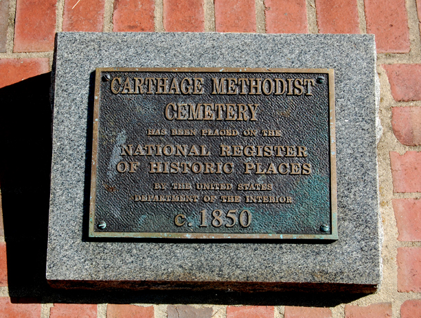
| Memorials | : | 1 |
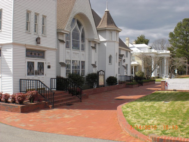
| Location | : | Carthage, Moore County, USA |
| Coordinate | : | 35.3508030, -79.4214230 |
frequently asked questions (FAQ):
-
Where is Carthage United Methodist Church Cemetery?
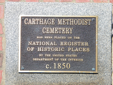
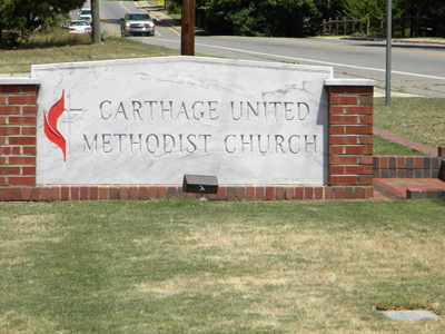
Carthage United Methodist Church Cemetery is located at 401 McReynolds Street Carthage, Moore County ,North Carolina , 28327USA.
-
Carthage United Methodist Church Cemetery cemetery's updated grave count on graveviews.com?
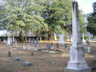
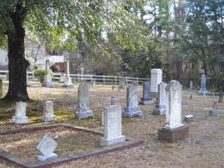
1 memorials
-
Where are the coordinates of the Carthage United Methodist Church Cemetery?
Latitude: 35.3508030
Longitude: -79.4214230
Nearby Cemetories:
1. First Presbyterian Church Cemetery
Moore County, USA
Coordinate: 35.3459180, -79.4202590
2. Carthage Presbyterian Church Cemetery
Carthage, Moore County, USA
Coordinate: 35.3465070, -79.4183190
3. Cross Hill Cemetery
Carthage, Moore County, USA
Coordinate: 35.3561040, -79.4299240
4. Saint Augustine AME Zion Church Cemetery
Carthage, Moore County, USA
Coordinate: 35.3409460, -79.4253210
5. Muse-Glascock Family Cemetery
Carthage, Moore County, USA
Coordinate: 35.3575211, -79.4321289
6. John Hall Presbyterian Church Cemetery
Carthage, Moore County, USA
Coordinate: 35.3419230, -79.4296210
7. First Missionary Baptist Church Cemetery
Carthage, Moore County, USA
Coordinate: 35.3654450, -79.4160830
8. Saint Johns Holy Church of God Cemetery
Carthage, Moore County, USA
Coordinate: 35.3574510, -79.4405290
9. Mount Olive AME Zion Church Cemetery
Carthage, Moore County, USA
Coordinate: 35.3567530, -79.4424460
10. Stony Hill Free Will Baptist Church Cemetery
Carthage, Moore County, USA
Coordinate: 35.3353860, -79.4073180
11. Community Friends Church Cemetery
Carthage, Moore County, USA
Coordinate: 35.3417360, -79.3957510
12. Sassafras Springs Cemetery
Carthage, Moore County, USA
Coordinate: 35.3202400, -79.4099100
13. Priest Hill Presbyterian Church Cemetery
Carthage, Moore County, USA
Coordinate: 35.3695820, -79.3839880
14. Trinity Bible Church Cemetery
Carthage, Moore County, USA
Coordinate: 35.3215750, -79.3938350
15. Warner Family Cemetery
Carthage, Moore County, USA
Coordinate: 35.3398440, -79.4695190
16. Summer Hill Baptist Church Cemetery
Carthage, Moore County, USA
Coordinate: 35.3093470, -79.4372090
17. Emmanuel Baptist Church Cemetery
Carthage, Moore County, USA
Coordinate: 35.3569160, -79.3615360
18. Bethlehem Baptist Church Cemetery
Carthage, Moore County, USA
Coordinate: 35.3525150, -79.4856250
19. Pleasant Hill Freewill Baptist Church Cemetery
Carthage, Moore County, USA
Coordinate: 35.4067770, -79.4425240
20. Red Branch Baptist Church Cemetery
Carthage, Moore County, USA
Coordinate: 35.3826320, -79.3548600
21. Stone Chapel Baptist Church Cemetery
Carthage, Moore County, USA
Coordinate: 35.3593300, -79.3418900
22. Victory Community Baptist Church Cemetery
Carthage, Moore County, USA
Coordinate: 35.2877820, -79.4522750
23. Union Presbyterian Church Cemetery
Carthage, Moore County, USA
Coordinate: 35.3164650, -79.3483260
24. Davis Family Cemetery
Robbins, Moore County, USA
Coordinate: 35.3798600, -79.4992600