
| Memorials | : | 0 |
| Location | : | Carthage, Moore County, USA |
| Coordinate | : | 35.3398440, -79.4695190 |
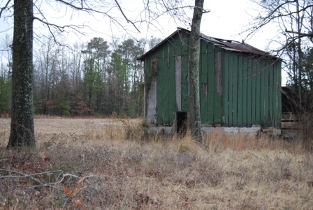
| Description | : | After turning onto Lamms Grove Road from Bethlehem Church Road, travel @ 1 mile. On right is an old barn. Park here. Walk towards the right across a field, there is an oak and cedar grove. Cemetery is best found in winter. |
frequently asked questions (FAQ):
-
Where is Warner Family Cemetery?
Warner Family Cemetery is located at Lamms Road Carthage, Moore County ,North Carolina ,USA.
-
Warner Family Cemetery cemetery's updated grave count on graveviews.com?
0 memorials
-
Where are the coordinates of the Warner Family Cemetery?
Latitude: 35.3398440
Longitude: -79.4695190

Nearby Cemetories:
1. Bethlehem Baptist Church Cemetery
Carthage, Moore County, USA
Coordinate: 35.3525150, -79.4856250
2. Mount Olive AME Zion Church Cemetery
Carthage, Moore County, USA
Coordinate: 35.3567530, -79.4424460
3. Saint Johns Holy Church of God Cemetery
Carthage, Moore County, USA
Coordinate: 35.3574510, -79.4405290
4. John Hall Presbyterian Church Cemetery
Carthage, Moore County, USA
Coordinate: 35.3419230, -79.4296210
5. Muse-Glascock Family Cemetery
Carthage, Moore County, USA
Coordinate: 35.3575211, -79.4321289
6. Saint Augustine AME Zion Church Cemetery
Carthage, Moore County, USA
Coordinate: 35.3409460, -79.4253210
7. Cross Hill Cemetery
Carthage, Moore County, USA
Coordinate: 35.3561040, -79.4299240
8. Summer Hill Baptist Church Cemetery
Carthage, Moore County, USA
Coordinate: 35.3093470, -79.4372090
9. First Presbyterian Church Cemetery
Moore County, USA
Coordinate: 35.3459180, -79.4202590
10. Carthage United Methodist Church Cemetery
Carthage, Moore County, USA
Coordinate: 35.3508030, -79.4214230
11. Carthage Presbyterian Church Cemetery
Carthage, Moore County, USA
Coordinate: 35.3465070, -79.4183190
12. Davis Family Cemetery
Robbins, Moore County, USA
Coordinate: 35.3798600, -79.4992600
13. Ingram Branch Presbyterian Church Cemetery
West End, Moore County, USA
Coordinate: 35.2900570, -79.4727800
14. First Missionary Baptist Church Cemetery
Carthage, Moore County, USA
Coordinate: 35.3654450, -79.4160830
15. Old Scotch Graveyard
Moore County, USA
Coordinate: 35.3471260, -79.5309753
16. Stony Hill Free Will Baptist Church Cemetery
Carthage, Moore County, USA
Coordinate: 35.3353860, -79.4073180
17. Scott Cemetery
Moore County, USA
Coordinate: 35.3469009, -79.5317001
18. Sassafras Springs Cemetery
Carthage, Moore County, USA
Coordinate: 35.3202400, -79.4099100
19. Fairview Baptist Church Cemetery
West End, Moore County, USA
Coordinate: 35.2903633, -79.4917068
20. Victory Community Baptist Church Cemetery
Carthage, Moore County, USA
Coordinate: 35.2877820, -79.4522750
21. Doubs Chapel United Methodist Church Cemetery
West End, Moore County, USA
Coordinate: 35.2835840, -79.4743410
22. Chestley Horner Grave Marker
Robbins, Moore County, USA
Coordinate: 35.3925143, -79.5013028
23. Community Friends Church Cemetery
Carthage, Moore County, USA
Coordinate: 35.3417360, -79.3957510
24. Calvary Baptist Church Cemetery
Carthage, Moore County, USA
Coordinate: 35.3935980, -79.5044520