
| Memorials | : | 0 |
| Location | : | Atlantic County, USA |
| Coordinate | : | 39.4082794, -74.7136078 |
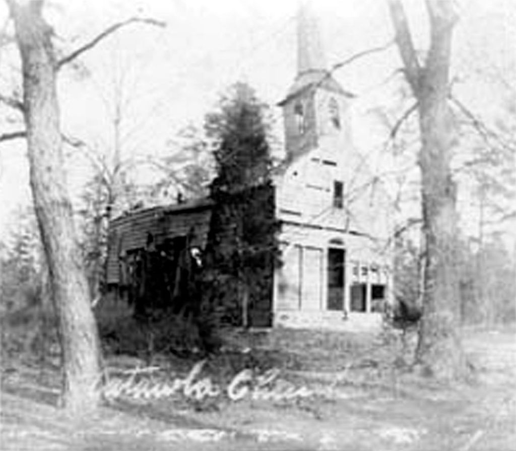
| Description | : | What is left of the cemetery is in the woods perpendicular to the Mays Landing-Somers Point Road at the sign. You can see a few depressions in the ground from the historical marker. This is the burial ground of the George West family, whose elegant home was across the road from the church. In 1829, the local people became suspicious of Joseph West, a lawyer by profession, when his father George, mother Amy, and brothers James S and George S all died of a "short illness" within 22 days, leaving Joseph the sole heir of the family estate. Joseph was an... Read More |
frequently asked questions (FAQ):
-
Where is Catawba Church and Burying Ground?
Catawba Church and Burying Ground is located at Atlantic County ,New Jersey ,USA.
-
Catawba Church and Burying Ground cemetery's updated grave count on graveviews.com?
0 memorials
-
Where are the coordinates of the Catawba Church and Burying Ground?
Latitude: 39.4082794
Longitude: -74.7136078

Nearby Cemetories:
1. Smith-Ireland Burying Ground
Estellville, Atlantic County, USA
Coordinate: 39.4151800, -74.7329640
2. Atlantic County Veterans Cemetery
Estell Manor, Atlantic County, USA
Coordinate: 39.3882790, -74.7386017
3. Steelmans Creek Burial Ground
Estell Manor, Atlantic County, USA
Coordinate: 39.3878517, -74.7388687
4. Estellville Methodist Church Cemetery
Mays Landing, Atlantic County, USA
Coordinate: 39.3976900, -74.7477700
5. Methodist Burying Ground
Estellville, Atlantic County, USA
Coordinate: 39.3978615, -74.7480164
6. Union Cemetery
Mays Landing, Atlantic County, USA
Coordinate: 39.4373894, -74.7080536
7. Old Burying Ground
Estellville, Atlantic County, USA
Coordinate: 39.3959680, -74.7518810
8. Lincoln Memorial Park
Mays Landing, Atlantic County, USA
Coordinate: 39.4478493, -74.6872635
9. Westcott Free Burying Ground
Mays Landing, Atlantic County, USA
Coordinate: 39.4526215, -74.7281189
10. Holy Cross Cemetery and Chapel Mausoleum
Mays Landing, Atlantic County, USA
Coordinate: 39.4490395, -74.6839523
11. Presbyterian Cemetery
Mays Landing, Atlantic County, USA
Coordinate: 39.4539185, -74.7269821
12. Asbury Methodist Episcopal Church Cemetery
English Creek, Atlantic County, USA
Coordinate: 39.3621483, -74.6706314
13. Carmantown Cemetery
Carmantown, Atlantic County, USA
Coordinate: 39.4483250, -74.6446000
14. Palestine Bible Protestant Church Cemetery
Scullville, Atlantic County, USA
Coordinate: 39.3487091, -74.6608810
15. Bethlehem Evangelical Lutheran Cemetery
Dorothy, Atlantic County, USA
Coordinate: 39.4056396, -74.8247070
16. Saint Bernard Clairvaux Roman Catholic Cemetery
Dorothy, Atlantic County, USA
Coordinate: 39.4073067, -74.8260803
17. Estell Manor Community Church Cemetery
Estell Manor, Atlantic County, USA
Coordinate: 39.3763160, -74.8270490
18. Laurel Memorial Park and Crematory
Egg Harbor Township, Atlantic County, USA
Coordinate: 39.4565887, -74.5941925
19. Zion United Methodist Church Cemetery
Egg Harbor Township, Atlantic County, USA
Coordinate: 39.3674200, -74.5880000
20. Zion Cemetery
Bargaintown, Atlantic County, USA
Coordinate: 39.3661390, -74.5885100
21. Beth Kehillah Cemetery
Egg Harbor Township, Atlantic County, USA
Coordinate: 39.4091250, -74.5689580
22. Emeth Shalom Cemetery
Egg Harbor Township, Atlantic County, USA
Coordinate: 39.4067154, -74.5674896
23. Rodef Sholom Cemetery
Egg Harbor Township, Atlantic County, USA
Coordinate: 39.4080000, -74.5670500
24. Old Weymouth Meeting House Cemetery
Weymouth, Atlantic County, USA
Coordinate: 39.5122070, -74.7802200