
| Memorials | : | 0 |
| Location | : | West Bend, Washington County, USA |
| Coordinate | : | 43.3944500, -88.2410500 |
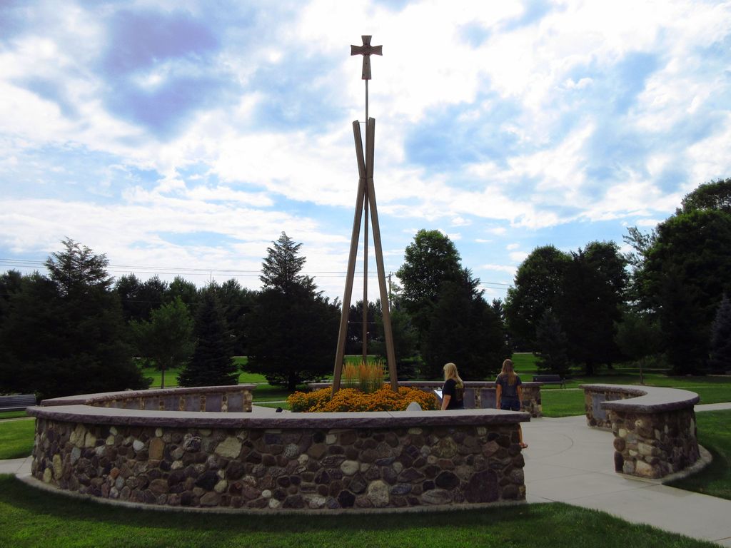
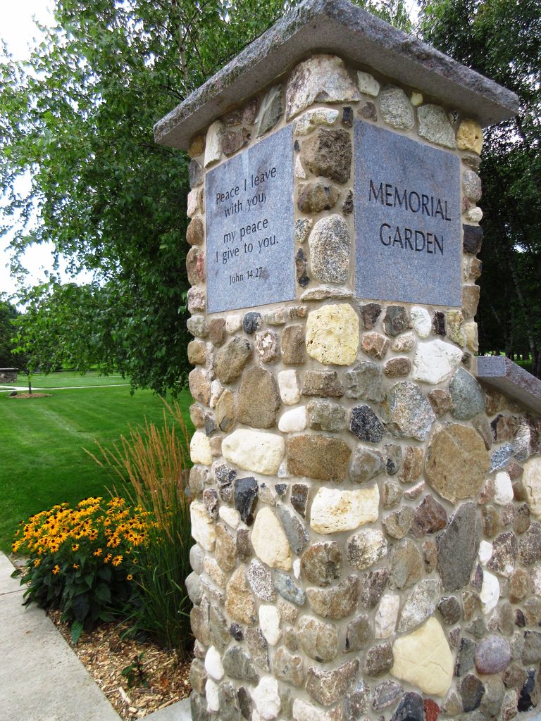
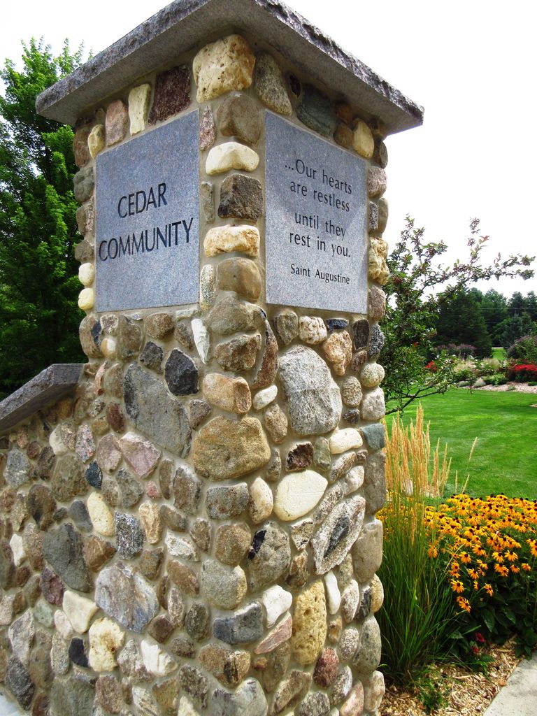
| Description | : | A sacred place of natural beauty where … Lives are remembered, Relationships honored, Families cherished, and Faith sustained. Founded by Cedar Community residents in 2010 and dedicated on September 13, 2012, the Cedar Community Memorial Garden is a uniquely meaningful and comforting final resting place for loved ones' cremains. It is overseen by a volunteer Memorial Garden Council and managed by the Cedar Community Foundation. Memorial trees, benches, markers and other tributes also are available. |
frequently asked questions (FAQ):
-
Where is Cedar Community Memorial Garden?
Cedar Community Memorial Garden is located at 5595 Cty Rd Z West Bend, Washington County ,Wisconsin , 53095-3654USA.
-
Cedar Community Memorial Garden cemetery's updated grave count on graveviews.com?
0 memorials
-
Where are the coordinates of the Cedar Community Memorial Garden?
Latitude: 43.3944500
Longitude: -88.2410500

Nearby Cemetories:
1. Saint Pauls Evangelical Lutheran Cemetery
West Bend, Washington County, USA
Coordinate: 43.3871640, -88.2409970
2. Washington County Memorial Park
West Bend, Washington County, USA
Coordinate: 43.3998200, -88.2028800
3. Saint Matthias Catholic Cemetery
Nabob, Washington County, USA
Coordinate: 43.4201700, -88.2713200
4. Diefenbachs Corner Cemetery
Slinger, Washington County, USA
Coordinate: 43.3537000, -88.2613100
5. Peaceful Hills Pet Cemetery
Slinger, Washington County, USA
Coordinate: 43.3690450, -88.2894670
6. Pilgrims Rest Cemetery
West Bend, Washington County, USA
Coordinate: 43.4196400, -88.1921300
7. Union Cemetery
West Bend, Washington County, USA
Coordinate: 43.3828800, -88.1809100
8. Union Cemetery
West Bend, Washington County, USA
Coordinate: 43.4225006, -88.1896973
9. Saint James Episcopal Church Columbarium
West Bend, Washington County, USA
Coordinate: 43.4223600, -88.1866200
10. Holy Angels Cemetery
West Bend, Washington County, USA
Coordinate: 43.4127159, -88.1784668
11. Cedar Creek Cemetery
Cedar Creek, Washington County, USA
Coordinate: 43.3450012, -88.2208023
12. Kopp Cemetery
West Bend, Washington County, USA
Coordinate: 43.4528400, -88.2713100
13. Union Cemetery
Slinger, Washington County, USA
Coordinate: 43.3396988, -88.2822037
14. Washington County Hospital Cemetery
West Bend, Washington County, USA
Coordinate: 43.4307330, -88.1711730
15. Saint Marys Cemetery
West Bend, Washington County, USA
Coordinate: 43.4444771, -88.1896362
16. Lac Lawrann Conservancy
Barton, Washington County, USA
Coordinate: 43.4379200, -88.1732500
17. Rosenheimer Cemetery
Slinger, Washington County, USA
Coordinate: 43.3365900, -88.2875600
18. Saint Peters Evangelical Lutheran Church Cemetery
Kohlsville, Washington County, USA
Coordinate: 43.4540800, -88.2835300
19. Mayfield Cemetery
Mayfield, Washington County, USA
Coordinate: 43.3342018, -88.1980972
20. Saint Peter Cemetery Old
Slinger, Washington County, USA
Coordinate: 43.3335100, -88.2821600
21. Old Saint Marys Cemetery
West Bend, Washington County, USA
Coordinate: 43.4524994, -88.1917038
22. Saint Peter Cemetery New
Slinger, Washington County, USA
Coordinate: 43.3437500, -88.3042200
23. Saint Lawrence Cemetery
Saint Lawrence, Washington County, USA
Coordinate: 43.3686300, -88.3320000
24. Friedens Cemetery
Jackson, Washington County, USA
Coordinate: 43.3382200, -88.1812500