
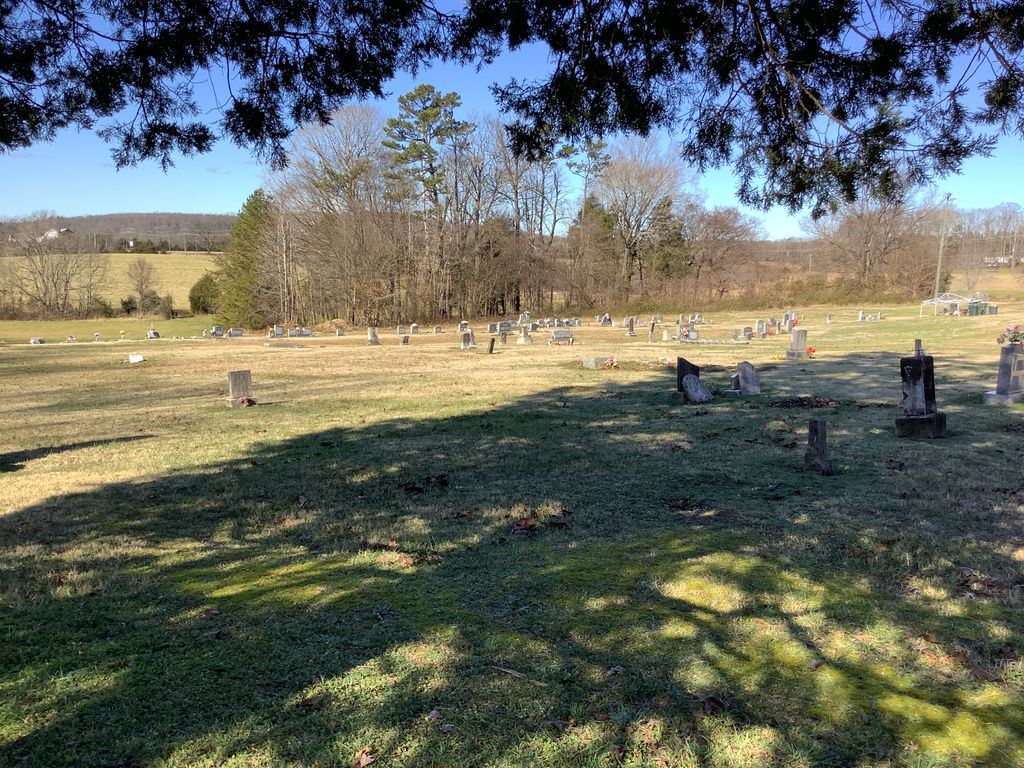
| Memorials | : | 11 |
| Location | : | Rowan County, USA |
| Phone | : | 704-278-2947 |
| Coordinate | : | 35.7240520, -80.6270450 |
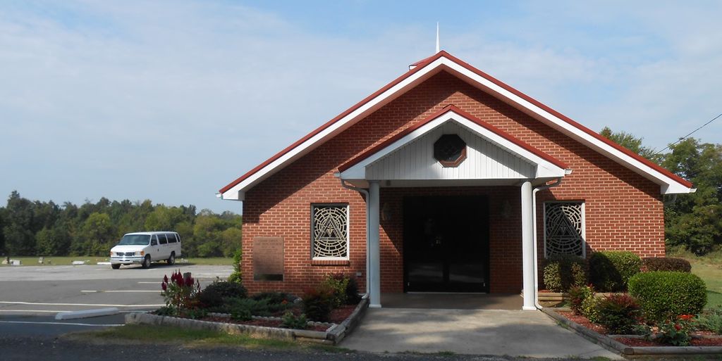
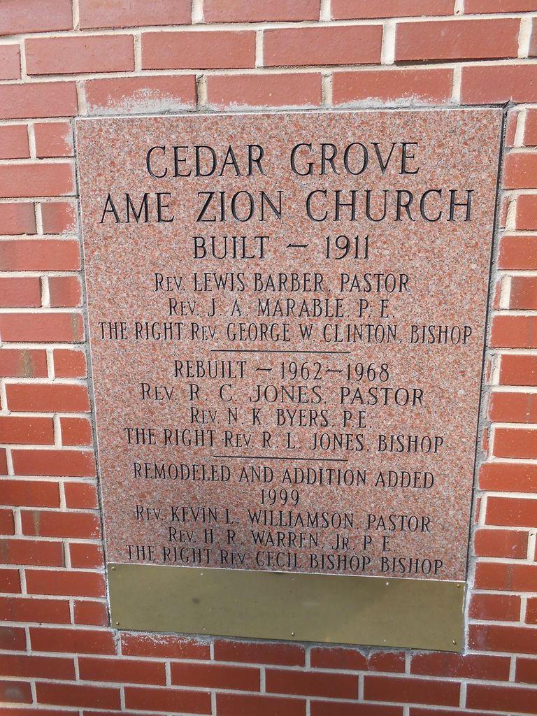
| Description | : | Telephone: 704-278-2947 Located at the intersection of Old Highway 70 and Hildebrand, about 2 miles east of the town of Cleveland, NC. Mailing address is Salisbury, but the physical location is about several miles northwest of Salisbury, about 3.5 miles east of Cleveland, at the intersection of Old Highway 70 and Hildebrand Road. |
frequently asked questions (FAQ):
-
Where is Cedar Grove AME Zion Church Cemetery?
Cedar Grove AME Zion Church Cemetery is located at 2430 Hildebrand Road Rowan County ,North Carolina ,USA.
-
Cedar Grove AME Zion Church Cemetery cemetery's updated grave count on graveviews.com?
8 memorials
-
Where are the coordinates of the Cedar Grove AME Zion Church Cemetery?
Latitude: 35.7240520
Longitude: -80.6270450
Nearby Cemetories:
1. Lebanon Lutheran Church Cemetery
Cleveland, Rowan County, USA
Coordinate: 35.7402300, -80.6266800
2. Christ Episcopal Church Cemetery
Cleveland, Rowan County, USA
Coordinate: 35.7333000, -80.6653380
3. Ebenezer Methodist Church Cemetery
Mount Ulla, Rowan County, USA
Coordinate: 35.6930200, -80.6425900
4. Allen Temple Presbyterian Church Cemetery
Cleveland, Rowan County, USA
Coordinate: 35.7343320, -80.6684760
5. Mount Vernon Presbyterian Church
Cleveland, Rowan County, USA
Coordinate: 35.7653590, -80.6231360
6. Unity Presbyterian Cemetery
Woodleaf, Rowan County, USA
Coordinate: 35.7613360, -80.6022520
7. Sherrills Ford Road Church Cemetery
Salisbury, Rowan County, USA
Coordinate: 35.6884308, -80.5954590
8. Cleveland First Baptist Church Cemetery
Cleveland, Rowan County, USA
Coordinate: 35.7347650, -80.6802790
9. Cleveland Town Cemetery
Cleveland, Rowan County, USA
Coordinate: 35.7357660, -80.6806540
10. Cleveland Memorial Garden
Cleveland, Rowan County, USA
Coordinate: 35.7276640, -80.6863050
11. Mount Zion Baptist Church
Mount Ulla, Rowan County, USA
Coordinate: 35.6712060, -80.6366480
12. Salem Lutheran Church Cemetery
Salisbury, Rowan County, USA
Coordinate: 35.6871986, -80.5721970
13. Third Creek Presbyterian Church Cemetery
Cleveland, Rowan County, USA
Coordinate: 35.7607420, -80.6841160
14. Saint Matthew's Episcopal Church Cemetery
Salisbury, Rowan County, USA
Coordinate: 35.7058983, -80.5554962
15. The Arbor United Methodist Church Cemetery
Salisbury, Rowan County, USA
Coordinate: 35.7356700, -80.5509200
16. Saint Lukes Evangelical Lutheran Church Cemetery
Mount Ulla, Rowan County, USA
Coordinate: 35.6810800, -80.6849760
17. Thyatira Presbyterian Church Cemetery
Mill Bridge, Rowan County, USA
Coordinate: 35.6506310, -80.6371002
18. Emanuel Pentecostal Church
Woodleaf, Rowan County, USA
Coordinate: 35.7965180, -80.6037410
19. Knox Grove Baptist Church
Cleveland, Rowan County, USA
Coordinate: 35.7557070, -80.7115100
20. Saint Marks Lutheran Church Cemetery
Salisbury, Rowan County, USA
Coordinate: 35.6541670, -80.5822220
21. Oakland Presbyterian Church USA
Mount Ulla Township, Rowan County, USA
Coordinate: 35.6549000, -80.6785000
22. Enon Baptist Church Cemetery
Salisbury, Rowan County, USA
Coordinate: 35.7082291, -80.5275421
23. Saint Andrews Episcopal Church Cemetery
Woodleaf, Rowan County, USA
Coordinate: 35.7884712, -80.5620041
24. Second Creek AME Zion - New Birth of Christ Church
Franklin Township, Rowan County, USA
Coordinate: 35.7461100, -80.5252800