
| Memorials | : | 1 |
| Location | : | Roxbury, New Kent County, USA |
| Coordinate | : | 37.4858010, -77.1165660 |
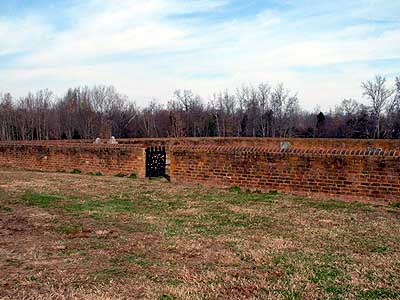
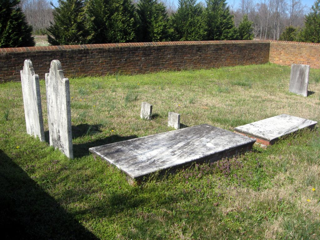
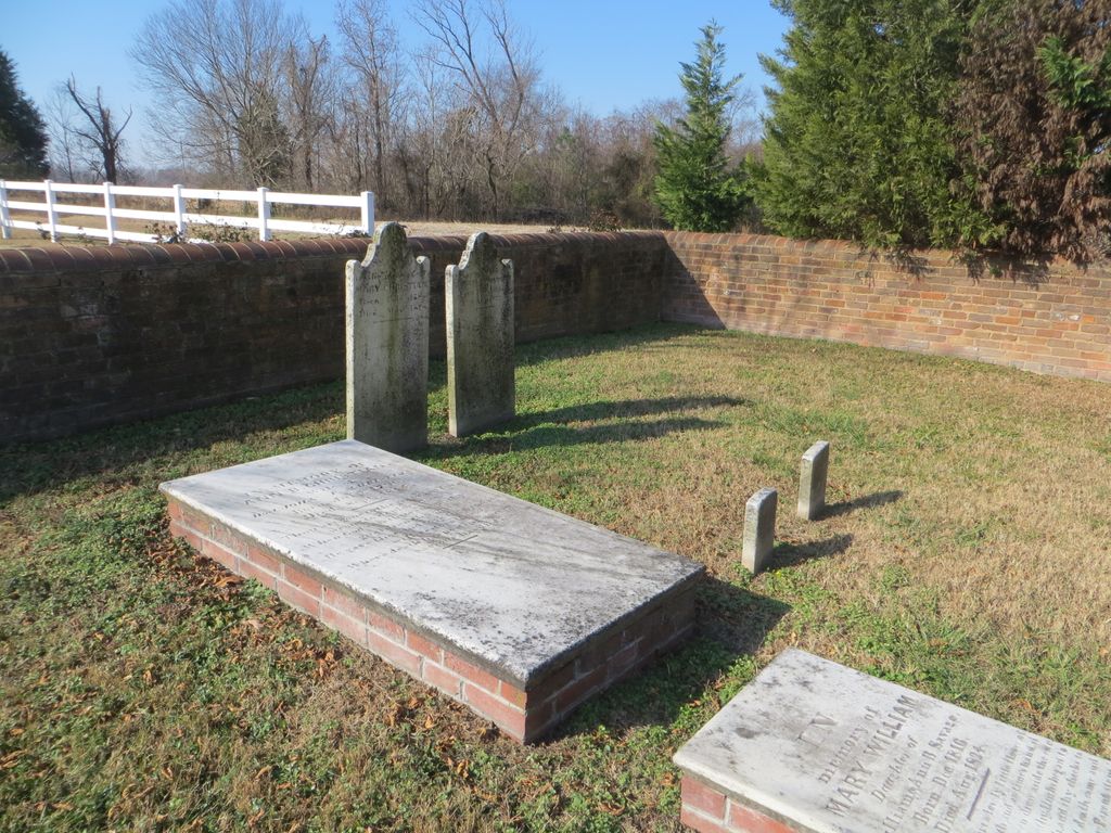
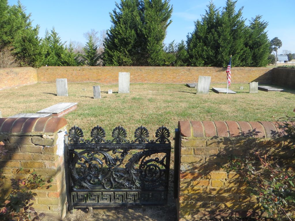
| Description | : | New Kent County, VA GIS Tax Map #: 31-10A Owner: CEDAR GROVE CEMETERY Acres 0.12 |
frequently asked questions (FAQ):
-
Where is Cedar Grove Plantation Cemetery?
Cedar Grove Plantation Cemetery is located at Emmaus Church Road (Rt. 106) Roxbury, New Kent County ,Virginia , 23140USA.
-
Cedar Grove Plantation Cemetery cemetery's updated grave count on graveviews.com?
1 memorials
-
Where are the coordinates of the Cedar Grove Plantation Cemetery?
Latitude: 37.4858010
Longitude: -77.1165660
Nearby Cemetories:
1. Mount Calvary Baptist Church Cemetery
Providence Forge, New Kent County, USA
Coordinate: 37.4720306, -77.1041565
2. Emmaus Baptist Church
Providence Forge, New Kent County, USA
Coordinate: 37.4991000, -77.0924000
3. New Life Baptist Church Cemetery
Quinton, New Kent County, USA
Coordinate: 37.5205430, -77.0914280
4. Second Liberty Baptist Church Cemetery
Quinton, New Kent County, USA
Coordinate: 37.5238080, -77.0928470
5. Olivet Presbyterian Church Cemetery
New Kent County, USA
Coordinate: 37.4802190, -77.0634780
6. Providence Methodist Church Cemetery
Quinton, New Kent County, USA
Coordinate: 37.5319990, -77.1511510
7. Mount Pleasant Cemetery
Roxbury, Charles City County, USA
Coordinate: 37.4350014, -77.1414032
8. M. R. Stowe
Hatteras, Dare County, USA
Coordinate: 37.5123639, -77.1829190
9. Rising Mount Zion Baptist Church Cemetery
New Kent, New Kent County, USA
Coordinate: 37.5247020, -77.0532810
10. Union Baptist Church Cemetery
Charles City, Charles City County, USA
Coordinate: 37.4311000, -77.1663000
11. Saint Peter's Episcopal Church Cemetery
Putneys Mill, New Kent County, USA
Coordinate: 37.5403550, -77.0563270
12. Cedar Grove Baptist Church Cemetery
Charles City County, USA
Coordinate: 37.4144000, -77.0937000
13. Samaria Baptist Church Cemetery
Providence Forge, New Kent County, USA
Coordinate: 37.4120000, -77.1270000
14. Elko Union Church Cemetery
Henrico County, USA
Coordinate: 37.4760017, -77.2126999
15. Whitlock Cemetery
Sandston, Henrico County, USA
Coordinate: 37.5128773, -77.2136472
16. Cardin Family Cemetery
Providence Forge, New Kent County, USA
Coordinate: 37.4677670, -77.0155810
17. Keesee Family Cemetery
Henrico County, USA
Coordinate: 37.4294500, -77.2042167
18. Cauthorn Family Farm Cemetery
Charles City, Charles City County, USA
Coordinate: 37.4045639, -77.1677551
19. Glendale Community Bible Church Cemetery
Glendale, Henrico County, USA
Coordinate: 37.4425080, -77.2290100
20. Lebanon Baptist Church Cemetery
New Kent, New Kent County, USA
Coordinate: 37.5857640, -77.1231060
21. Hopewell Baptist Church Cemetery
New Kent, New Kent County, USA
Coordinate: 37.5872993, -77.1308975
22. Salem Church Cemetery
Blanks Store, Charles City County, USA
Coordinate: 37.3871994, -77.1572037
23. Rising Mount Zion Baptist Church Cemetery
Sandston, Henrico County, USA
Coordinate: 37.5070953, -77.2455597
24. Antioch Baptist Church
Sandston, Henrico County, USA
Coordinate: 37.5125008, -77.2446976