
| Memorials | : | 0 |
| Location | : | Dzierżoniów, Powiat dzierżoniowski, Poland |
| Coordinate | : | 50.6796800, 16.7478100 |
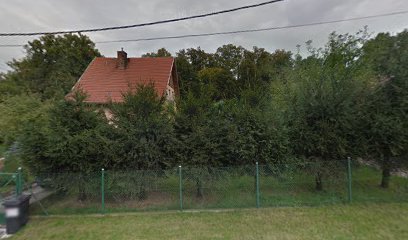
| Description | : | This cemetery was for the Protestant community of Ober-Peilau (now Piława Górna). The community was founded following the annexation of Silesia by Prussia in 1742, when Count Ernst Julius von Seidlitz, a Protestant nobleman, allowed a group of Protestant refugees from Bohemia and Moravia to settle on his lands. He named the new settlement "Gnadenfrei" to commemorate being freed by God's grace from oppression under the Catholic Habsburgs. The cemetery for the community was opened on March 16, 1743, and expanded in 1763. Formerly, there was a large sandstone gate that marked the entrance. By 1843 the cemetery had grown to... Read More |
frequently asked questions (FAQ):
-
Where is Cemetery of the Moravian Brethren?
Cemetery of the Moravian Brethren is located at ul. Stanisława Staszica Dzierżoniów, Powiat dzierżoniowski ,Dolnośląskie ,Poland.
-
Cemetery of the Moravian Brethren cemetery's updated grave count on graveviews.com?
0 memorials
-
Where are the coordinates of the Cemetery of the Moravian Brethren?
Latitude: 50.6796800
Longitude: 16.7478100
Nearby Cemetories:
1. Przerzeczyn-Zdrój Catholic Cemetery
Dzierżoniów, Powiat dzierżoniowski, Poland
Coordinate: 50.6861300, 16.8271900
2. Dobrocin Church Graveyard
Dzierżoniów, Powiat dzierżoniowski, Poland
Coordinate: 50.7329900, 16.7043400
3. Dobrocin Old Cemetery
Dzierżoniów, Powiat dzierżoniowski, Poland
Coordinate: 50.7399000, 16.7004100
4. Cmentarz Komunalny w Bielawie
Powiat dzierżoniowski, Poland
Coordinate: 50.6761332, 16.6364939
5. Lutomierz Church of Our Lady of Częstochowa
Wałbrzych, Miasto Wałbrzych, Poland
Coordinate: 50.6088393, 16.7103653
6. Dzierżoniów Evangelical Cemetery
Dzierżoniów, Powiat dzierżoniowski, Poland
Coordinate: 50.7306020, 16.6596510
7. Dzierżoniów Jewish Cemetery
Wrocław, Miasto Wrocław, Poland
Coordinate: 50.7309280, 16.6574080
8. Church of St. George
Dzierżoniów, Powiat dzierżoniowski, Poland
Coordinate: 50.7267411, 16.6515931
9. Bielawa Catholic Cemetery
Dzierżoniów, Powiat dzierżoniowski, Poland
Coordinate: 50.6872000, 16.6163400
10. Uciechów Church of St. Bartholomew
Dzierżoniów, Powiat dzierżoniowski, Poland
Coordinate: 50.7543547, 16.6839740
11. Wilków Wielki Church of the Sacred Heart of Jesus
Dzierżoniów, Powiat dzierżoniowski, Poland
Coordinate: 50.7522266, 16.8487100
12. Church of St. An
Ząbkowice Śląskie, Powiat ząbkowicki, Poland
Coordinate: 50.5885900, 16.8091700
13. Sieniewka Church Graveyard
Dzierżoniów, Powiat dzierżoniowski, Poland
Coordinate: 50.7779400, 16.7699800
14. Church of St. Hedwig
Wrocław, Miasto Wrocław, Poland
Coordinate: 50.5855530, 16.8145860
15. Pieszyce Catholic Graveyard
Dzierżoniów, Powiat dzierżoniowski, Poland
Coordinate: 50.7148800, 16.5803600
16. Żelowice Church of the Holy Cross
Powiat strzeliński, Poland
Coordinate: 50.7266949, 16.9131025
17. Srebrna Góra Catholic Graveyard
Świdnica, Powiat świdnicki, Poland
Coordinate: 50.5765000, 16.6603200
18. Srebrna Góra Protestant Cemetery
Wałbrzych, Miasto Wałbrzych, Poland
Coordinate: 50.5741590, 16.6596770
19. Zarzyca Church of St. Andrew
Powiat strzeliński, Poland
Coordinate: 50.7102559, 16.9375405
20. Słupice Protestant Cemetery
Dzierżoniów, Powiat dzierżoniowski, Poland
Coordinate: 50.8145259, 16.7496167
21. Słupice Cemetery
Świdnica, Powiat świdnicki, Poland
Coordinate: 50.8146200, 16.7499300
22. Rościszów Protestant Cemetery
Dzierżoniów, Powiat dzierżoniowski, Poland
Coordinate: 50.7023420, 16.5306884
23. Faulbrück Forced Labor Camp
Dzierżoniów, Powiat dzierżoniowski, Poland
Coordinate: 50.7808000, 16.5889000
24. Rościszów Church Graveyard
Dzierżoniów, Powiat dzierżoniowski, Poland
Coordinate: 50.7070700, 16.5217000