
| Memorials | : | 0 |
| Location | : | Greven, Kreis Steinfurt, Germany |
| Coordinate | : | 52.1021470, 7.6117640 |
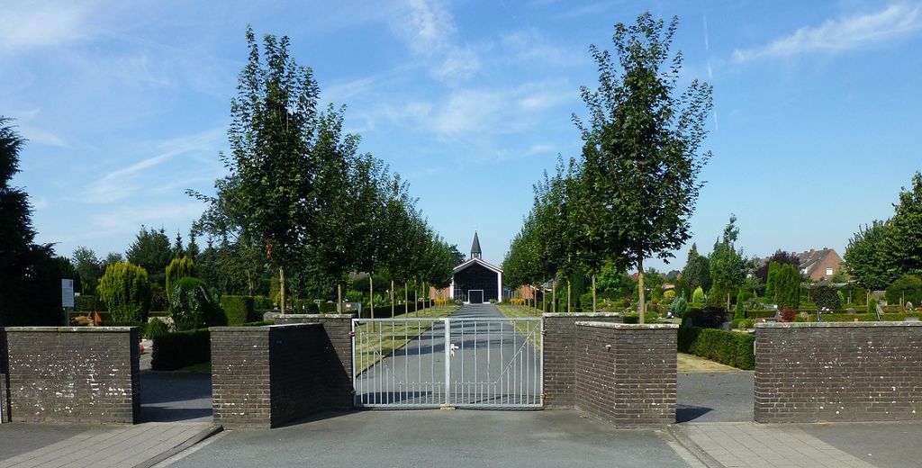
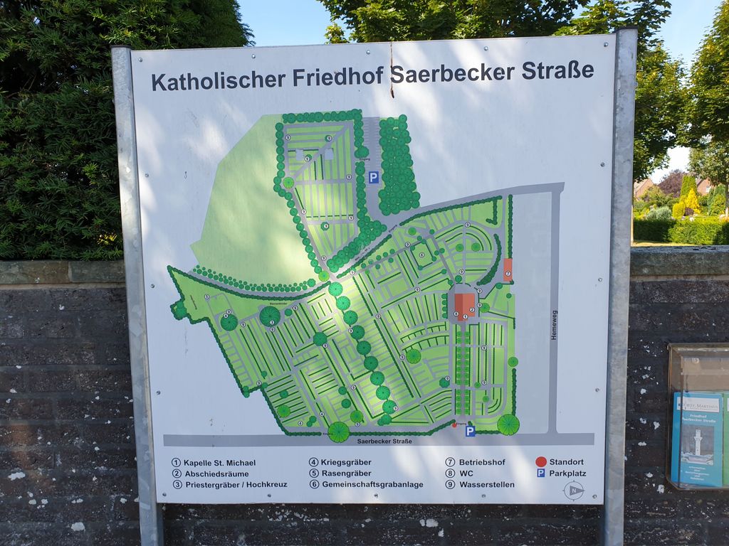
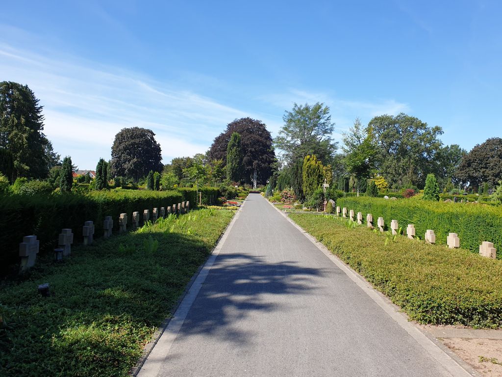
| Description | : | Correct Spelling of Cemetery Name: "Cemetery on Saerbecker Strasse" Cemetery Phone: +49-2571-3663 Cemetery Founded in 1894 The cemetery on Saerbecker Straße is the largest graveyard in Greven. It was inaugurated on October 8, 1894, and extended in the years 1960 and 1989. The graveyard is intended for the burial of all the dead, regardless of their worldview and religious confession, from the urban area of Greven. Grevener citizens, who had their first residence in Greven until their death and actually lived here, were buried in the cemetery on Saerbeckerstrasse. Other deceased may be buried in the graveyard with permission. The administration is located at... Read More |
frequently asked questions (FAQ):
-
Where is Cemetery on Sauerbecker Strauss?
Cemetery on Sauerbecker Strauss is located at Saerbecker Strasse 70 Greven, Kreis Steinfurt ,Nordrhein-Westfalen , 48268Germany.
-
Cemetery on Sauerbecker Strauss cemetery's updated grave count on graveviews.com?
0 memorials
-
Where are the coordinates of the Cemetery on Sauerbecker Strauss?
Latitude: 52.1021470
Longitude: 7.6117640
Nearby Cemetories:
1. Alter Evangelischer Friedhof Greven
Greven, Kreis Steinfurt, Germany
Coordinate: 52.0933874, 7.6268045
2. Friedhof Hembergen
Emsdetten, Kreis Steinfurt, Germany
Coordinate: 52.1517733, 7.6129417
3. Friedhof Sprakel
Sprakel, Stadtkreis Münster, Germany
Coordinate: 52.0344862, 7.6229518
4. Friedhof Saerbeck
Saerbeck, Kreis Steinfurt, Germany
Coordinate: 52.1733068, 7.6293525
5. Friedhof Hemberger Damm
Emsdetten, Kreis Steinfurt, Germany
Coordinate: 52.1643232, 7.5472950
6. Evangelischer Friedhof am Föhrendamm
Emsdetten, Kreis Steinfurt, Germany
Coordinate: 52.1604257, 7.5292858
7. Friedhof Gelmer
Gelmer, Stadtkreis Münster, Germany
Coordinate: 52.0302485, 7.6795620
8. Katholischer Friedhof
Emsdetten, Kreis Steinfurt, Germany
Coordinate: 52.1697468, 7.5289933
9. Katholischer Friedhof Nordwalde
Nordwalde, Kreis Steinfurt, Germany
Coordinate: 52.0804644, 7.4765322
10. Alter Friedhof Heidberge, Emsdetten
Emsdetten, Kreis Steinfurt, Germany
Coordinate: 52.1712502, 7.5264616
11. Friedhof (ev.)
Ladbergen, Kreis Steinfurt, Germany
Coordinate: 52.1345950, 7.7435209
12. Friedhof Nienberge
Münster, Stadtkreis Münster, Germany
Coordinate: 51.9976400, 7.5635700
13. Munster Haus Spital Prisoners of War Cemetery
Münster, Stadtkreis Münster, Germany
Coordinate: 51.9828100, 7.5607100
14. Friedhof Borghorst (Königsallee)
Borghorst, Kreis Steinfurt, Germany
Coordinate: 52.1204832, 7.4127861
15. Friedhof Handorf, Münster
Handorf, Stadtkreis Münster, Germany
Coordinate: 51.9870594, 7.7013414
16. Friedhof der Schwestern der Göttlichen Vorsehung
Münster, Stadtkreis Münster, Germany
Coordinate: 51.9828835, 7.6897560
17. Waldfriedhof Lauheide
Telgte, Kreis Warendorf, Germany
Coordinate: 52.0038117, 7.7520859
18. Munster Heath War Cemetery
Telgte, Kreis Warendorf, Germany
Coordinate: 52.0045400, 7.7579800
19. Alter Überwasserfriedhof
Münster, Stadtkreis Münster, Germany
Coordinate: 51.9669930, 7.6117340
20. Jüdischer Friedhof Münster
Münster, Stadtkreis Münster, Germany
Coordinate: 51.9665100, 7.6064100
21. Cathedral of Munster
Münster, Stadtkreis Münster, Germany
Coordinate: 51.9630560, 7.6255560
22. Schwesternfriedhof Münster St. Mauritz
Münster, Stadtkreis Münster, Germany
Coordinate: 51.9615640, 7.6520500
23. Zentralfriedhof
Münster, Stadtkreis Münster, Germany
Coordinate: 51.9586720, 7.6095690
24. Friedhof Kattenvenne
Kattenvenne, Kreis Steinfurt, Germany
Coordinate: 52.1116686, 7.8665967