
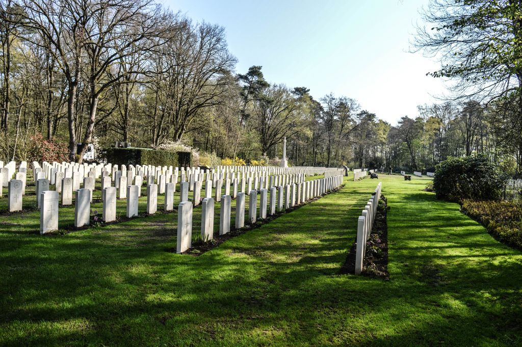
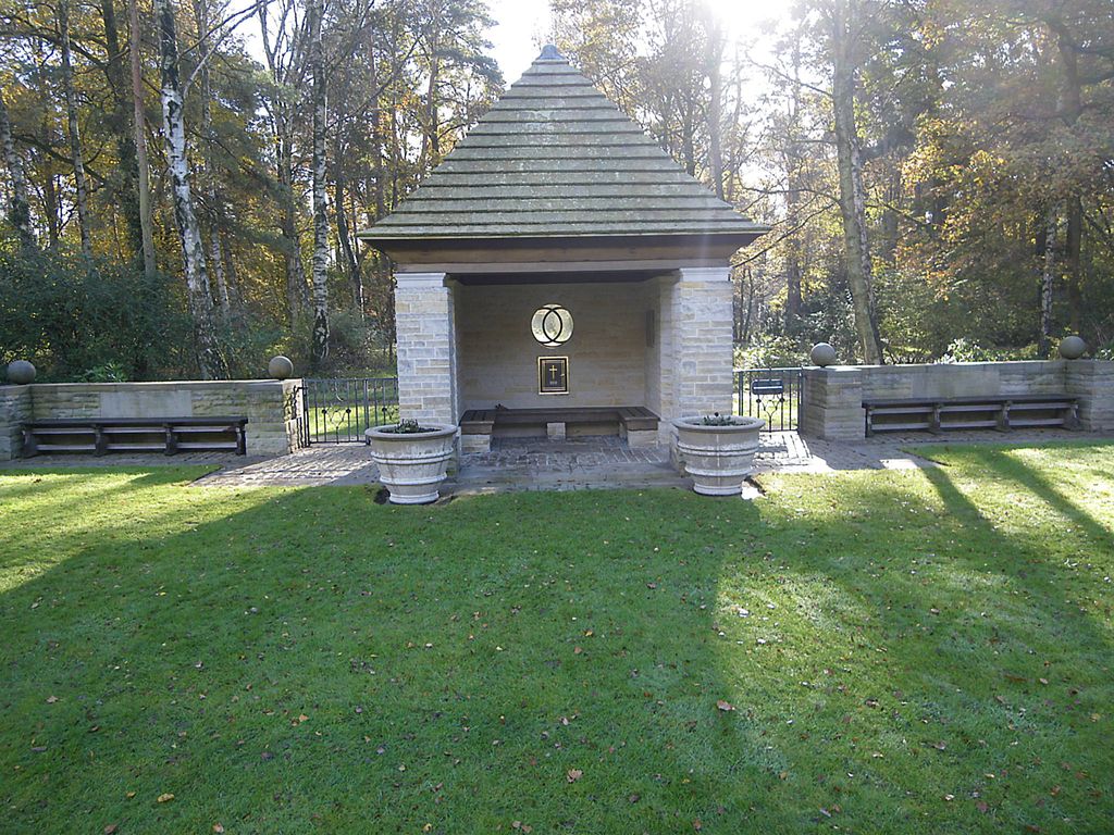
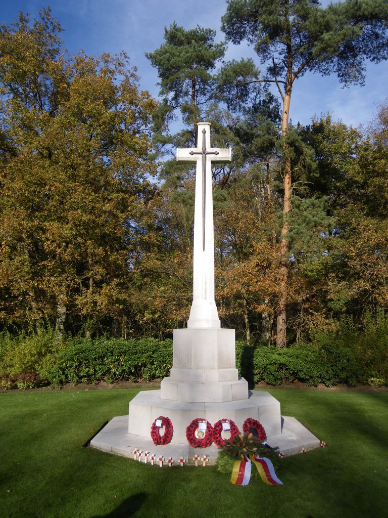
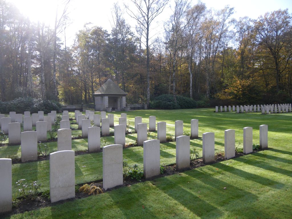
| Memorials | : | 0 |
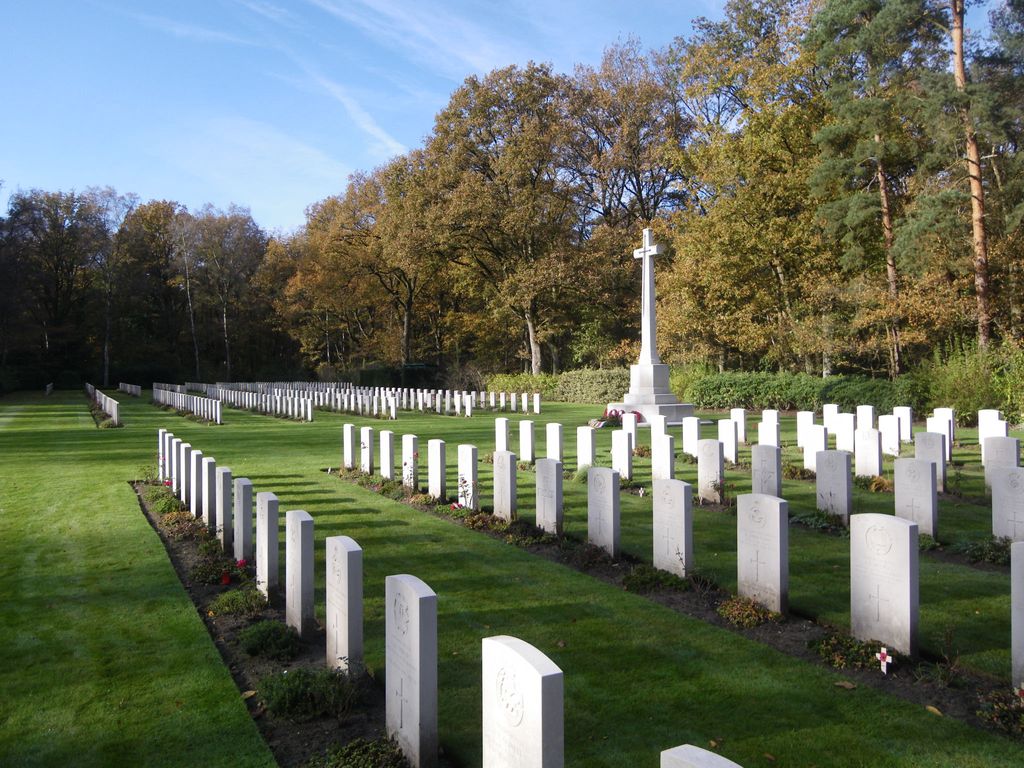
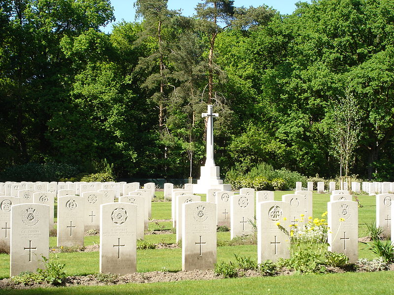
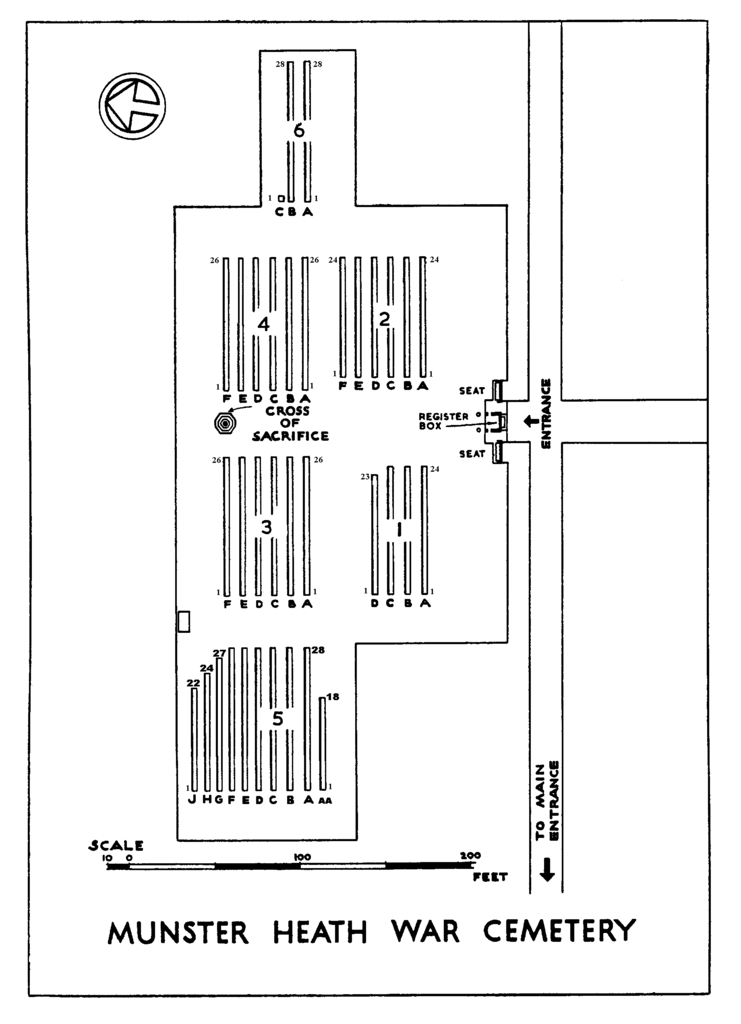
| Location | : | Telgte, Kreis Warendorf, Germany |
| Coordinate | : | 52.0045400, 7.7579800 |
frequently asked questions (FAQ):
-
Where is Munster Heath War Cemetery?
Munster Heath War Cemetery is located at Telgte, Kreis Warendorf ,Nordrhein-Westfalen ,Germany.
-
Munster Heath War Cemetery cemetery's updated grave count on graveviews.com?
0 memorials
-
Where are the coordinates of the Munster Heath War Cemetery?
Latitude: 52.0045400
Longitude: 7.7579800
Nearby Cemetories:
1. Waldfriedhof Lauheide
Telgte, Kreis Warendorf, Germany
Coordinate: 52.0038117, 7.7520859
2. Friedhof Handorf, Münster
Handorf, Stadtkreis Münster, Germany
Coordinate: 51.9870594, 7.7013414
3. Friedhof der Schwestern der Göttlichen Vorsehung
Münster, Stadtkreis Münster, Germany
Coordinate: 51.9828835, 7.6897560
4. Friedhof Gelmer
Gelmer, Stadtkreis Münster, Germany
Coordinate: 52.0302485, 7.6795620
5. Schwesternfriedhof Münster St. Mauritz
Münster, Stadtkreis Münster, Germany
Coordinate: 51.9615640, 7.6520500
6. Friedhof Sprakel
Sprakel, Stadtkreis Münster, Germany
Coordinate: 52.0344862, 7.6229518
7. Cathedral of Munster
Münster, Stadtkreis Münster, Germany
Coordinate: 51.9630560, 7.6255560
8. Alter Überwasserfriedhof
Münster, Stadtkreis Münster, Germany
Coordinate: 51.9669930, 7.6117340
9. Jüdischer Friedhof Münster
Münster, Stadtkreis Münster, Germany
Coordinate: 51.9665100, 7.6064100
10. Zentralfriedhof
Münster, Stadtkreis Münster, Germany
Coordinate: 51.9586720, 7.6095690
11. Friedhof Nienberge
Münster, Stadtkreis Münster, Germany
Coordinate: 51.9976400, 7.5635700
12. Alter Evangelischer Friedhof Greven
Greven, Kreis Steinfurt, Germany
Coordinate: 52.0933874, 7.6268045
13. Hiltrup St Clement
Münster, Stadtkreis Münster, Germany
Coordinate: 51.9055328, 7.6385660
14. Munster Haus Spital Prisoners of War Cemetery
Münster, Stadtkreis Münster, Germany
Coordinate: 51.9828100, 7.5607100
15. Friedhof Kattenvenne
Kattenvenne, Kreis Steinfurt, Germany
Coordinate: 52.1116686, 7.8665967
16. Friedhof (ev.)
Ladbergen, Kreis Steinfurt, Germany
Coordinate: 52.1345950, 7.7435209
17. Cemetery on Sauerbecker Strauss
Greven, Kreis Steinfurt, Germany
Coordinate: 52.1021470, 7.6117640
18. Friedhof Albersloh
Albersloh, Kreis Warendorf, Germany
Coordinate: 51.8698964, 7.7324400
19. Friedhof Warendorf
Warendorf, Kreis Warendorf, Germany
Coordinate: 51.9448630, 7.9954740
20. Neuer Friedhof am Liener Landweg
Glandorf, Landkreis Osnabrück, Germany
Coordinate: 52.0867970, 7.9957720
21. Friedhof Hembergen
Emsdetten, Kreis Steinfurt, Germany
Coordinate: 52.1517733, 7.6129417
22. Hohner Friedhof (ev.)
Lengerich, Kreis Steinfurt, Germany
Coordinate: 52.1707971, 7.8896156
23. Friedhof Saerbeck
Saerbeck, Kreis Steinfurt, Germany
Coordinate: 52.1733068, 7.6293525
24. Katholischer Friedhof Nordwalde
Nordwalde, Kreis Steinfurt, Germany
Coordinate: 52.0804644, 7.4765322