
| Memorials | : | 0 |
| Location | : | Irving College, Warren County, USA |
| Coordinate | : | 35.5608600, -85.6454600 |
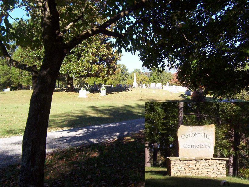
| Description | : | Center Hill Cemetery, originally known as the Hill Family Graveyard, for the Hill family that originally settled this beautiful cove, then was known as Hill's Creek Cemetery until around 1960, becoming Center Hill Cemetery, which it remains today. Directions: from McMinnville, TN, go south on Hwy 56 for approximately 4 miles, turn left/east on Hill's Creek Road and proceed for 2.75 miles to Center Hill Road, turn right/east on Center Hill Rd and the Cemetery will be at the top of the hill, on the left. |
frequently asked questions (FAQ):
-
Where is Center Hill Cemetery?
Center Hill Cemetery is located at Center Hill Road Irving College, Warren County ,Tennessee ,USA.
-
Center Hill Cemetery cemetery's updated grave count on graveviews.com?
0 memorials
-
Where are the coordinates of the Center Hill Cemetery?
Latitude: 35.5608600
Longitude: -85.6454600
Nearby Cemetories:
1. Sellers Place Cemetery
Spring Creek, Warren County, USA
Coordinate: 35.5827100, -85.6422000
2. Mount Sinai Baptist Church Cemetery
McMinnville, Warren County, USA
Coordinate: 35.5945610, -85.6526190
3. Uncle Joe Barnes Cemetery
Warren County, USA
Coordinate: 35.5881200, -85.6799700
4. Barnes Cemetery
Warren County, USA
Coordinate: 35.5881200, -85.6799700
5. Homeland Acres Cemetery
Altamont, Grundy County, USA
Coordinate: 35.5226400, -85.6667200
6. Shiloh United Methodist Church Cemetery
Steppsville, Warren County, USA
Coordinate: 35.5479900, -85.6959900
7. Philadelphia Cemetery
Mount Olive, Grundy County, USA
Coordinate: 35.5203018, -85.6856003
8. Morton Memorial Cemetery
Beersheba Springs, Grundy County, USA
Coordinate: 35.4925200, -85.6530100
9. King Cemetery
Tarlton, Grundy County, USA
Coordinate: 35.4902720, -85.6484350
10. Leesburg Cemetery
McMinnville, Warren County, USA
Coordinate: 35.5725600, -85.7343600
11. Armstrong Church Cemetery
Irving College, Warren County, USA
Coordinate: 35.5752160, -85.7364720
12. Cope Cemetery
Mount Zion, Warren County, USA
Coordinate: 35.5588600, -85.7516600
13. Smyrna Cemetery
Irving College, Warren County, USA
Coordinate: 35.6342000, -85.7053500
14. Walker Cemetery
Beersheba Springs, Grundy County, USA
Coordinate: 35.4738998, -85.6738968
15. Hennessee Cemetery
Warren County, USA
Coordinate: 35.6398582, -85.6993256
16. Beersheba Springs Cemetery
Beersheba Springs, Grundy County, USA
Coordinate: 35.4686012, -85.6556015
17. Grace Chapel Cemetery
Beersheba Springs, Grundy County, USA
Coordinate: 35.4678001, -85.6647034
18. Church of Jesus Christ of Latter Day Saints Cemete
Grundy County, USA
Coordinate: 35.5132400, -85.7495300
19. Hunerwadel Cemetery
Grundy County, USA
Coordinate: 35.4633800, -85.6505600
20. Northcutt Cove Cemetery
Grundy County, USA
Coordinate: 35.5189410, -85.7541920
21. Northcutts Cove Cemetery
Grundy County, USA
Coordinate: 35.5181007, -85.7538986
22. Richardson Family Cemetery
Beersheba Springs, Grundy County, USA
Coordinate: 35.4665750, -85.6803440
23. Pleasant Hill Cemetery
Van Buren County, USA
Coordinate: 35.5910988, -85.5271988
24. Schild-Tate Cemetery
Beersheba Springs, Grundy County, USA
Coordinate: 35.4609200, -85.6741900