
| Memorials | : | 0 |
| Location | : | Bures St Mary, Babergh District, England |
| Coordinate | : | 51.9753000, 0.7907000 |
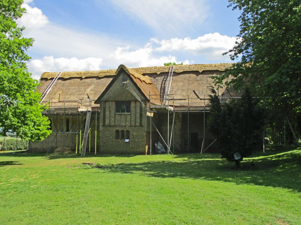
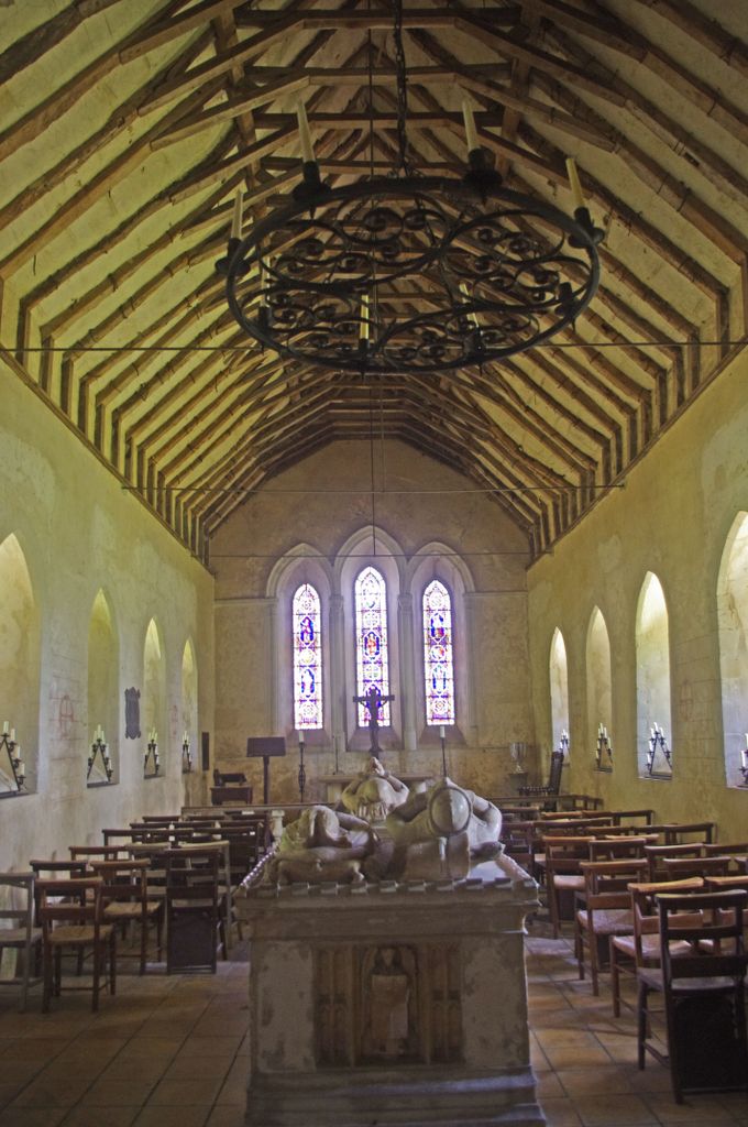
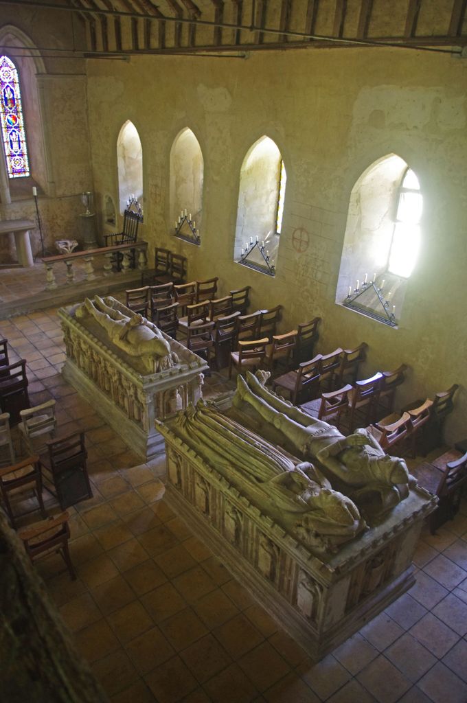
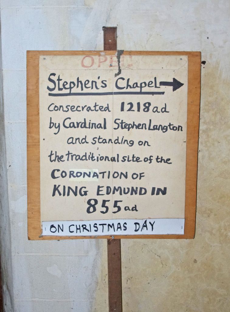
| Description | : | Originally a chapel said to have been erected by Abbot Sampson of Bury in the late C12 or early C13, on the site of the King Church where Edmund was crowned King of the Angles in 855. The interior has 3 fine tombs of the De Vere family removed from Colne Priory, Earls Colne, Essex. One is to Robert de Vere, 5th Earl of Oxford (d 1296) has ogee arched niches on the sides. Another to Thomas de Vere, 8th Earl of Oxford (d 1371) also has ogee arched niches on the sides, and the third to Richard de Vere (d... Read More |
frequently asked questions (FAQ):
-
Where is Chapel of St. Stephen?
Chapel of St. Stephen is located at 5377 Chapel of St Stephen Bures St Mary, Babergh District ,Suffolk , CO8 5LDEngland.
-
Chapel of St. Stephen cemetery's updated grave count on graveviews.com?
0 memorials
-
Where are the coordinates of the Chapel of St. Stephen?
Latitude: 51.9753000
Longitude: 0.7907000
Nearby Cemetories:
1. Bures Baptist Chapel Chapelyard
Bures St Mary, Babergh District, England
Coordinate: 51.9730130, 0.7763930
2. Bures Cemetery
Bures St Mary, Babergh District, England
Coordinate: 51.9786420, 0.7754800
3. St. Mary the Virgin Churchyard
Bures St Mary, Babergh District, England
Coordinate: 51.9719370, 0.7746110
4. St John the Baptist Churchyard
Mount Bures, Colchester Borough, England
Coordinate: 51.9581450, 0.7705560
5. St Andrew Churchyard
Wormingford, Colchester Borough, England
Coordinate: 51.9551000, 0.8115000
6. St. Mary the Virgin Churchyard
Wissington, Babergh District, England
Coordinate: 51.9634930, 0.8436940
7. World War I Memorial
Assington, Babergh District, England
Coordinate: 52.0138200, 0.8193504
8. St Edmund King and Martyr Churchyard
Assington, Babergh District, England
Coordinate: 52.0138120, 0.8194260
9. All Saints Churchyard
Little Cornard, Babergh District, England
Coordinate: 52.0175530, 0.7703720
10. St. Peter and St. Paul's Churchyard
Little Horkesley, Colchester Borough, England
Coordinate: 51.9516000, 0.8517000
11. St. Mary's Churchyard
Chilton, Babergh District, England
Coordinate: 52.0146121, 0.7541590
12. Nayland Cemetery
Nayland, Babergh District, England
Coordinate: 51.9735000, 0.8677410
13. All Saints Churchyard
Great Horkesley, Colchester Borough, England
Coordinate: 51.9550190, 0.8672580
14. St. James' Churchyard
Nayland, Babergh District, England
Coordinate: 51.9715440, 0.8748140
15. St Andrew Churchyard
White Colne, Braintree District, England
Coordinate: 51.9362700, 0.7328930
16. St. Mary the Virgin Churchyard
Great Henny, Braintree District, England
Coordinate: 52.0073800, 0.7191400
17. St. John the Evangelist Churchyard
Twinstead, Braintree District, England
Coordinate: 51.9974900, 0.7096940
18. All Saints Church
Fordham, Colchester Borough, England
Coordinate: 51.9181000, 0.8014340
19. St John the Baptist Churchyard
Pebmarsh, Braintree District, England
Coordinate: 51.9689130, 0.6971600
20. All Saints Churchyard
Wakes Colne, Colchester Borough, England
Coordinate: 51.9238500, 0.7467100
21. St Andrew Churchyard
Great Cornard, Babergh District, England
Coordinate: 52.0304820, 0.7602450
22. All Saints Churchyard
Newton, Babergh District, England
Coordinate: 52.0364000, 0.7966500
23. All Saints Churchyard
Middleton, Braintree District, England
Coordinate: 52.0238730, 0.7255760
24. Saint Mary Churchyard
Stoke by Nayland, Babergh District, England
Coordinate: 51.9895000, 0.8925210