| Memorials | : | 19 |
| Location | : | Nayland, Babergh District, England |
| Coordinate | : | 51.9735000, 0.8677410 |
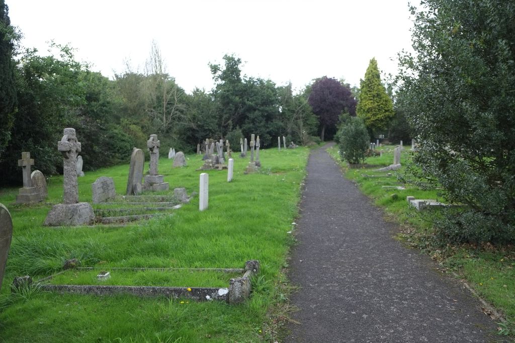
| Description | : | Nayland is a village in the Stour Valley on the Suffolk side of the border between Suffolk and Essex. The name Nayland means an island, and the village developed on the higher ground amidst the lower river flood plain. It provided a good place for both a safe crossing of the river and an early manorial centre, probably a wooden castle. These advantages brought a market by 1227 and, by the late Middle Ages, it was a successful small town. The village and the surrounding area, like much of East Anglia, was a hotbed of Puritan sentiment during much of... Read More |
frequently asked questions (FAQ):
-
Where is Nayland Cemetery?
Nayland Cemetery is located at Nayland, Babergh District ,Suffolk ,England.
-
Nayland Cemetery cemetery's updated grave count on graveviews.com?
17 memorials
-
Where are the coordinates of the Nayland Cemetery?
Latitude: 51.9735000
Longitude: 0.8677410
Nearby Cemetories:
1. St. James' Churchyard
Nayland, Babergh District, England
Coordinate: 51.9715440, 0.8748140
2. St. Mary the Virgin Churchyard
Wissington, Babergh District, England
Coordinate: 51.9634930, 0.8436940
3. All Saints Churchyard
Great Horkesley, Colchester Borough, England
Coordinate: 51.9550190, 0.8672580
4. Saint Mary Churchyard
Stoke by Nayland, Babergh District, England
Coordinate: 51.9895000, 0.8925210
5. St. Peter and St. Paul's Churchyard
Little Horkesley, Colchester Borough, England
Coordinate: 51.9516000, 0.8517000
6. Saint Peters Churchyard
Boxted, Colchester Borough, England
Coordinate: 51.9617380, 0.9072480
7. St Mary Churchyard
Polstead, Babergh District, England
Coordinate: 52.0054860, 0.8964940
8. St Andrew Churchyard
Wormingford, Colchester Borough, England
Coordinate: 51.9551000, 0.8115000
9. Our Lady Immaculate Withermarsh Green
Stoke by Nayland, Babergh District, England
Coordinate: 51.9950800, 0.9326260
10. Chapel of St. Stephen
Bures St Mary, Babergh District, England
Coordinate: 51.9753000, 0.7907000
11. St Edmund King and Martyr Churchyard
Assington, Babergh District, England
Coordinate: 52.0138120, 0.8194260
12. World War I Memorial
Assington, Babergh District, England
Coordinate: 52.0138200, 0.8193504
13. Boxford Cemetery
Boxford, Babergh District, England
Coordinate: 52.0268400, 0.8601300
14. St Mary's Churchyard
Boxford, Babergh District, England
Coordinate: 52.0280870, 0.8594160
15. Bures Baptist Chapel Chapelyard
Bures St Mary, Babergh District, England
Coordinate: 51.9730130, 0.7763930
16. Bures Cemetery
Bures St Mary, Babergh District, England
Coordinate: 51.9786420, 0.7754800
17. St Mary the Virgin Churchyard
Langham, Colchester Borough, England
Coordinate: 51.9644450, 0.9596300
18. St. Mary the Virgin Churchyard
Bures St Mary, Babergh District, England
Coordinate: 51.9719370, 0.7746110
19. St Mary's Church Burial Ground
Higham, Forest Heath District, England
Coordinate: 51.9782680, 0.9626690
20. St. Mary the Virgin Church
West Bergholt, Colchester Borough, England
Coordinate: 51.9143650, 0.8501530
21. St John the Baptist Churchyard
Mount Bures, Colchester Borough, England
Coordinate: 51.9581450, 0.7705560
22. West Bergholt Methodist Churchyard
West Bergholt, Colchester Borough, England
Coordinate: 51.9123993, 0.8507000
23. St Michael's churchyard
Colchester Borough, England
Coordinate: 51.9107874, 0.8918244
24. St. Bartholomew's Churchyard
Groton, Babergh District, England
Coordinate: 52.0388810, 0.8558090

