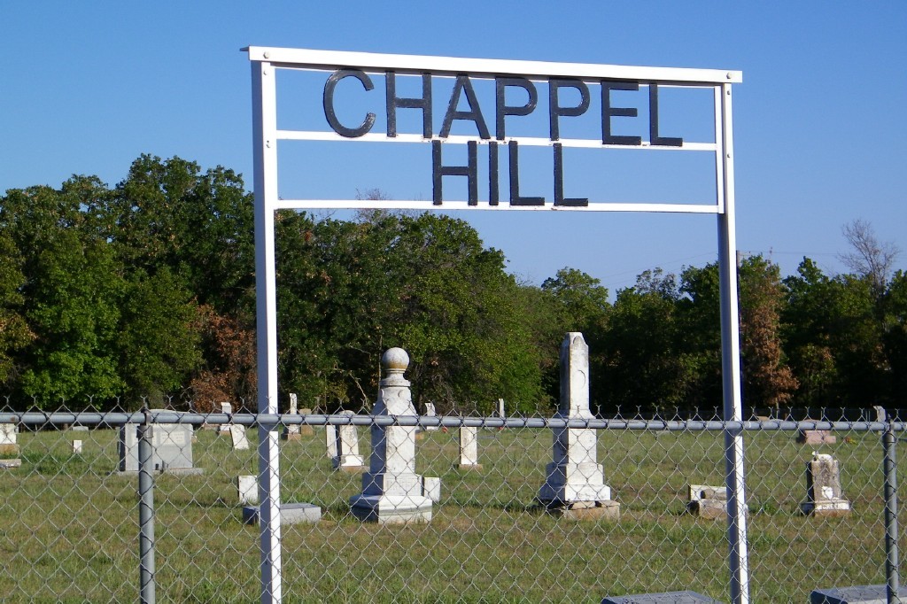
| Memorials | : | 2 |
| Location | : | Cleveland County, USA |
| Coordinate | : | 35.0300950, -97.1596140 |
| Description | : | Chappel Cemetery is about 10 miles east of Lexington, across the street from the southeast corner of the Lexington Wildlife Management Area. It sits at the northeast corner of the intersecion of Moffatt Road and 192nd Street. The map coordinates are for the 192nd Street entrance, but there is also a Moffatt Road entrance. Mapping websites often show this cemetery as Cropper Cemetery. |
frequently asked questions (FAQ):
-
Where is Chappel Hill Cemetery?
Chappel Hill Cemetery is located at Cleveland County ,Oklahoma ,USA.
-
Chappel Hill Cemetery cemetery's updated grave count on graveviews.com?
2 memorials
-
Where are the coordinates of the Chappel Hill Cemetery?
Latitude: 35.0300950
Longitude: -97.1596140
Nearby Cemetories:
1. Rose Cemetery
Lexington, Cleveland County, USA
Coordinate: 34.9947770, -97.1607283
2. Metcalf Cemetery Wilkerson
Wanette, Pottawatomie County, USA
Coordinate: 35.0581017, -97.1258011
3. Martin Hill Cemetery
Pottawatomie County, USA
Coordinate: 34.9996986, -97.1141968
4. Box Cemetery
Cleveland County, USA
Coordinate: 34.9707985, -97.1417007
5. Council Creek Cemetery
Pottawatomie County, USA
Coordinate: 35.0867004, -97.1250000
6. Red Oak Cemetery
Etowah, Cleveland County, USA
Coordinate: 35.1011009, -97.1505966
7. Saint Gregory Cemetery
Trousdale, Pottawatomie County, USA
Coordinate: 35.0172220, -97.0718800
8. Mount Zion Cemetery
Lexington, Cleveland County, USA
Coordinate: 34.9564018, -97.1493988
9. Corbett Cemetery
Cleveland County, USA
Coordinate: 34.9756330, -97.2303600
10. Holsonbake Cemetery
Cleveland County, USA
Coordinate: 34.9707985, -97.2652969
11. Willow View Cemetery
Cleveland County, USA
Coordinate: 35.0653000, -97.2825012
12. Banner Cemetery
Cleveland County, USA
Coordinate: 35.1016998, -97.2564011
13. Moral Cemetery
Tribbey, Pottawatomie County, USA
Coordinate: 35.0722010, -97.0372010
14. Tribbey Cemetery
Tribbey, Pottawatomie County, USA
Coordinate: 35.0966988, -97.0516968
15. Lexington Cemetery
Lexington, Cleveland County, USA
Coordinate: 35.0028000, -97.3005981
16. Rosedale Cemetery
Rosedale, McClain County, USA
Coordinate: 34.9063988, -97.1624985
17. Prospect Cemetery
Tribbey, Pottawatomie County, USA
Coordinate: 35.1302986, -97.0708008
18. Wanette Cemetery
Wanette, Pottawatomie County, USA
Coordinate: 34.9719009, -97.0196991
19. Thompson Family Cemetery
Wanette, Pottawatomie County, USA
Coordinate: 34.9799400, -97.0147700
20. Saint Johns Cemetery
Lexington, Cleveland County, USA
Coordinate: 35.0106010, -97.3171997
21. Bethel Cemetery
Noble, Cleveland County, USA
Coordinate: 35.1596985, -97.1967010
22. Mars Hill Cemetery
Saint Louis, Pottawatomie County, USA
Coordinate: 35.1603012, -97.1252975
23. Friendship Cemetery
Tribbey, Pottawatomie County, USA
Coordinate: 35.1025009, -97.0194016
24. Blue Branch Cemetery
Rosedale, McClain County, USA
Coordinate: 34.8841120, -97.1591230

