
| Memorials | : | 0 |
| Location | : | Chateau-Renault, Departement d'Indre-et-Loire, France |
| Coordinate | : | 47.5980800, 0.9118300 |
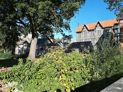
| Description | : | Chateau Renault is a town and commune 17 miles (27 kilometres) north-east of Tours, the chief town of the department of Indre-et-Loire, and some 12 miles (20 kilometres) north of the town of Amboise. The cemetery lies to the north of the town, on the road leading to the village of Montoire. There is 1 Commonwealth burial of the 1939-1945 war here, to the west of the northern gate. |
frequently asked questions (FAQ):
-
Where is Chateau Renault Communal Cemetery?
Chateau Renault Communal Cemetery is located at Chateau-Renault, Departement d'Indre-et-Loire ,Centre ,France.
-
Chateau Renault Communal Cemetery cemetery's updated grave count on graveviews.com?
0 memorials
-
Where are the coordinates of the Chateau Renault Communal Cemetery?
Latitude: 47.5980800
Longitude: 0.9118300
Nearby Cemetories:
1. Cimetiere Limeray
Limeray, Departement d'Indre-et-Loire, France
Coordinate: 47.4615163, 1.0433687
2. Cimetière de Beaumont-la Ronce
Beaumont-la-Ronce, Departement d'Indre-et-Loire, France
Coordinate: 47.5682270, 0.6691530
3. Saint Rimay Cemetery
Saint-Rimay, Departement du Loir-et-Cher, France
Coordinate: 47.7671450, 0.9147830
4. Amboise Église Saint-Florentin
Amboise, Departement d'Indre-et-Loire, France
Coordinate: 47.4129100, 0.9834890
5. Chapelle Saint Hubert
Amboise, Departement d'Indre-et-Loire, France
Coordinate: 47.4129640, 0.9857170
6. Thore Cemetery
Thore-la-Rochette, Departement du Loir-et-Cher, France
Coordinate: 47.7903454, 0.9685482
7. Cimetière communal de Rilly-sur-Loire
Rilly-sur-Loire, Departement du Loir-et-Cher, France
Coordinate: 47.4668000, 1.1374000
8. Cimetière d'Amboise
Amboise, Departement d'Indre-et-Loire, France
Coordinate: 47.3982410, 0.9672830
9. Souge-sur-Braye Communal Cemetery
Souge, Departement du Loir-et-Cher, France
Coordinate: 47.7701400, 0.7302300
10. Villiers-sur-Loir Communal Cemetery
Villiers-sur-Loir, Departement du Loir-et-Cher, France
Coordinate: 47.8035800, 0.9910300
11. Church of Saint-Georges (Defunct)
Vendome, Departement du Loir-et-Cher, France
Coordinate: 47.7891290, 1.0655560
12. Abbaye de la Trinité
Vendome, Departement du Loir-et-Cher, France
Coordinate: 47.7911110, 1.0688890
13. Collégiale Saint-Georges
Vendome, Departement du Loir-et-Cher, France
Coordinate: 47.7936110, 1.0663890
14. Cimetière de Sainte-Radegonde
Tours, Departement d'Indre-et-Loire, France
Coordinate: 47.4087600, 0.7173900
15. Vendome Town Cemetery
Vendome, Departement du Loir-et-Cher, France
Coordinate: 47.8052110, 1.0682970
16. Cimetière de la Salle à Tours
Tours, Departement d'Indre-et-Loire, France
Coordinate: 47.4095400, 0.7000900
17. St. Symphorien New Communal Cemetery
Tours, Departement d'Indre-et-Loire, France
Coordinate: 47.4067700, 0.6930100
18. Collégiale de Bueil-en-Touraine
Bueil-en-Touraine, Departement d'Indre-et-Loire, France
Coordinate: 47.6455560, 0.5508330
19. Saint-Gatien's Cathedral
Tours, Departement d'Indre-et-Loire, France
Coordinate: 47.3956000, 0.6945740
20. Cimetière La-Forêt
Blois, Departement du Loir-et-Cher, France
Coordinate: 47.5918600, 1.2864761
21. Basilique Saint-Julien
Tours, Departement d'Indre-et-Loire, France
Coordinate: 47.3958410, 0.6874440
22. Cimetière des Grouëts
Blois, Departement du Loir-et-Cher, France
Coordinate: 47.5550338, 1.2866732
23. Basilique de St-Martin
Tours, Departement d'Indre-et-Loire, France
Coordinate: 47.3930280, 0.6829720
24. Collégiale St-Jean de Plessis-les-Tours (Defunct)
Tours, Departement d'Indre-et-Loire, France
Coordinate: 47.3822800, 0.6602400