
| Memorials | : | 1 |
| Location | : | Churchville, Lewis County, USA |
| Coordinate | : | 39.1050600, -80.5941370 |
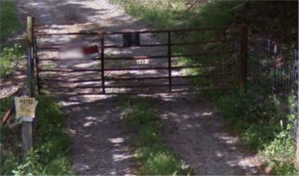
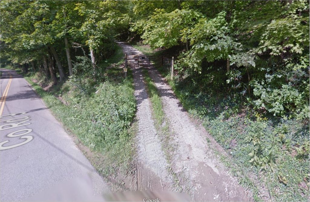
| Description | : | The Cheuvront Cemetery is located on a hill at the north end of Churchville on the site of the old Rufus Cheuvront farm. The access road is on the east side of Rt. 9 (Churchville Road) about a quarter of a mile north of the intersection of Rt. 9 and the turnoff to Isaac's Fork Road. The cemetery comprises just a handful of graves. On October 21, 1993, Charles White and Lovell Bush found and were able to read five headstones (for Rufus, Lydia, Leman, Clara, and Lucy), as part of the cemetery census done in Lewis County by the Hacker's... Read More |
frequently asked questions (FAQ):
-
Where is Cheuvront Cemetery?
Cheuvront Cemetery is located at Churchville, Lewis County ,West Virginia ,USA.
-
Cheuvront Cemetery cemetery's updated grave count on graveviews.com?
1 memorials
-
Where are the coordinates of the Cheuvront Cemetery?
Latitude: 39.1050600
Longitude: -80.5941370
Nearby Cemetories:
1. Woofter Cemetery
Lewis County, USA
Coordinate: 39.1044006, -80.6200027
2. Mount Zion Baptist Church Cemetery
Weston, Lewis County, USA
Coordinate: 39.1182850, -80.5699220
3. Snyder Cemetery
Churchville, Lewis County, USA
Coordinate: 39.0918312, -80.5624847
4. Saint Mary's Cemetery
Fink, Lewis County, USA
Coordinate: 39.1180992, -80.6264038
5. Law Chapel Cemetery
Lewis County, USA
Coordinate: 39.1374670, -80.5739770
6. Freemansburg United Methodist Church Cemetery
Freemansburg, Lewis County, USA
Coordinate: 39.0913030, -80.5290410
7. Freemansburg Baptist Cemetery
Freemansburg, Lewis County, USA
Coordinate: 39.0903750, -80.5290080
8. Beech Grove Cemetery
Weston, Lewis County, USA
Coordinate: 39.1070170, -80.5141540
9. Mount Morris Cemetery
Freemansburg, Lewis County, USA
Coordinate: 39.1066510, -80.5128230
10. Upper Little Indian Fork Cemetery
Coldwater, Doddridge County, USA
Coordinate: 39.1632996, -80.6296997
11. Walnut Fork Cemetery
Lewis County, USA
Coordinate: 39.0706910, -80.6644980
12. Morris Cemetery
Benson, Harrison County, USA
Coordinate: 39.1669006, -80.5547028
13. Straight Run Cemetery
Hurst, Lewis County, USA
Coordinate: 39.0802994, -80.6774979
14. Mount Lebanon Cemetery
Harrison County, USA
Coordinate: 39.1721992, -80.5603027
15. Lough Cemetery
New Milton, Doddridge County, USA
Coordinate: 39.1514160, -80.6667000
16. Saint Boniface Catholic Cemetery
Camden, Lewis County, USA
Coordinate: 39.0342580, -80.6288680
17. Indian Fork Cemetery
Doddridge County, USA
Coordinate: 39.1739006, -80.6380997
18. Henry Cemetery
Camden, Lewis County, USA
Coordinate: 39.0292350, -80.5751540
19. Green Hill Cemetery
Harrison County, USA
Coordinate: 39.1610080, -80.5112400
20. Saint Johannes Lutheran Church Cemetery
New Milton, Doddridge County, USA
Coordinate: 39.1258320, -80.7014290
21. Waldeck Cemetery
Waldeck, Lewis County, USA
Coordinate: 39.0486860, -80.5095950
22. Hurst Cemetery
Lewis County, USA
Coordinate: 39.0741997, -80.6999969
23. Pleasant Hill United Methodist Church Cemetery
Harrison County, USA
Coordinate: 39.1469990, -80.4944340
24. Halderman Cemetery
Lewis County, USA
Coordinate: 39.0821991, -80.7039032