
| Memorials | : | 0 |
| Location | : | Lilesville, Anson County, USA |
| Coordinate | : | 34.9329060, -79.9543510 |
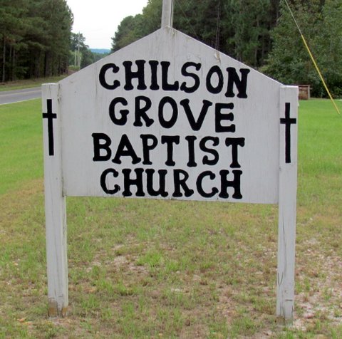
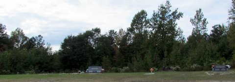
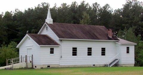
| Description | : | Primarily an African American Church Cemetery. From Highway 74, go south on Hailey's Ferry Road, then right on Ursery Road, then left on Grover Bennett Rd, then left on State Road 1806. Church will be on the left hand side of the road. On September 30, 2015 all existing headstones at that time were photographed. |
frequently asked questions (FAQ):
-
Where is Chilson Grove Baptist Church Cemetery?
Chilson Grove Baptist Church Cemetery is located at Lilesville, Anson County ,North Carolina ,USA.
-
Chilson Grove Baptist Church Cemetery cemetery's updated grave count on graveviews.com?
0 memorials
-
Where are the coordinates of the Chilson Grove Baptist Church Cemetery?
Latitude: 34.9329060
Longitude: -79.9543510
Nearby Cemetories:
1. Jones Cemetery
Lilesville, Anson County, USA
Coordinate: 34.9423770, -79.9501170
2. Elijah Ratliff Cemetery
Lilesville, Anson County, USA
Coordinate: 34.9423900, -79.9500100
3. Harris Cemetery
Lilesville, Anson County, USA
Coordinate: 34.9410670, -79.9622400
4. Seago Cemetery
Lilesville, Anson County, USA
Coordinate: 34.9375660, -79.9398920
5. Old Centenery Cemetery
Lilesville, Anson County, USA
Coordinate: 34.9308900, -79.9377500
6. Gum Springs Baptist Church Cemetery
Lilesville, Anson County, USA
Coordinate: 34.9364450, -79.9367270
7. Harris Cemetery
Lilesville, Anson County, USA
Coordinate: 34.9360890, -79.9731300
8. Ingram Cemetery
Lilesville, Anson County, USA
Coordinate: 34.9511850, -79.9562320
9. Williams Family Cemetery
Lilesville, Anson County, USA
Coordinate: 34.9472800, -79.9763360
10. C H Ratliff Cemetery
Anson County, USA
Coordinate: 34.9267040, -79.9235840
11. Hinson Cemetery
Morven, Anson County, USA
Coordinate: 34.9156900, -79.9180220
12. Forestville United Methodist Church Cemetery
Lilesville, Anson County, USA
Coordinate: 34.9654600, -79.9375200
13. Rock Hill Missionary Baptist Church Cemetery
Pee Dee, Anson County, USA
Coordinate: 34.9513500, -79.9138000
14. Robinson-Ellerbe Cemetery
Pee Dee, Anson County, USA
Coordinate: 34.9223540, -79.9076900
15. Elizabeth Baptist Church Cemetery
Pee Dee, Anson County, USA
Coordinate: 34.9214210, -79.9068800
16. Liles Cemetery
Lilesville, Anson County, USA
Coordinate: 34.9689020, -79.9784360
17. Shady Grove Methodist Church Cemetery
Cairo, Anson County, USA
Coordinate: 34.9193500, -79.8984580
18. Cedar Creek Meeting House Cemetery
Lilesville, Anson County, USA
Coordinate: 34.9717330, -79.9910800
19. Shiloh United Methodist Church Cemetery
Cairo, Anson County, USA
Coordinate: 34.8853190, -79.9371730
20. Lilesville Cemetery
Lilesville, Anson County, USA
Coordinate: 34.9719930, -79.9917390
21. Battle-Lindsey Cemetery
Lilesville, Anson County, USA
Coordinate: 34.9722960, -79.9957630
22. Womble Chapel AME Zion Church Cemetery
Lilesville, Anson County, USA
Coordinate: 34.9338100, -79.8894000
23. Martin Adams Cemetery
Cairo, Anson County, USA
Coordinate: 34.8797350, -79.9502560
24. Barrett Cemetery
Pee Dee, Anson County, USA
Coordinate: 34.9351350, -79.8893220