
| Memorials | : | 1 |
| Location | : | Cairo, Anson County, USA |
| Coordinate | : | 34.9193500, -79.8984580 |
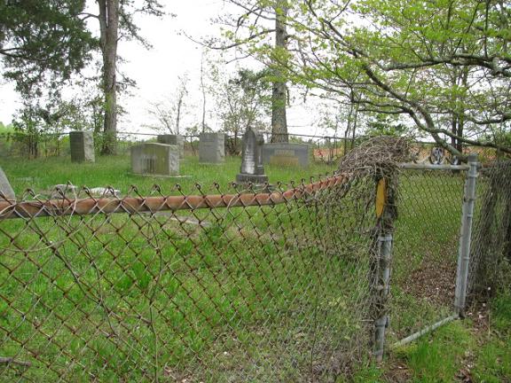
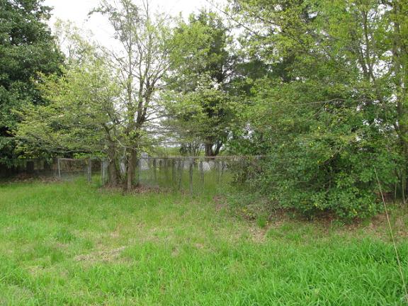
| Description | : | Coming from Lilesville, N.C. east on highway 74. Turn right on highway 145 south. Turn left on Pitt Road. Cemetery is on the right beside the highway at the peach orchard. This is two cemeteries in one separated by a wire fence. The cemetery on the right has been kept up. The one on the left has not. From the road the cemetery on the left has Adcock, Clark (Clarke), Hudson, Liles, Sinclair, Webb. The cemetery on the right has Boggan, DeBerry, Fisher, Flowers, Hinson. Note: According to the Anson County Historical Society, Shady Grove Methodist Church Cemetery is the correct name.... Read More |
frequently asked questions (FAQ):
-
Where is Shady Grove Methodist Church Cemetery?
Shady Grove Methodist Church Cemetery is located at Pitt Road Cairo, Anson County ,North Carolina ,USA.
-
Shady Grove Methodist Church Cemetery cemetery's updated grave count on graveviews.com?
1 memorials
-
Where are the coordinates of the Shady Grove Methodist Church Cemetery?
Latitude: 34.9193500
Longitude: -79.8984580
Nearby Cemetories:
1. Elizabeth Baptist Church Cemetery
Pee Dee, Anson County, USA
Coordinate: 34.9214210, -79.9068800
2. Robinson-Ellerbe Cemetery
Pee Dee, Anson County, USA
Coordinate: 34.9223540, -79.9076900
3. Womble Chapel AME Zion Church Cemetery
Lilesville, Anson County, USA
Coordinate: 34.9338100, -79.8894000
4. Hinson Cemetery
Morven, Anson County, USA
Coordinate: 34.9156900, -79.9180220
5. Barrett Cemetery
Pee Dee, Anson County, USA
Coordinate: 34.9351350, -79.8893220
6. C H Ratliff Cemetery
Anson County, USA
Coordinate: 34.9267040, -79.9235840
7. Thomas Diggs Cemetery
Pee Dee, Anson County, USA
Coordinate: 34.8969660, -79.8801540
8. Diggs Cemetery
Cairo, Anson County, USA
Coordinate: 34.8970000, -79.8800100
9. Old Centenery Cemetery
Lilesville, Anson County, USA
Coordinate: 34.9308900, -79.9377500
10. Rock Hill Missionary Baptist Church Cemetery
Pee Dee, Anson County, USA
Coordinate: 34.9513500, -79.9138000
11. Gum Springs Baptist Church Cemetery
Lilesville, Anson County, USA
Coordinate: 34.9364450, -79.9367270
12. Seago Cemetery
Lilesville, Anson County, USA
Coordinate: 34.9375660, -79.9398920
13. Flowers Family
Cairo, Anson County, USA
Coordinate: 34.8779040, -79.8860550
14. Shiloh United Methodist Church Cemetery
Cairo, Anson County, USA
Coordinate: 34.8853190, -79.9371730
15. Chilson Grove Baptist Church Cemetery
Lilesville, Anson County, USA
Coordinate: 34.9329060, -79.9543510
16. Elijah Ratliff Cemetery
Lilesville, Anson County, USA
Coordinate: 34.9423900, -79.9500100
17. Jones Cemetery
Lilesville, Anson County, USA
Coordinate: 34.9423770, -79.9501170
18. Thomas Ratliff Cemetery
Cairo, Anson County, USA
Coordinate: 34.8708450, -79.9166700
19. John Wall Cemetery
Richmond County, USA
Coordinate: 34.9582060, -79.8539540
20. Old Quaker Cemetery
Cordova, Richmond County, USA
Coordinate: 34.8906200, -79.8400200
21. Forestville United Methodist Church Cemetery
Lilesville, Anson County, USA
Coordinate: 34.9654600, -79.9375200
22. Harris Cemetery
Lilesville, Anson County, USA
Coordinate: 34.9410670, -79.9622400
23. Ingram Cemetery
Lilesville, Anson County, USA
Coordinate: 34.9511850, -79.9562320
24. Martin Adams Cemetery
Cairo, Anson County, USA
Coordinate: 34.8797350, -79.9502560