
| Memorials | : | 4 |
| Location | : | Brandon, Douglas County, USA |
| Coordinate | : | 45.9481010, -95.5932999 |
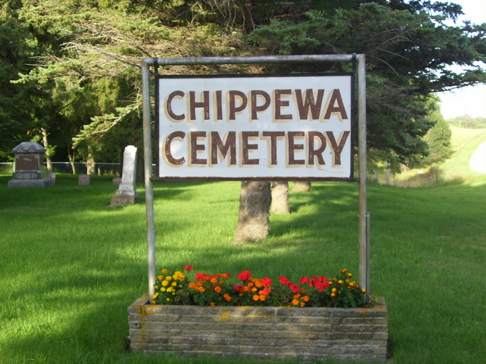
| Description | : | Chippewa Cemetery is located one mile south of Brandon, then one mile east on Skrove Road. A plot of land was given by Ole Thompson in 1875 with the intention that a church and cemetery would be established on the site. Because the railroad had not yet been built, they delayed building the church until the railroad route was established. The church was built in Brandon and the cemetery was located on the original plot. In 1966 the cemetery was incorporated and enlarged by an addition to the west of the original plot. |
frequently asked questions (FAQ):
-
Where is Chippewa Cemetery?
Chippewa Cemetery is located at Brandon, Douglas County ,Minnesota ,USA.
-
Chippewa Cemetery cemetery's updated grave count on graveviews.com?
4 memorials
-
Where are the coordinates of the Chippewa Cemetery?
Latitude: 45.9481010
Longitude: -95.5932999
Nearby Cemetories:
1. Chippewa Lutheran Church Burial Site
Brandon, Douglas County, USA
Coordinate: 45.9618100, -95.6003300
2. Saint Ann's Cemetery
Brandon, Douglas County, USA
Coordinate: 45.9669100, -95.5936100
3. Brandon Cemetery
Brandon, Douglas County, USA
Coordinate: 45.9702988, -95.6128006
4. Adkinsville Cemetery
Douglas County, USA
Coordinate: 45.9073700, -95.5965600
5. Saint Petri Cemetery
Alexandria, Douglas County, USA
Coordinate: 45.9255900, -95.6448200
6. West Moe Lutheran Cemetery
Douglas County, USA
Coordinate: 45.9053200, -95.6153600
7. East Moe Lutheran Church Cemetery
Garfield, Douglas County, USA
Coordinate: 45.9285000, -95.5305700
8. Edgefield Cemetery
Douglas County, USA
Coordinate: 46.0124779, -95.6031952
9. Moe Heights Cemetery
Douglas County, USA
Coordinate: 45.8746986, -95.5931015
10. Saint Johns Cemetery
Garfield, Douglas County, USA
Coordinate: 45.9411011, -95.4824982
11. Oak Hill Cemetery
Garfield, Douglas County, USA
Coordinate: 45.9723470, -95.4817660
12. Saint Lukes Cemetery
Garfield, Douglas County, USA
Coordinate: 45.9721985, -95.4805984
13. Mound Grove Cemetery
Evansville, Douglas County, USA
Coordinate: 46.0019444, -95.6880556
14. Finnish Apostolic Cemetery
Holmes City, Douglas County, USA
Coordinate: 45.8613470, -95.6046580
15. Saint Pauls Lutheran Church Cemetery
Holmes City, Douglas County, USA
Coordinate: 45.8604700, -95.5878100
16. Fryksande Lutheran Cemetery
Evansville, Douglas County, USA
Coordinate: 45.9067001, -95.7181015
17. Lake Ida Cemetery
Garfield, Douglas County, USA
Coordinate: 45.9486008, -95.4421997
18. White Garden Cemetery
Douglas County, USA
Coordinate: 45.8619003, -95.5068970
19. Zionsborg Cemetery
Douglas County, USA
Coordinate: 45.9338989, -95.7561035
20. Rose Hill Cemetery
Holmes City, Douglas County, USA
Coordinate: 45.8408012, -95.5361023
21. Trinity Lutheran Cemetery
Holmes City, Douglas County, USA
Coordinate: 45.8405800, -95.5359060
22. Lake Moses Cemetery
Millerville, Douglas County, USA
Coordinate: 46.0662300, -95.6141300
23. Seven Dolors Catholic Cemetery
Millerville, Douglas County, USA
Coordinate: 46.0700200, -95.5620900
24. Lake Charley Cemetery
Douglas County, USA
Coordinate: 45.9444008, -95.4116974