
| Memorials | : | 0 |
| Location | : | Douglas County, USA |
| Coordinate | : | 46.0124779, -95.6031952 |
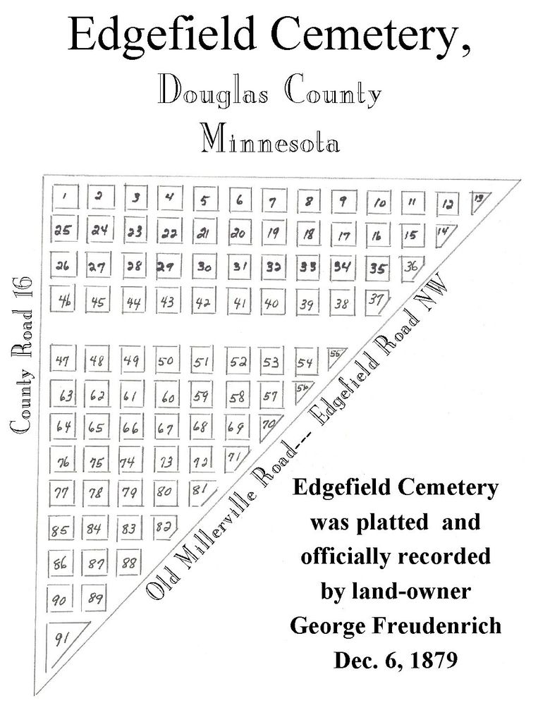
| Description | : | Edgefield Cemetery Brandon's Pioneer Cemetery-Est., CA 1866 The origin of Brandon and its pioneer cemetery began in 1859, with the establishment of the "Chippewa Stage Station" on the "Abercrombie Trail" on the North shore of Little Chippewa Lake, by Henry and Mary Gager. In 1862, the Sioux Indian uprising forced the Gager family to flee the area and the soldiers of the 8th Regiment of the Minnesota Volunteers out of Fort Ripley took over the area and the name changed to Fort Chippewa. In 1866 the settlers began to return and a Swiss immigrant, George A. Freudenreich, purchased Gager's 160 acre homestead... Read More |
frequently asked questions (FAQ):
-
Where is Edgefield Cemetery?
Edgefield Cemetery is located at Douglas County ,Minnesota ,USA.
-
Edgefield Cemetery cemetery's updated grave count on graveviews.com?
0 memorials
-
Where are the coordinates of the Edgefield Cemetery?
Latitude: 46.0124779
Longitude: -95.6031952


Nearby Cemetories:
1. Brandon Cemetery
Brandon, Douglas County, USA
Coordinate: 45.9702988, -95.6128006
2. Saint Ann's Cemetery
Brandon, Douglas County, USA
Coordinate: 45.9669100, -95.5936100
3. Chippewa Lutheran Church Burial Site
Brandon, Douglas County, USA
Coordinate: 45.9618100, -95.6003300
4. Lake Moses Cemetery
Millerville, Douglas County, USA
Coordinate: 46.0662300, -95.6141300
5. Mound Grove Cemetery
Evansville, Douglas County, USA
Coordinate: 46.0019444, -95.6880556
6. Seven Dolors Catholic Cemetery
Millerville, Douglas County, USA
Coordinate: 46.0700200, -95.5620900
7. Chippewa Cemetery
Brandon, Douglas County, USA
Coordinate: 45.9481010, -95.5932999
8. Trinity Lutheran Cemetery
Millerville, Douglas County, USA
Coordinate: 46.0924800, -95.6126400
9. Christina Lake Lutheran Church Cemetery
Evansville, Douglas County, USA
Coordinate: 46.0638400, -95.7070200
10. Saint Petri Cemetery
Alexandria, Douglas County, USA
Coordinate: 45.9255900, -95.6448200
11. Oak Hill Cemetery
Garfield, Douglas County, USA
Coordinate: 45.9723470, -95.4817660
12. Saint Lukes Cemetery
Garfield, Douglas County, USA
Coordinate: 45.9721985, -95.4805984
13. East Moe Lutheran Church Cemetery
Garfield, Douglas County, USA
Coordinate: 45.9285000, -95.5305700
14. Adkinsville Cemetery
Douglas County, USA
Coordinate: 45.9073700, -95.5965600
15. Ellis Family Burial Site
Leaf Valley, Douglas County, USA
Coordinate: 46.0491200, -95.4589400
16. West Moe Lutheran Cemetery
Douglas County, USA
Coordinate: 45.9053200, -95.6153600
17. Saint Johns Cemetery
Garfield, Douglas County, USA
Coordinate: 45.9411011, -95.4824982
18. Ebenezer Cemetery
Leaf Valley, Douglas County, USA
Coordinate: 46.0278015, -95.4419022
19. Inspiration Peak Cemetery
Clitherall, Otter Tail County, USA
Coordinate: 46.1364970, -95.5844130
20. Sacred Heart Catholic Church Cemetery
Urbank, Otter Tail County, USA
Coordinate: 46.1234900, -95.5105200
21. Lake Ida Cemetery
Garfield, Douglas County, USA
Coordinate: 45.9486008, -95.4421997
22. Eagle Lake Free Cemetery
Urbank, Otter Tail County, USA
Coordinate: 46.1366997, -95.6613998
23. Zionsborg Cemetery
Douglas County, USA
Coordinate: 45.9338989, -95.7561035
24. Fryksande Lutheran Cemetery
Evansville, Douglas County, USA
Coordinate: 45.9067001, -95.7181015