
| Memorials | : | 1 |
| Location | : | Smith Town, McCreary County, USA |
| Coordinate | : | 36.7184107, -84.5302171 |
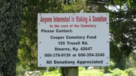
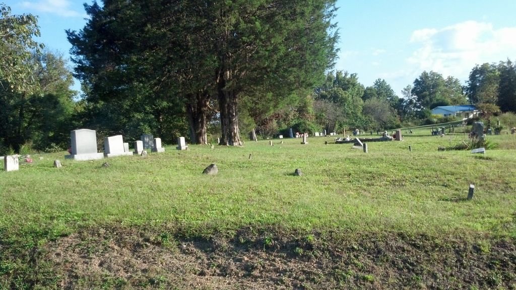
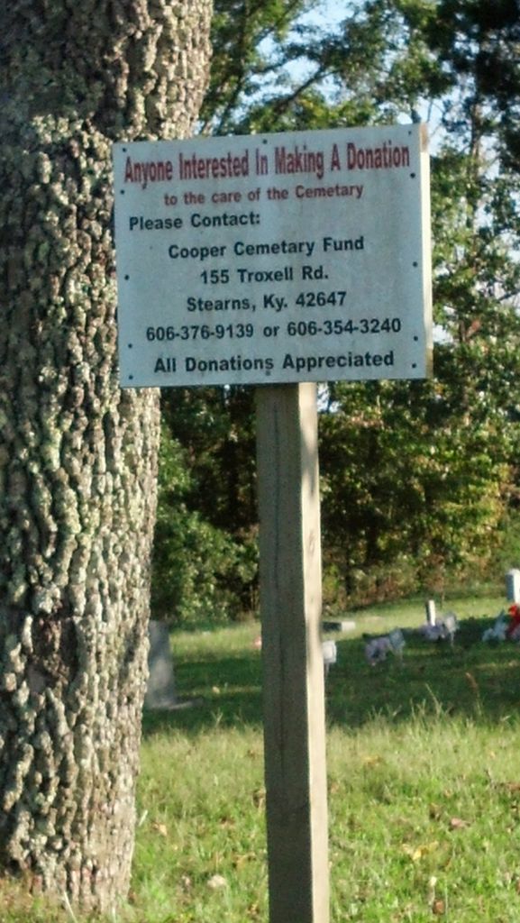
| Description | : | This cemetery is located at Smith Town or Smithtown. The USGS topographic map listed it as the Chitwood Cemetery. Local residents called it the Cooper Cemetery, and in the last twenty years or so it has also been known as the Hilltop Cemetery. The U.S. Geological Survey (USGS) Geographic Names Information System (GNIS) feature ID for the cemetery is 511353 (Chitwood Cemetery). |
frequently asked questions (FAQ):
-
Where is Chitwood Cemetery?
Chitwood Cemetery is located at Ottis New Road Smith Town, McCreary County ,Kentucky , 42647USA.
-
Chitwood Cemetery cemetery's updated grave count on graveviews.com?
1 memorials
-
Where are the coordinates of the Chitwood Cemetery?
Latitude: 36.7184107
Longitude: -84.5302171
Nearby Cemetories:
1. Carter Cemetery
McCreary County, USA
Coordinate: 36.7406006, -84.4985962
2. Mountain View Cemetery
McCreary County, USA
Coordinate: 36.7175960, -84.5746640
3. Angel Cemetery
Stearns, McCreary County, USA
Coordinate: 36.6982100, -84.4912100
4. Keith Cemetery
McCreary County, USA
Coordinate: 36.7458240, -84.5659980
5. Nancy Grave Cemetery
McCreary County, USA
Coordinate: 36.6822014, -84.5535965
6. Holloway Cemetery
Marshes Siding, McCreary County, USA
Coordinate: 36.7372017, -84.4794006
7. Stearns Cemetery
Stearns, McCreary County, USA
Coordinate: 36.6922836, -84.4794998
8. Coffey Cemetery
McCreary County, USA
Coordinate: 36.7414017, -84.5888977
9. Lower Hickory Grove Cemetery
McCreary County, USA
Coordinate: 36.6762848, -84.4868317
10. Stevens-Foster Cemetery
Barthell, McCreary County, USA
Coordinate: 36.6639560, -84.5104000
11. Corder Cemetery
Hill Top, McCreary County, USA
Coordinate: 36.7503480, -84.5917470
12. Taylor Ridge Cemetery
Marshes Siding, McCreary County, USA
Coordinate: 36.7509560, -84.4572150
13. Ross Grove Cemetery
McCreary County, USA
Coordinate: 36.6545143, -84.4968491
14. Barr Cemetery
Barthell, McCreary County, USA
Coordinate: 36.6537270, -84.5618930
15. Phillips Cemetery
McCreary County, USA
Coordinate: 36.6998100, -84.6165300
16. Barren Fork Cemetery
McCreary County, USA
Coordinate: 36.7771988, -84.4692001
17. Davis Cemetery
Marshes Siding, McCreary County, USA
Coordinate: 36.7868996, -84.5789032
18. King Cemetery
McCreary County, USA
Coordinate: 36.6407200, -84.5605200
19. Phillips Cemetery
McCreary County, USA
Coordinate: 36.7528000, -84.6232986
20. Smith Cemetery
McCreary County, USA
Coordinate: 36.6513820, -84.4703630
21. Otter Creek Cemetery
McCreary County, USA
Coordinate: 36.6358490, -84.5081024
22. Pine Knot Cemetery
Pine Knot, McCreary County, USA
Coordinate: 36.6650009, -84.4475021
23. Pine Knot Memorial Garden
Pine Knot, McCreary County, USA
Coordinate: 36.6650000, -84.4475000
24. Flat Rock Cemetery
Flat Rock, McCreary County, USA
Coordinate: 36.7954800, -84.4838200