
| Memorials | : | 67 |
| Location | : | Hepple, Northumberland Unitary Authority, England |
| Coordinate | : | 55.2995800, -2.0261400 |
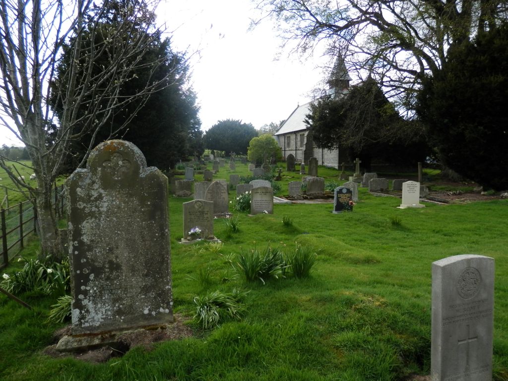
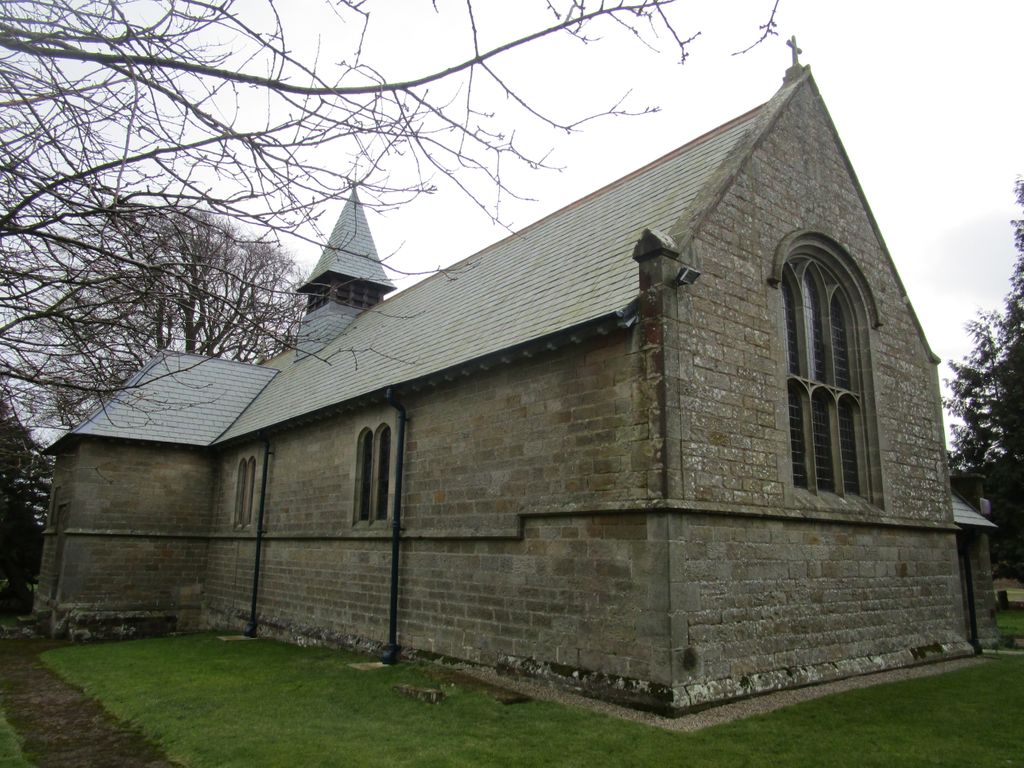
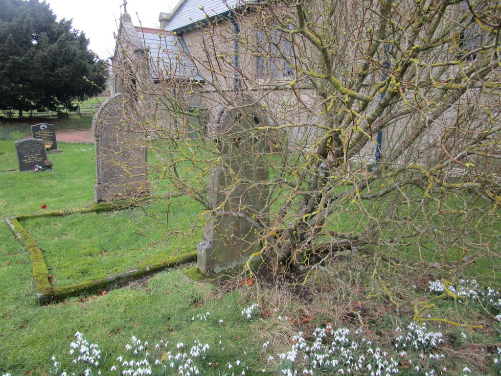
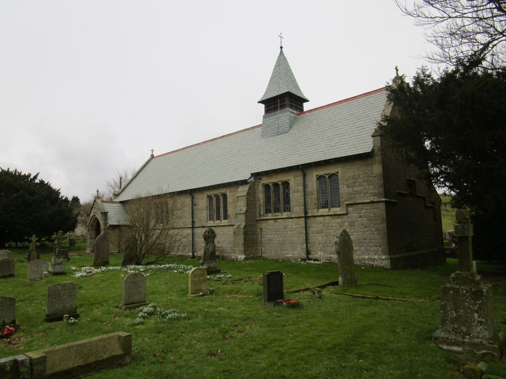
| Description | : | Christ Church, Hepple, was founded with a bequest by Sir Walter Buchanan-Riddell, who died in 1892, and in his will left some money for the purpose of building a church and a school at Hepple. The architect Mr C. Hodgson-Fowler adopted a simple late perpendicular style using local stone. The church and burial ground were consecrated June 5th, 1897, by the first Lord Bishop of Newcastle, Ernest Roland Wilberforce. The church was designated as a chapel-at-ease within the ecclesiastical parish of Rothbury. A brass plate in the wall near the pulpit bears the following inscription:—“To the Glory of God, the honour... Read More |
frequently asked questions (FAQ):
-
Where is Christ Church Churchyard?
Christ Church Churchyard is located at Hepple, Northumberland Unitary Authority ,Northumberland ,England.
-
Christ Church Churchyard cemetery's updated grave count on graveviews.com?
4 memorials
-
Where are the coordinates of the Christ Church Churchyard?
Latitude: 55.2995800
Longitude: -2.0261400

Nearby Cemetories:
1. Saint Mary the Virgin
Alwinton, Northumberland Unitary Authority, England
Coordinate: 55.3180180, -2.0725620
2. St Mary The Virgin Churchyard
Holystone, Northumberland Unitary Authority, England
Coordinate: 55.3181420, -2.0728750
3. St Michael and All Angels Churchyard
Alwinton, Northumberland Unitary Authority, England
Coordinate: 55.3460600, -2.1218900
4. St. Cuthbert's Churchyard
Elsdon, Northumberland Unitary Authority, England
Coordinate: 55.2336850, -2.1013070
5. St. Michael & All Angels Churchyard
Alnham, Northumberland Unitary Authority, England
Coordinate: 55.3926170, -2.0159210
6. Brinkburn Priory and Manor House
Longframlington, Northumberland Unitary Authority, England
Coordinate: 55.2789620, -1.8194090
7. Brinkburn Priory
Brinkburn, Northumberland Unitary Authority, England
Coordinate: 55.2788120, -1.8191170
8. Longframlington Cemetery
Longframlington, Northumberland Unitary Authority, England
Coordinate: 55.3085440, -1.8003926
9. St Mary the Virgin Churchyard
Longframlington, Northumberland Unitary Authority, England
Coordinate: 55.3028950, -1.7952920
10. Longframlington Church Cemetery Extension
Longframlington, Northumberland Unitary Authority, England
Coordinate: 55.3014700, -1.7950600
11. Holy Trinity Church
Horsley, Northumberland Unitary Authority, England
Coordinate: 55.2687020, -2.2511820
12. St Cuthbert Churchyard
Corsenside, Northumberland Unitary Authority, England
Coordinate: 55.1974870, -2.1737480
13. Cambo Burial Ground
Cambo, Northumberland Unitary Authority, England
Coordinate: 55.1678800, -1.9665200
14. Holy Trinity Churchyard
Cambo, Northumberland Unitary Authority, England
Coordinate: 55.1659450, -1.9598470
15. St John the Baptist Churchyard
Edlingham, Northumberland Unitary Authority, England
Coordinate: 55.3758250, -1.8212200
16. St. Michael and All Angels Churchyard
Ingram, Northumberland Unitary Authority, England
Coordinate: 55.4405530, -1.9706240
17. St Bartholomew Churchyard
Kirkwhelpington, Northumberland Unitary Authority, England
Coordinate: 55.1539930, -2.0070970
18. Bolton Chapel
Edlingham, Northumberland Unitary Authority, England
Coordinate: 55.4168580, -1.8335818
19. Saint Andrews Churchyard
Hartburn, Northumberland Unitary Authority, England
Coordinate: 55.1683350, -1.8596667
20. Saint Helen’s Churchyard
Longhorsley, Northumberland Unitary Authority, England
Coordinate: 55.2432500, -1.7588200
21. St. Wilfrid Churchyard
Kirkharle, Northumberland Unitary Authority, England
Coordinate: 55.1381750, -1.9832180
22. Felton Cemetery
Felton, Northumberland Unitary Authority, England
Coordinate: 55.3020920, -1.7118410
23. St Andrew Churchyard
Bolam, Northumberland Unitary Authority, England
Coordinate: 55.1376680, -1.8565600
24. St. John Churchyard
Meldon, Northumberland Unitary Authority, England
Coordinate: 55.1489650, -1.8144770