
| Memorials | : | 1 |
| Location | : | Jefferson, Jefferson County, USA |
| Coordinate | : | 43.0121000, -88.7639500 |
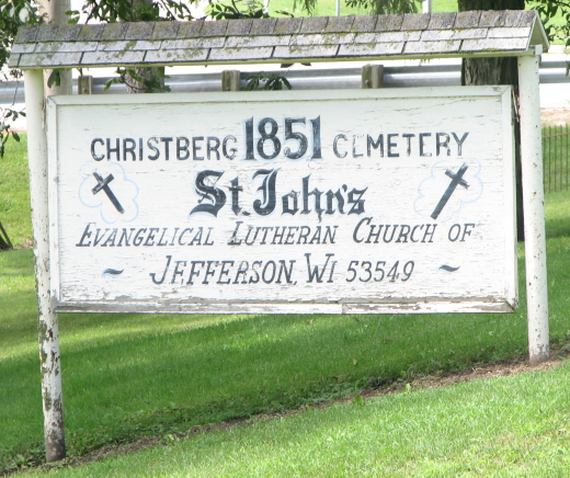
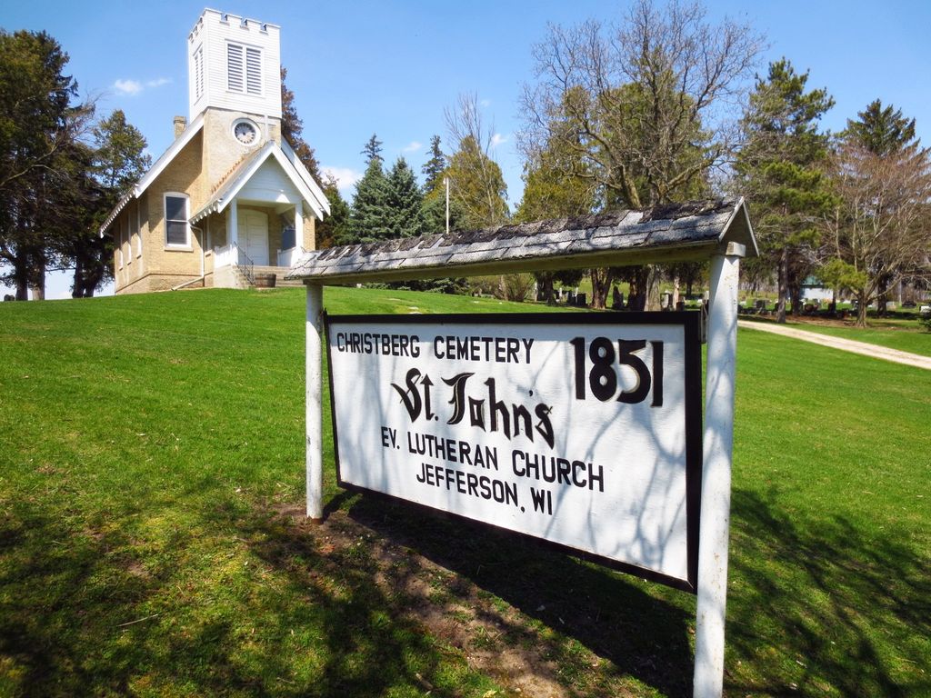
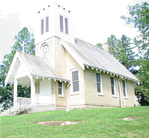
| Description | : | In 1849 a group of people began meeting to plan the formation of a Lutheran congregation near Jefferson Wisconsin and with 2 acres of land donated by Nic Bayreuther and Karl Layritz Christberg Cemetery and Church were created. The original church was a plain log structure with no tower or other marks that would associate it with a church. In the following years, pine siding would be added to give the church more character and beauty. For seven years the immigrant families worshipped at Christberg with reading services sometimes supplemented by visiting pastors from neighbouring Helenville and Watertown. In 1857... Read More |
frequently asked questions (FAQ):
-
Where is Christberg Cemetery?
Christberg Cemetery is located at N 4702 Christberg Road Jefferson, Jefferson County ,Wisconsin , 53549USA.
-
Christberg Cemetery cemetery's updated grave count on graveviews.com?
1 memorials
-
Where are the coordinates of the Christberg Cemetery?
Latitude: 43.0121000
Longitude: -88.7639500
Nearby Cemetories:
1. Saint Lawrence Catholic Church Cemetery
Jefferson, Jefferson County, USA
Coordinate: 43.0051100, -88.7783100
2. Saint Coletta Cemetery
Jefferson, Jefferson County, USA
Coordinate: 43.0044900, -88.7794800
3. Union Cemetery
Jefferson, Jefferson County, USA
Coordinate: 43.0107994, -88.7966995
4. Saint John the Baptist Catholic Cemetery
Jefferson, Jefferson County, USA
Coordinate: 43.0099983, -88.7985992
5. Greenwood Cemetery
Jefferson, Jefferson County, USA
Coordinate: 43.0116997, -88.8041992
6. Zion Lutheran Church Cemetery
Helenville, Jefferson County, USA
Coordinate: 43.0194016, -88.7218170
7. Rock River Cemetery
Jefferson, Jefferson County, USA
Coordinate: 42.9832993, -88.8078003
8. Evergreen Cemetery
Helenville, Jefferson County, USA
Coordinate: 43.0117160, -88.6982380
9. Jefferson County Potters Field Cemetery
Jefferson, Jefferson County, USA
Coordinate: 42.9904870, -88.8247690
10. Saint Marys Cemetery
Johnson Creek, Jefferson County, USA
Coordinate: 43.0685997, -88.7814026
11. Wild Wood Cemetery
Fort Atkinson, Jefferson County, USA
Coordinate: 42.9539490, -88.7903824
12. Evergreen Cemetery
Johnson Creek, Jefferson County, USA
Coordinate: 43.0764008, -88.7703018
13. Immanuel Evangelical Lutheran Church Cemetery
Farmington, Jefferson County, USA
Coordinate: 43.0763580, -88.7366430
14. Farmington Cemetery
Farmington, Jefferson County, USA
Coordinate: 43.0724983, -88.6872025
15. Cushman Cemetery
Hebron, Jefferson County, USA
Coordinate: 42.9622002, -88.6714020
16. Bakertown Baptist Cemetery
Sullivan, Jefferson County, USA
Coordinate: 43.0434608, -88.6571198
17. Munro Cemetery
Hebron, Jefferson County, USA
Coordinate: 42.9319992, -88.7190018
18. Arity Family Cemetery
Fort Atkinson, Jefferson County, USA
Coordinate: 42.9787800, -88.8753600
19. Evergreen Cemetery
Fort Atkinson, Jefferson County, USA
Coordinate: 42.9407997, -88.8405991
20. Crowder Cemetery
Sullivan, Jefferson County, USA
Coordinate: 43.0003319, -88.6397018
21. Saint Lukes Cemetery
Rome, Jefferson County, USA
Coordinate: 42.9982986, -88.6399994
22. Salem Evangelical United Brethren Cemetery
Milford, Jefferson County, USA
Coordinate: 43.0972710, -88.8208313
23. Saint Joseph Catholic Cemetery
Fort Atkinson, Jefferson County, USA
Coordinate: 42.9313900, -88.8365000
24. Concord Cemetery
Farmington, Jefferson County, USA
Coordinate: 43.0736008, -88.6572037