
| Memorials | : | 1 |
| Location | : | Jefferson, Jefferson County, USA |
| Coordinate | : | 42.9904870, -88.8247690 |
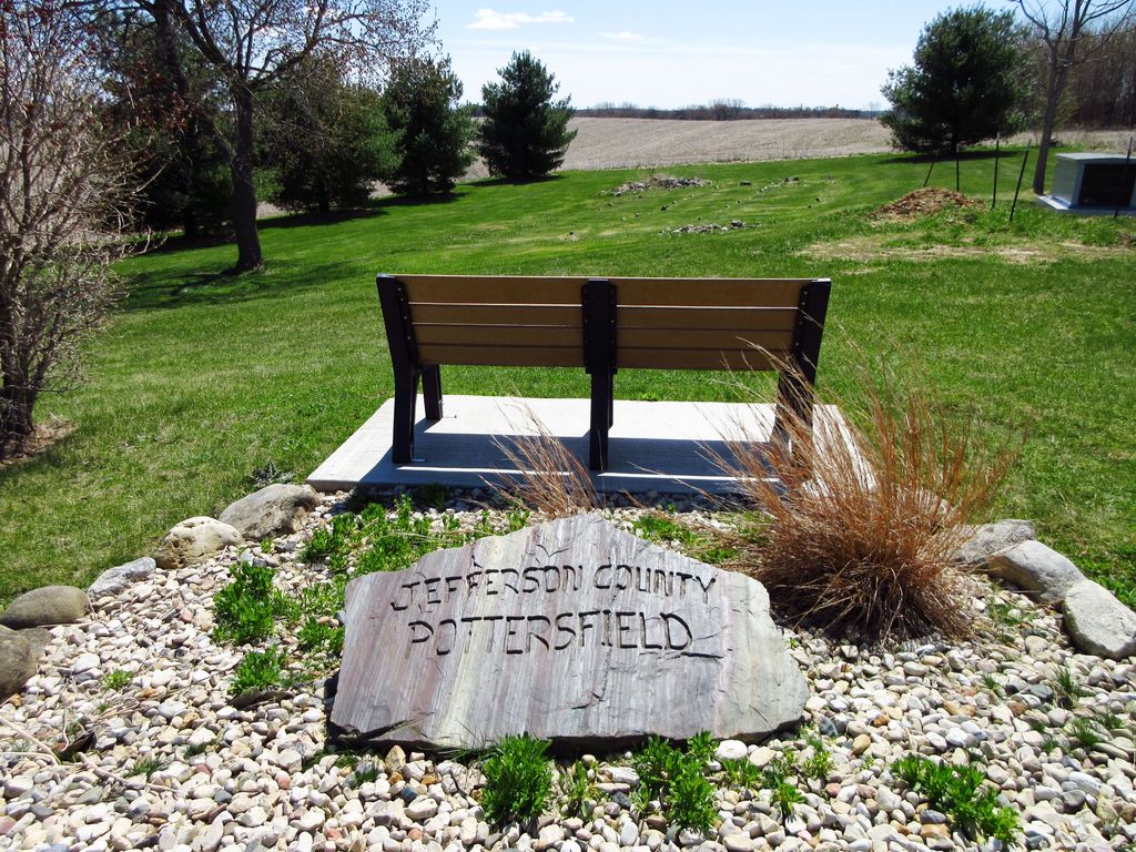
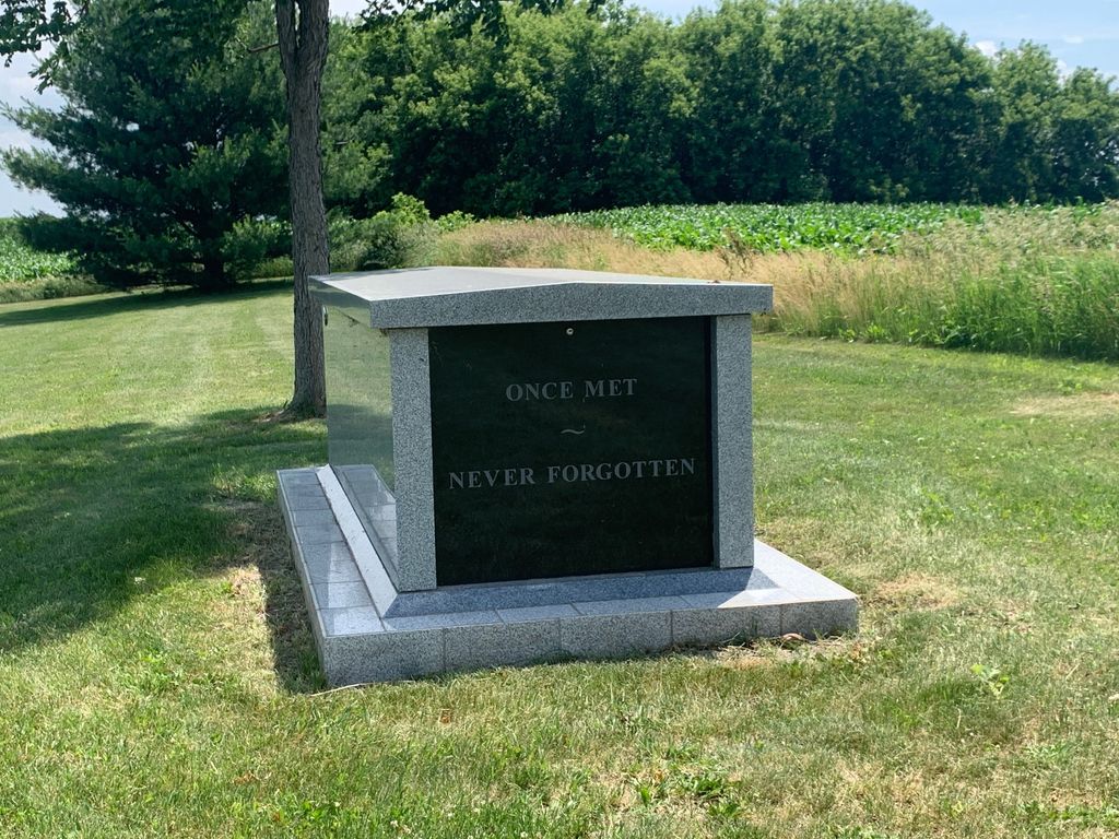
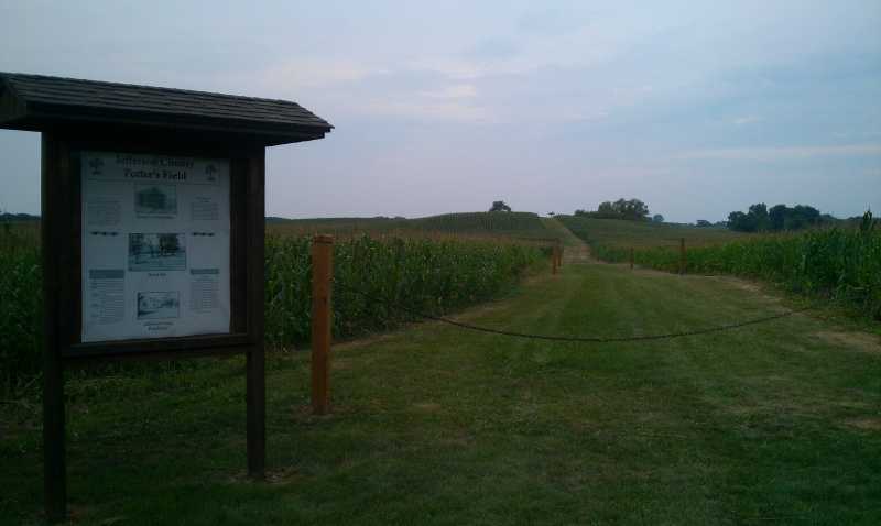
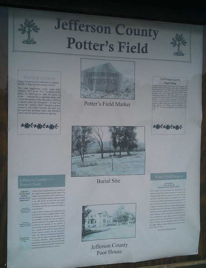
| Description | : | This burial site is located behind the UW Extension Building. It served as a final resting place for residents of the county poor farm and county asylum from 1856 through 1950. The area has been restored and records are kept by the Jefferson County Land and Water Conservation Department. Additional records are kept by the Dodge-Jefferson Genealogical Society. There is a cemetery monument and an informational kiosk at the main burial site. A limited number of individual markers remain - but they contain only the grave number. Some of the death dates given here may in fact be... Read More |
frequently asked questions (FAQ):
-
Where is Jefferson County Potters Field Cemetery?
Jefferson County Potters Field Cemetery is located at Collins Road Jefferson, Jefferson County ,Wisconsin , 53549USA.
-
Jefferson County Potters Field Cemetery cemetery's updated grave count on graveviews.com?
1 memorials
-
Where are the coordinates of the Jefferson County Potters Field Cemetery?
Latitude: 42.9904870
Longitude: -88.8247690
Nearby Cemetories:
1. Rock River Cemetery
Jefferson, Jefferson County, USA
Coordinate: 42.9832993, -88.8078003
2. Greenwood Cemetery
Jefferson, Jefferson County, USA
Coordinate: 43.0116997, -88.8041992
3. Saint John the Baptist Catholic Cemetery
Jefferson, Jefferson County, USA
Coordinate: 43.0099983, -88.7985992
4. Union Cemetery
Jefferson, Jefferson County, USA
Coordinate: 43.0107994, -88.7966995
5. Saint Coletta Cemetery
Jefferson, Jefferson County, USA
Coordinate: 43.0044900, -88.7794800
6. Saint Lawrence Catholic Church Cemetery
Jefferson, Jefferson County, USA
Coordinate: 43.0051100, -88.7783100
7. Arity Family Cemetery
Fort Atkinson, Jefferson County, USA
Coordinate: 42.9787800, -88.8753600
8. Wild Wood Cemetery
Fort Atkinson, Jefferson County, USA
Coordinate: 42.9539490, -88.7903824
9. Christberg Cemetery
Jefferson, Jefferson County, USA
Coordinate: 43.0121000, -88.7639500
10. Evergreen Cemetery
Fort Atkinson, Jefferson County, USA
Coordinate: 42.9407997, -88.8405991
11. Ward Cemetery
Oakland, Jefferson County, USA
Coordinate: 42.9616680, -88.8955740
12. Saint Joseph Catholic Cemetery
Fort Atkinson, Jefferson County, USA
Coordinate: 42.9313900, -88.8365000
13. North Oakland Cemetery
Oakland, Jefferson County, USA
Coordinate: 43.0018997, -88.9088974
14. Taylor Family Cemetery
Fort Atkinson, Jefferson County, USA
Coordinate: 42.9476900, -88.9070320
15. Zion Lutheran Church Cemetery
Helenville, Jefferson County, USA
Coordinate: 43.0194016, -88.7218170
16. Lakeview Cemetery
Fort Atkinson, Jefferson County, USA
Coordinate: 42.9103012, -88.8482971
17. Union Cemetery
Sumner, Jefferson County, USA
Coordinate: 42.9342003, -88.9085999
18. Saint Marys Cemetery
Johnson Creek, Jefferson County, USA
Coordinate: 43.0685997, -88.7814026
19. Faith Community Church Memorial Garden
Fort Atkinson, Jefferson County, USA
Coordinate: 42.9010570, -88.8311600
20. Evergreen Cemetery
Johnson Creek, Jefferson County, USA
Coordinate: 43.0764008, -88.7703018
21. Evergreen Cemetery
Helenville, Jefferson County, USA
Coordinate: 43.0117160, -88.6982380
22. Oakland Center Cemetery
Oakland, Jefferson County, USA
Coordinate: 42.9767200, -88.9532600
23. Munro Cemetery
Hebron, Jefferson County, USA
Coordinate: 42.9319992, -88.7190018
24. Aztalan Cemetery
Milford, Jefferson County, USA
Coordinate: 43.0839005, -88.8630981