
| Memorials | : | 0 |
| Location | : | Rice County, USA |
| Coordinate | : | 44.4324989, -93.3572235 |
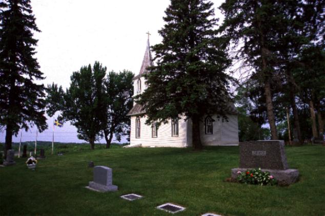
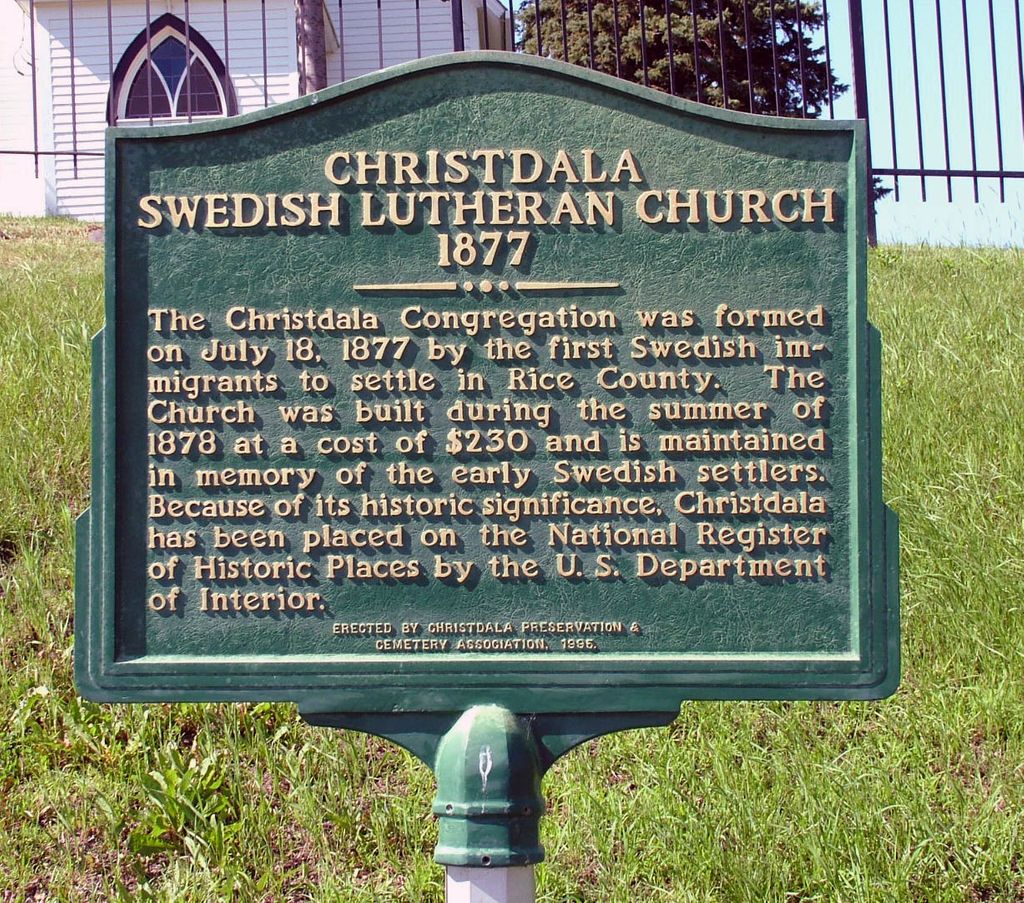
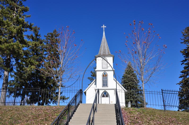
| Description | : | Located in Forest Township, the cemetery is situated on 1 1/8th acres of land overlooking Circle Lake. Maintained by the Christdala Church Preservation & Association a non-profit Corp. which was est. on 9/20/1994 their objective is to restore and maintain in unaltered & original condition of the cemetery and church; to preserve the heritage and legacy brought to America by Swedish immigrants who Est. Christdala. |
frequently asked questions (FAQ):
-
Where is Christdala Evangelical Lutheran Church Cemetery?
Christdala Evangelical Lutheran Church Cemetery is located at Rice County ,Minnesota ,USA.
-
Christdala Evangelical Lutheran Church Cemetery cemetery's updated grave count on graveviews.com?
0 memorials
-
Where are the coordinates of the Christdala Evangelical Lutheran Church Cemetery?
Latitude: 44.4324989
Longitude: -93.3572235
Nearby Cemetories:
1. German Union Cemetery
Rice County, USA
Coordinate: 44.4199982, -93.3808365
2. Forest Cemetery
Millersburg, Rice County, USA
Coordinate: 44.4138800, -93.3219050
3. Trondhjem Cemetery
Rice County, USA
Coordinate: 44.4638901, -93.4019394
4. Fox Lake Norwegian Cemetery
Millersburg, Rice County, USA
Coordinate: 44.3848550, -93.3343400
5. Berg Cemetery
Dundas, Rice County, USA
Coordinate: 44.4433300, -93.2813900
6. Rolling Green Cemetery
Rice County, USA
Coordinate: 44.4585991, -93.2786026
7. Calvary Hill Cemetery
Lonsdale, Rice County, USA
Coordinate: 44.4706001, -93.4282990
8. Czech National Cemetery
Lonsdale, Rice County, USA
Coordinate: 44.4863100, -93.4256100
9. Saint Patrick Catholic Cemetery
Shieldsville, Rice County, USA
Coordinate: 44.3629100, -93.4147890
10. Solor Lutheran Cemetery
Webster, Rice County, USA
Coordinate: 44.5244408, -93.3527756
11. Annunciation Cemetery
Hazelwood, Rice County, USA
Coordinate: 44.5155602, -93.2869415
12. North Grove Cemetery
Faribault, Rice County, USA
Coordinate: 44.3519402, -93.2572174
13. Saint Johns Lutheran Cemetery
Webster, Rice County, USA
Coordinate: 44.5393066, -93.3826752
14. Holy Cross Episcopal Church Cemetery
Dundas, Rice County, USA
Coordinate: 44.4259530, -93.2037810
15. Hazelwood Lutheran Cemetery
Webster, Rice County, USA
Coordinate: 44.5301018, -93.2858963
16. Groveland Cemetery
Dundas, Rice County, USA
Coordinate: 44.4294434, -93.2030563
17. French Catholic Cemetery
Wheatland, Rice County, USA
Coordinate: 44.4858550, -93.4935120
18. Holy Trinity Cemetery
Veseli, Rice County, USA
Coordinate: 44.5174128, -93.4621822
19. Saint Johns Cemetery
Veseli, Rice County, USA
Coordinate: 44.5158005, -93.4674988
20. Trebon Cemetery
Rice County, USA
Coordinate: 44.3552933, -93.4827423
21. Oak Ridge Cemetery
Faribault, Rice County, USA
Coordinate: 44.3222008, -93.2742004
22. Fugleskjel Memorial
Northfield, Rice County, USA
Coordinate: 44.4594841, -93.1856842
23. Saint Lawrence Cemetery
Faribault, Rice County, USA
Coordinate: 44.3205986, -93.2739029
24. Cemetery of the Good Shepherd
Faribault, Rice County, USA
Coordinate: 44.3147200, -93.2611080