
| Memorials | : | 5 |
| Location | : | Kings Norton, Harborough District, England |
| Coordinate | : | 52.5978980, -0.9842260 |
frequently asked questions (FAQ):
-
Where is Church of Saint John the Baptist?
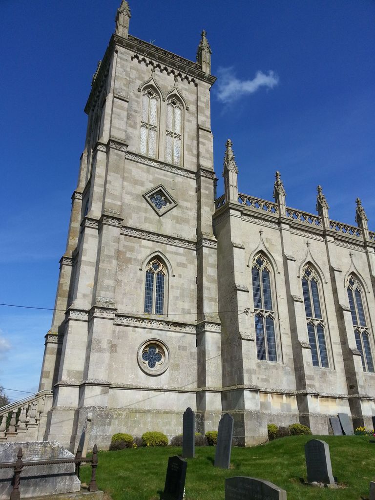
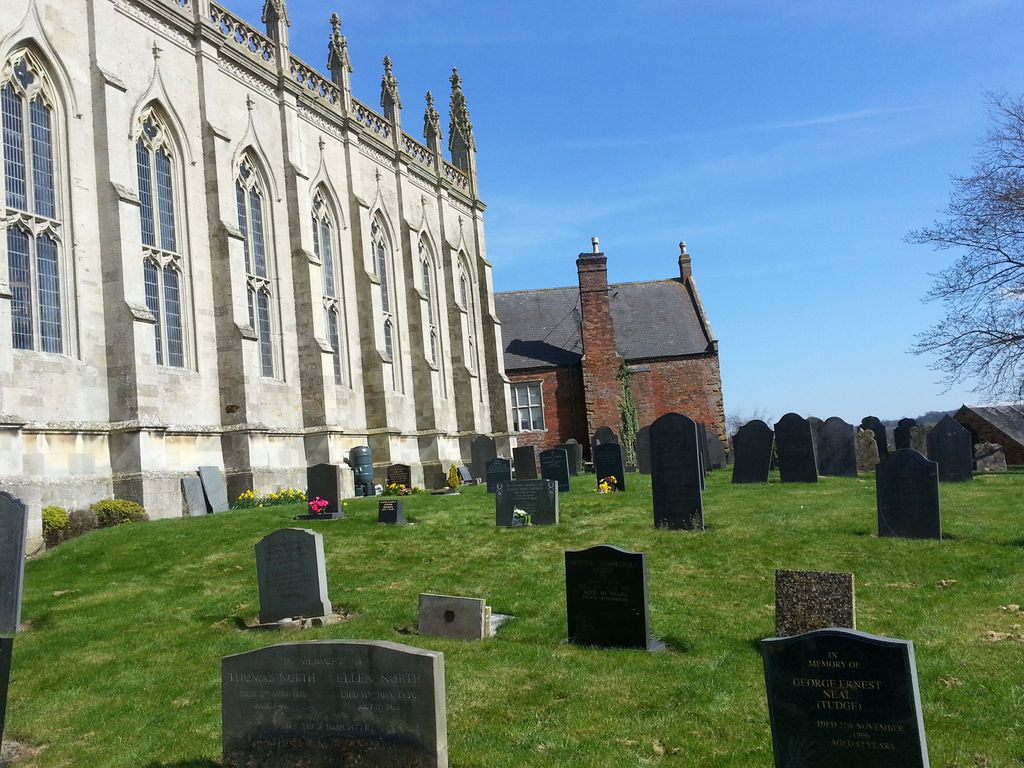
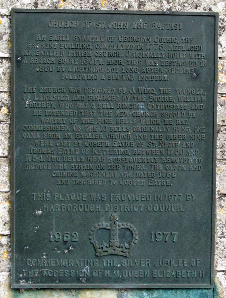
Church of Saint John the Baptist is located at Norton Lane Kings Norton, Harborough District ,Leicestershire , LE7 9BAEngland.
-
Church of Saint John the Baptist cemetery's updated grave count on graveviews.com?
5 memorials
-
Where are the coordinates of the Church of Saint John the Baptist?
Latitude: 52.5978980
Longitude: -0.9842260
Nearby Cemetories:
1. St. John's Baptist Churchyard
Little Stretton, Harborough District, England
Coordinate: 52.5972084, -1.0135030
2. St Michael and All Angels
Illston-on-the-Hill, Harborough District, England
Coordinate: 52.5870520, -0.9583040
3. St Andrew Churchyard
Burton Overy, Harborough District, England
Coordinate: 52.5772410, -1.0000700
4. St Catharine Churchyard
Houghton-on-the-Hill, Harborough District, England
Coordinate: 52.6232620, -1.0023630
5. St. Mary the Virgin Churchyard
Carlton Curlieu, Harborough District, England
Coordinate: 52.5686730, -0.9778820
6. St John the Baptist Churchyard
Billesdon, Harborough District, England
Coordinate: 52.6159495, -0.9379699
7. Great Glen Crematorium
Great Glen, Harborough District, England
Coordinate: 52.5673937, -1.0205274
8. Billesdon Cemetery
Billesdon, Harborough District, England
Coordinate: 52.6185500, -0.9317400
9. Saint Cuthbert Churchyard
Great Glen, Harborough District, England
Coordinate: 52.5739000, -1.0390700
10. Church of St. Mary and All Saints
Stoughton, Harborough District, England
Coordinate: 52.6129090, -1.0552350
11. St. Nicholas Church
Shangton, Harborough District, England
Coordinate: 52.5573280, -0.9458070
12. Noseley Parish Church
Noseley, Harborough District, England
Coordinate: 52.5792690, -0.9129710
13. Saint Luke Churchyard
Thurnby, Harborough District, England
Coordinate: 52.6291480, -1.0457760
14. St Thomas a Becket Churchyard
Skeffington, Harborough District, England
Coordinate: 52.6163920, -0.9063090
15. Kibworth Congregational Chapel
Kibworth Harcourt, Harborough District, England
Coordinate: 52.5461450, -1.0006250
16. St Luke's Churchyard, Newton Harcourt
Wistow, Harborough District, England
Coordinate: 52.5646320, -1.0577376
17. St Wilfrid's Churchyard
Kibworth Beauchamp, Harborough District, England
Coordinate: 52.5410680, -0.9925480
18. Kibworth Villages New Cemetery
Kibworth Beauchamp, Harborough District, England
Coordinate: 52.5403442, -0.9864463
19. Kibworth Natural Burial Area
Kibworth Harcourt, Harborough District, England
Coordinate: 52.5402749, -0.9845069
20. St Wistans Church
Wistow, Harborough District, England
Coordinate: 52.5577010, -1.0522340
21. St. Andrews Churchyard
Tur Langton, Harborough District, England
Coordinate: 52.5442400, -0.9493500
22. St. Peter Churchyard
Oadby, Oadby and Wigston Borough, England
Coordinate: 52.5973900, -1.0805100
23. St. Denys' Churchyard
Evington, Leicester Unitary Authority, England
Coordinate: 52.6193210, -1.0743860
24. All Saints Churchyard
Scraptoft, Harborough District, England
Coordinate: 52.6441340, -1.0442270