
| Memorials | : | 0 |
| Location | : | Noseley, Harborough District, England |
| Coordinate | : | 52.5792690, -0.9129710 |
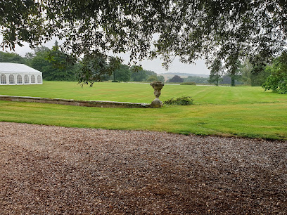
| Description | : | Noseley Chapel is part of the Noseley Hall estate, owned by the Hazlerigg family. There had been a separate parish church for the village, but it fell to ruin by the 16th century after which the chapel was used as the church for the parish. |
frequently asked questions (FAQ):
-
Where is Noseley Parish Church?
Noseley Parish Church is located at Noseley, Harborough District ,Leicestershire ,England.
-
Noseley Parish Church cemetery's updated grave count on graveviews.com?
0 memorials
-
Where are the coordinates of the Noseley Parish Church?
Latitude: 52.5792690
Longitude: -0.9129710
Nearby Cemetories:
1. St. John the Baptist Church Graveyard
Glooston, Harborough District, England
Coordinate: 52.5547690, -0.8959280
2. St Michael and All Angels
Illston-on-the-Hill, Harborough District, England
Coordinate: 52.5870520, -0.9583040
3. St. Nicholas Church
Shangton, Harborough District, England
Coordinate: 52.5573280, -0.9458070
4. St. Thomas A. Becket Churchyard
Tugby, Harborough District, England
Coordinate: 52.6015640, -0.8766340
5. St. John the Baptist Churchyard
Goadby, Harborough District, England
Coordinate: 52.5497940, -0.8783680
6. St Thomas a Becket Churchyard
Skeffington, Harborough District, England
Coordinate: 52.6163920, -0.9063090
7. St John the Baptist Churchyard
Billesdon, Harborough District, England
Coordinate: 52.6159495, -0.9379699
8. St. Mary the Virgin Churchyard
Carlton Curlieu, Harborough District, England
Coordinate: 52.5686730, -0.9778820
9. Billesdon Cemetery
Billesdon, Harborough District, England
Coordinate: 52.6185500, -0.9317400
10. St. Andrews Churchyard
Tur Langton, Harborough District, England
Coordinate: 52.5442400, -0.9493500
11. Church of Saint John the Baptist
Kings Norton, Harborough District, England
Coordinate: 52.5978980, -0.9842260
12. St Michael and All Angels Churchyard
Hallaton, Harborough District, England
Coordinate: 52.5609190, -0.8411740
13. St. Peter's Churchyard
Church Langton, Harborough District, England
Coordinate: 52.5335260, -0.9337150
14. All Saints Churchyard
Slawston, Harborough District, England
Coordinate: 52.5428240, -0.8500170
15. St Andrew Churchyard
Burton Overy, Harborough District, England
Coordinate: 52.5772410, -1.0000700
16. Thorpe Langton, St Leonard's Churchyard
Thorpe Langton, Harborough District, England
Coordinate: 52.5247101, -0.9104123
17. Kibworth Natural Burial Area
Kibworth Harcourt, Harborough District, England
Coordinate: 52.5402749, -0.9845069
18. Kibworth Villages New Cemetery
Kibworth Beauchamp, Harborough District, England
Coordinate: 52.5403442, -0.9864463
19. St Andrew's Churchyard
Welham, Harborough District, England
Coordinate: 52.5246240, -0.8733420
20. St Wilfrid's Churchyard
Kibworth Beauchamp, Harborough District, England
Coordinate: 52.5410680, -0.9925480
21. Kibworth Congregational Chapel
Kibworth Harcourt, Harborough District, England
Coordinate: 52.5461450, -1.0006250
22. St. John's Baptist Churchyard
Little Stretton, Harborough District, England
Coordinate: 52.5972084, -1.0135030
23. St Peter Churchyard
Tilton-on-the-Hill, Harborough District, England
Coordinate: 52.6435650, -0.9026860
24. Great Glen Crematorium
Great Glen, Harborough District, England
Coordinate: 52.5673937, -1.0205274