
| Memorials | : | 0 |
| Location | : | Biedrzychowice, Powiat lubański, Poland |
| Coordinate | : | 51.0391408, 15.3796510 |
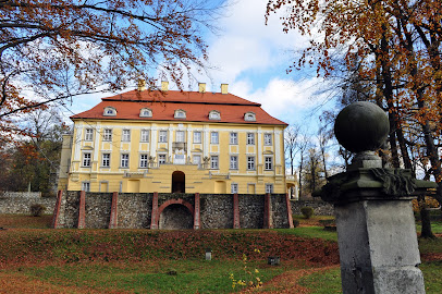
| Description | : | This church was originally founded as a Protestant church in 1654. At the time, Friedersdorf (today's Biedrzychowice) was located in the Protestant Duchy of Saxony, so it attracted Silesian and Bohemian Protestant refugees fleeing religious persecution in the Habsburg Empire. Its location close to the border with Austrian Silesia also made it convenient to serve Protestants living in nearby Greiffenberg (Gryfów Śląski). The local lord, Johann Ernst von Warnsdorf, therefore financed the construction of a so-called "Border Church". It was called "Zum Jesusbrunnen", or "At the Well of Jesus", because of a small spring that was located during construction, and... Read More |
frequently asked questions (FAQ):
-
Where is Church of St. Anthony?
Church of St. Anthony is located at Biedrzychowice, Powiat lubański ,Dolnośląskie ,Poland.
-
Church of St. Anthony cemetery's updated grave count on graveviews.com?
0 memorials
-
Where are the coordinates of the Church of St. Anthony?
Latitude: 51.0391408
Longitude: 15.3796510
Nearby Cemetories:
1. Gryfów Śląski Cemetery
Wrocław, Miasto Wrocław, Poland
Coordinate: 51.0313300, 15.4139900
2. Wieża Protestant Cemetery
Bolesławiec, Powiat bolesławiecki, Poland
Coordinate: 51.0247600, 15.4092000
3. Church of St. Hedwig
Gryfów Śląski, Powiat lwówecki, Poland
Coordinate: 51.0292397, 15.4152342
4. Rząsiny Church of the Assumption Graveyard
Bolesławiec, Powiat bolesławiecki, Poland
Coordinate: 51.0812200, 15.4383600
5. Giebułtów Church of St. Michael
Bolesławiec, Powiat bolesławiecki, Poland
Coordinate: 50.9795019, 15.3471404
6. Kościelnik Church of St. John the Baptist
Bolesławiec, Powiat bolesławiecki, Poland
Coordinate: 51.0849840, 15.2981083
7. Church of the Annunciation
Mirsk, Powiat lwówecki, Poland
Coordinate: 50.9689700, 15.3814000
8. Leśna Evangelical Cemetery
Bolesławiec, Powiat bolesławiecki, Poland
Coordinate: 51.0255000, 15.2608700
9. Lubomierz Cemetery
Bolesławiec, Powiat bolesławiecki, Poland
Coordinate: 51.0157900, 15.5053200
10. Wolimierz Church Graveyard
Bolesławiec, Powiat bolesławiecki, Poland
Coordinate: 50.9578400, 15.3179800
11. Rębiszów Catholic Church Graveyard
Bolesławiec, Powiat bolesławiecki, Poland
Coordinate: 50.9532800, 15.4434700
12. Lubań Communal Cemetery
Bolesławiec, Powiat bolesławiecki, Poland
Coordinate: 51.1271600, 15.2924400
13. Church of St. Hedwig
Niwnice, Powiat lwówecki, Poland
Coordinate: 51.1183700, 15.4872700
14. Grabiszyce Średnie Catholic Graveyard
Bolesławiec, Powiat bolesławiecki, Poland
Coordinate: 51.0158200, 15.2004200
15. Pobieda Communal Cemetery
Bolesławiec, Powiat bolesławiecki, Poland
Coordinate: 50.9362300, 15.2939900
16. Janice Protestant Cemetery
Bolesławiec, Powiat bolesławiecki, Poland
Coordinate: 50.9563051, 15.5339381
17. Pławna Dolna Church Graveyard
Bolesławiec, Powiat bolesławiecki, Poland
Coordinate: 51.0513800, 15.5878000
18. Pisarzowice Church Graveyard
Bolesławiec, Powiat bolesławiecki, Poland
Coordinate: 51.1428600, 15.2395900
19. Nawojów Łużycki Parish Cemetery
Bolesławiec, Powiat bolesławiecki, Poland
Coordinate: 51.1742953, 15.3403186
20. Siekierczyn Church of St. Anthony
Bolesławiec, Powiat bolesławiecki, Poland
Coordinate: 51.1179159, 15.1944265
21. Kotliska Church of St. Nicholas
Bolesławiec, Powiat bolesławiecki, Poland
Coordinate: 51.1553258, 15.5179024
22. Henryków Lubański Church Graveyard
Bolesławiec, Powiat bolesławiecki, Poland
Coordinate: 51.1663800, 15.2535600
23. Radomice Church of Sts. James and Catherine
Bolesławiec, Powiat bolesławiecki, Poland
Coordinate: 50.9922307, 15.6085615
24. Ołdrzychów Church Graveyard
Bolesławiec, Powiat bolesławiecki, Poland
Coordinate: 51.1961700, 15.3853300