
| Memorials | : | 24 |
| Location | : | Oughtibridge, Metropolitan Borough of Sheffield, England |
| Coordinate | : | 53.4349330, -1.5422590 |
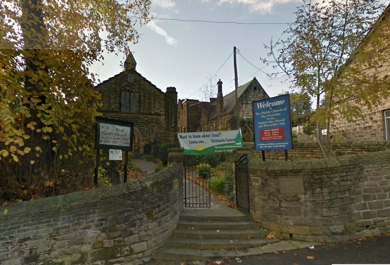
| Description | : | Oughtibridge is a residential village on the northern outskirts of Sheffield within the bounds of Bradfield civil parish. The village stands 5 miles northwest of the city centre in the valley of the River Don. The origins of Oughtibridge date back to the first part of the 12th century when a ford existed in the area over the Don. The ford was managed by a man named Oughtred who resided in a nearby cottage. When a bridge was built on the spot in approximately 1150 it became known as Oughtred's Bridge or by his nickname of Oughty's Bridge |
frequently asked questions (FAQ):
-
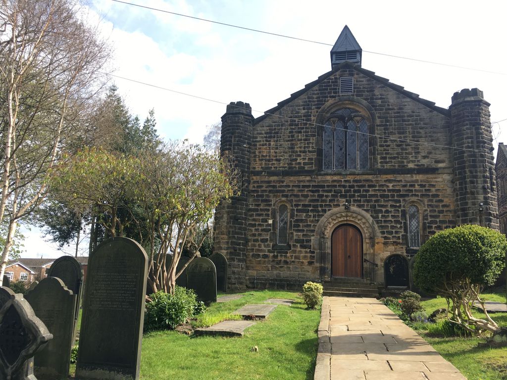
Where is Church of the Ascension?
Church of the Ascension is located at Church Street Oughtibridge, Metropolitan Borough of Sheffield ,South Yorkshire , S35 0JNEngland.
-
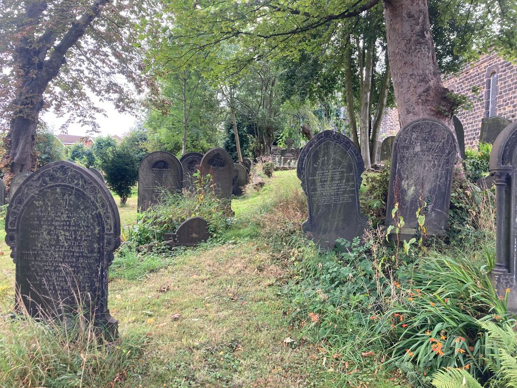
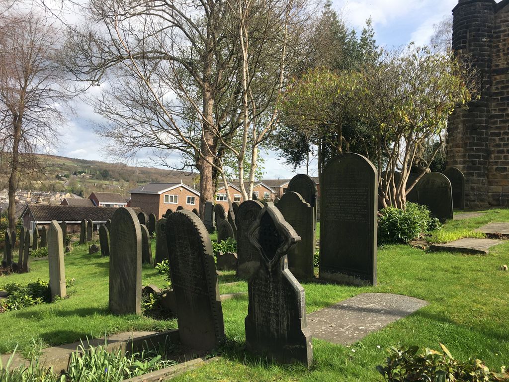
Church of the Ascension cemetery's updated grave count on graveviews.com?
24 memorials
-
Where are the coordinates of the Church of the Ascension?
Latitude: 53.4349330
Longitude: -1.5422590
Nearby Cemetories:
1. Birtin Cemetery
Oughtibridge, Metropolitan Borough of Sheffield, England
Coordinate: 53.4295900, -1.5485600
2. Grenoside Crematorium
Grenoside, Metropolitan Borough of Sheffield, England
Coordinate: 53.4375860, -1.5087020
3. Wadsley Churchyard
Sheffield, Metropolitan Borough of Sheffield, England
Coordinate: 53.4120290, -1.5181790
4. Loxley United Reformed Chapelyard
Sheffield, Metropolitan Borough of Sheffield, England
Coordinate: 53.4074490, -1.5459890
5. Loxley United Reformed Church
Bradfield, Metropolitan Borough of Sheffield, England
Coordinate: 53.4074084, -1.5456459
6. Wisewood Cemetery
Sheffield, Metropolitan Borough of Sheffield, England
Coordinate: 53.4038050, -1.5401300
7. Saint Nicholas Churchyard
High Bradfield, Metropolitan Borough of Sheffield, England
Coordinate: 53.4291200, -1.5991120
8. Hillsborough Walled Garden Memorials
Hillsborough, Metropolitan Borough of Sheffield, England
Coordinate: 53.4071221, -1.5039054
9. Wardsend Cemetery
Sheffield, Metropolitan Borough of Sheffield, England
Coordinate: 53.4086120, -1.4895330
10. Stannington Methodist Churchyard
Stannington, Metropolitan Borough of Sheffield, England
Coordinate: 53.3939340, -1.5454460
11. Underbank Unitarian Chapel
High Bradfield, Metropolitan Borough of Sheffield, England
Coordinate: 53.3942504, -1.5554100
12. Stannington Unitarian Chapel
Stannington, Metropolitan Borough of Sheffield, England
Coordinate: 53.3941350, -1.5556060
13. Hillsborough Barracks Chapel Courtyard
Hillsborough, Metropolitan Borough of Sheffield, England
Coordinate: 53.4013100, -1.4980900
14. Ecclesfield Cemetery
Ecclesfield, Metropolitan Borough of Sheffield, England
Coordinate: 53.4441210, -1.4719340
15. Christ Church Churchyard
Stannington, Metropolitan Borough of Sheffield, England
Coordinate: 53.3918830, -1.5469320
16. St. Paul's Churchyard
Sheffield, Metropolitan Borough of Sheffield, England
Coordinate: 53.4333670, -1.4692500
17. St. Mary the Virgin Churchyard
Ecclesfield, Metropolitan Borough of Sheffield, England
Coordinate: 53.4432350, -1.4698510
18. St. Mary's Churchyard
Bolsterstone, Metropolitan Borough of Sheffield, England
Coordinate: 53.4673770, -1.5935860
19. St Michael's Roman Catholic Cemetery
Sheffield, Metropolitan Borough of Sheffield, England
Coordinate: 53.3916300, -1.5162800
20. Rivelin Jewish Cemetery
Sheffield, Metropolitan Borough of Sheffield, England
Coordinate: 53.3914480, -1.5149920
21. Burncross Cemetery
Burncross, Metropolitan Borough of Sheffield, England
Coordinate: 53.4631420, -1.4796780
22. Ecclesfield Jewish Cemetery
Ecclesfield, Metropolitan Borough of Sheffield, England
Coordinate: 53.4299600, -1.4637700
23. St Mary Churchyard
Walkley, Metropolitan Borough of Sheffield, England
Coordinate: 53.3907127, -1.5148580
24. St. John the Baptist Churchyard
Chapeltown, Metropolitan Borough of Sheffield, England
Coordinate: 53.4651830, -1.4716260