
| Memorials | : | 1 |
| Location | : | Arlington, Arlington County, USA |
| Phone | : | 703-524-4115 |
| Website | : | www.covenantchurcharlington.org/about/other-info.html |
| Coordinate | : | 38.9081940, -77.1121820 |
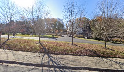
| Description | : | Church of the Covenant 2666 Military Road Arlington, VA 22207 Phone: 703-524-4415 |
frequently asked questions (FAQ):
-
Where is Church of the Covenant Memorial Garden?
Church of the Covenant Memorial Garden is located at 2666 N Military Road Arlington, Arlington County ,Virginia , 22207USA.
-
Church of the Covenant Memorial Garden cemetery's updated grave count on graveviews.com?
1 memorials
-
Where are the coordinates of the Church of the Covenant Memorial Garden?
Latitude: 38.9081940
Longitude: -77.1121820
Nearby Cemetories:
1. Saint Andrews Episcopal Church Memorial Garden
Arlington, Arlington County, USA
Coordinate: 38.9022380, -77.1097260
2. Saint Mary's Episcopal Church Columbarium
Arlington, Arlington County, USA
Coordinate: 38.9032740, -77.1277760
3. Mount Salvation Baptist Church
Halls Hill, Arlington County, USA
Coordinate: 38.8945710, -77.1255320
4. Calloway Cemetery
Arlington, Arlington County, USA
Coordinate: 38.8960890, -77.1292270
5. Saint Patrick Episcopal Church Columbarium
Foxhall Village, District of Columbia, USA
Coordinate: 38.9161130, -77.0912030
6. Walker Chapel United Methodist Church Cemetery
Arlington, Arlington County, USA
Coordinate: 38.9218670, -77.1281800
7. Union Burial Society of Georgetown Cemetery
Foxhall Village, District of Columbia, USA
Coordinate: 38.9231950, -77.0982780
8. Mount Olivet Methodist Church Cemetery
Arlington, Arlington County, USA
Coordinate: 38.8891400, -77.1196000
9. Rock Spring Congregational Church Memorial Garden
Arlington, Arlington County, USA
Coordinate: 38.9074840, -77.1378190
10. Ball Family Cemetery
Arlington, Arlington County, USA
Coordinate: 38.8866270, -77.1016140
11. Saint Charles School Cemetery
Arlington County, USA
Coordinate: 38.8852997, -77.0999985
12. Robert Ball Family Graveyard
Arlington, Arlington County, USA
Coordinate: 38.8825380, -77.1105760
13. Saint Thomas More Cathedral
Arlington, Arlington County, USA
Coordinate: 38.8808300, -77.1041700
14. Georgetown University Jesuit Cemetery
Washington, District of Columbia, USA
Coordinate: 38.9083000, -77.0737200
15. Dahlgren Chapel of the Sacred Heart Crypt
Georgetown, District of Columbia, USA
Coordinate: 38.9072850, -77.0735950
16. Saint Michael’s Episcopal Church Columbarium
Arlington County, USA
Coordinate: 38.8824060, -77.1322790
17. Holy Trinity Cemetery #2
Georgetown, District of Columbia, USA
Coordinate: 38.9096390, -77.0733730
18. Southern - Shreve Cemetery
Arlington County, USA
Coordinate: 38.8801080, -77.1278420
19. Georgetown Visitation Monastery Cemetery
Washington, District of Columbia, USA
Coordinate: 38.9094200, -77.0724600
20. Little Falls Presbyterian Church Memorial Garden
Arlington, Arlington County, USA
Coordinate: 38.9010860, -77.1533130
21. Holy Trinity Church Cemetery (Defunct)
Georgetown, District of Columbia, USA
Coordinate: 38.9071730, -77.0699850
22. Metropolitan Memorial United Methodist Columbarium
Washington, District of Columbia, USA
Coordinate: 38.9348950, -77.0875790
23. Holy Rood Cemetery
Washington, District of Columbia, USA
Coordinate: 38.9174995, -77.0702972
24. Old Presbyterian Cemetery
Georgetown, District of Columbia, USA
Coordinate: 38.9099998, -77.0671997