
| Memorials | : | 87 |
| Location | : | Rhoadesville, Orange County, USA |
| Phone | : | 540-423-1130 |
| Coordinate | : | 38.3430530, -77.9402740 |
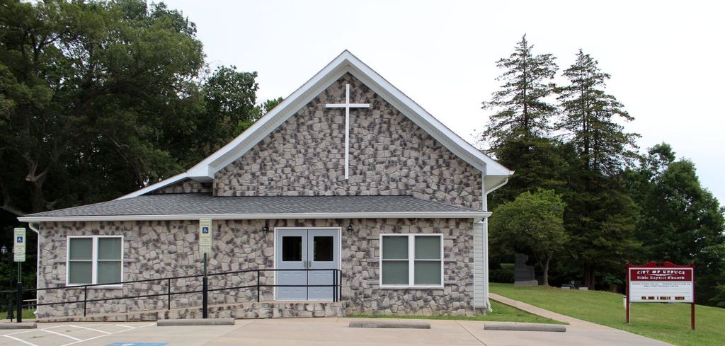
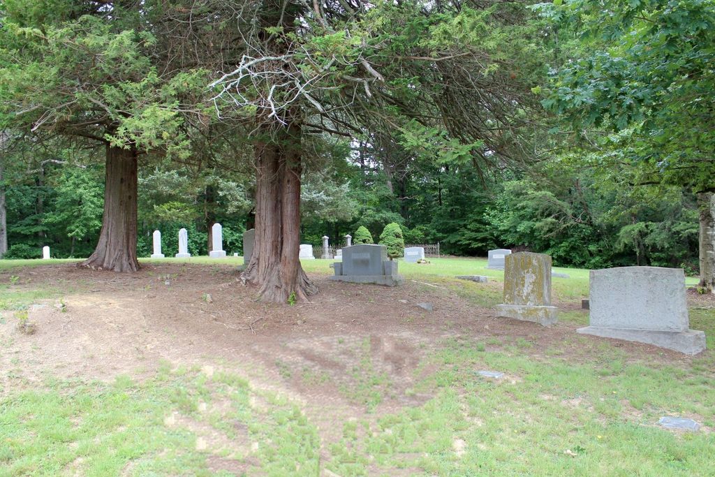
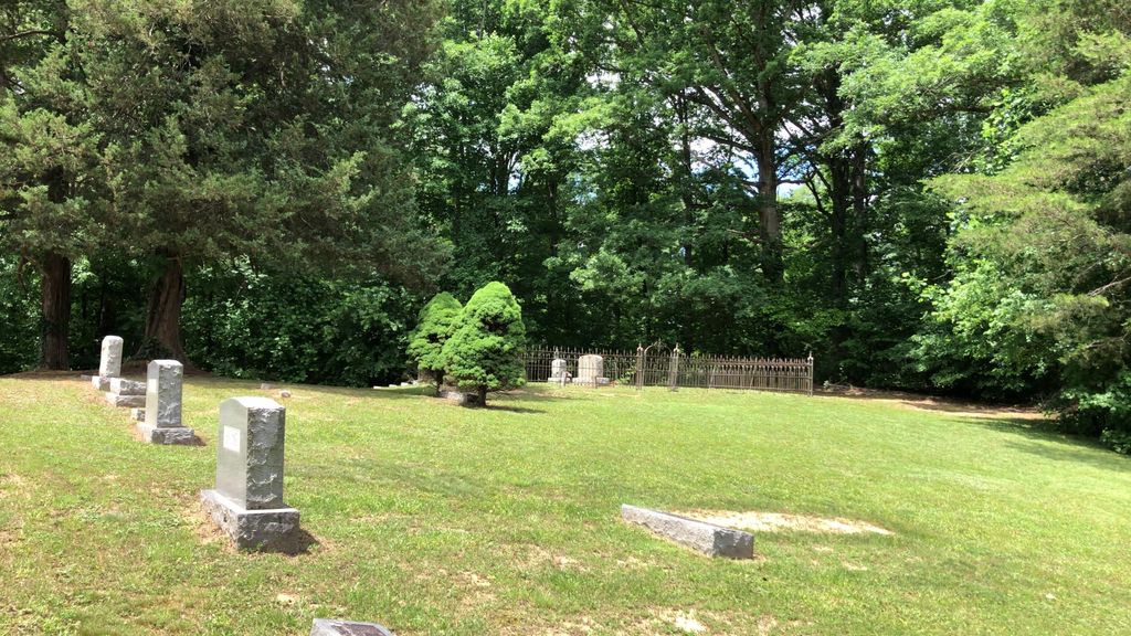
| Description | : | In the past this was the Palmyra Church and Google maps still shows the cemetery as Palmyra Cemetery. This is a small rural church cemetery in fairly good condition. It is located in Orange County, but has a Culpeper zip code. Formerly known as Palmyra Cemetery and owned by the Palmyra United Methodist Church, the current name was adopted about 10 years ago. It is open and accessible with some trees and shrubs. Orange County, VA GIS Parcel ID: 00800000000170 Owner: CITY OF REFUGE BIBLE BAPTIST CHURCH Acreage: 2.107 |
frequently asked questions (FAQ):
-
Where is City of Refuge Bible Baptist Church Cemetery?
City of Refuge Bible Baptist Church Cemetery is located at 4434 True Blue Road (Rt. 663) Rhoadesville, Orange County ,Virginia , 22701USA.
-
City of Refuge Bible Baptist Church Cemetery cemetery's updated grave count on graveviews.com?
87 memorials
-
Where are the coordinates of the City of Refuge Bible Baptist Church Cemetery?
Latitude: 38.3430530
Longitude: -77.9402740

Nearby Cemetories:
1. Davis Family Cemetery
Unionville, Orange County, USA
Coordinate: 38.3479030, -77.9424840
2. Pannill Cemetery
True Blue, Orange County, USA
Coordinate: 38.3549450, -77.9331730
3. Stringfellow Homestead Cemetery
Raccoon Ford, Culpeper County, USA
Coordinate: 38.3634520, -77.9426160
4. Porter - Jones Cemetery
Raccoon Ford, Culpeper County, USA
Coordinate: 38.3647000, -77.9408000
5. Mt. Holy Baptist Church Cemetery
Unionville, Orange County, USA
Coordinate: 38.3241997, -77.9580994
6. Saint Pauls Church Cemetery
Raccoon Ford, Culpeper County, USA
Coordinate: 38.3682090, -77.9508300
7. Mount Pisgah Baptist Church Cemetery
True Blue, Orange County, USA
Coordinate: 38.3480988, -77.8886032
8. Newington Cemetery
Orange County, USA
Coordinate: 38.3027328, -77.9765642
9. Coleman Cemetery
Rhoadesville, Orange County, USA
Coordinate: 38.3371450, -77.8692970
10. Rhoades Family Farm Cemetery
Burr Hill, Orange County, USA
Coordinate: 38.3380400, -77.8616560
11. Free Union Baptist Church Cemetery
Culpeper, Culpeper County, USA
Coordinate: 38.4041580, -77.9243510
12. Kube Family Cemetery
Rhoadesville, Orange County, USA
Coordinate: 38.2727547, -77.9350357
13. Rhoadesville Baptist Church Cemetery
Rhoadesville, Orange County, USA
Coordinate: 38.2705994, -77.9244003
14. Kube Family Cemetery
Rhoadesville, Orange County, USA
Coordinate: 38.3067640, -77.8576390
15. Mount Sinai Cemetery
Rhoadesville, Orange County, USA
Coordinate: 38.2713190, -77.9118550
16. Mitchells Presbyterian Church Cemetery
Mitchells, Culpeper County, USA
Coordinate: 38.3797200, -78.0244900
17. Geetown Cemetery
Unionville, Orange County, USA
Coordinate: 38.2729800, -77.9793580
18. Quann-Chambers Cemetery
Rhoadesville, Orange County, USA
Coordinate: 38.3074493, -77.8535843
19. Lee Family Cemetery
Unionville, Orange County, USA
Coordinate: 38.2670320, -77.9542830
20. Salem Cemetery
Rhoadesville, Orange County, USA
Coordinate: 38.2769012, -77.8871994
21. Bethel Baptist Church Cemetery
Mitchells, Culpeper County, USA
Coordinate: 38.3774130, -78.0307330
22. Rising Zion Baptist Church Cemetery
Culpeper County, USA
Coordinate: 38.4115190, -77.9993880
23. Pilgrim Cemetery
Mitchells, Culpeper County, USA
Coordinate: 38.3800011, -78.0355988
24. Cedar Grove Baptist Church Cemetery
Buena, Culpeper County, USA
Coordinate: 38.3412960, -78.0481880