
| Memorials | : | 6 |
| Location | : | Orange County, USA |
| Coordinate | : | 38.3027328, -77.9765642 |
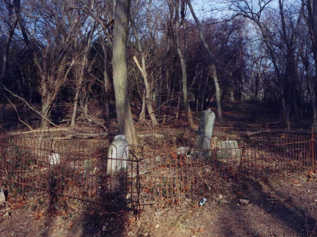
| Description | : | Newington Cemetery is located on private property to the west of the intersection of state routes 626 and 627, across Clarks Mountain Road from Battlefield Farms. Battlefield Farms is on property formerly owned by the family of Lucy Henshaw Walker who is buried in the cemetery. Newington Cemetery is on property formerly owned by Lawrence Sanford II, also buried in the cemetery. |
frequently asked questions (FAQ):
-
Where is Newington Cemetery?
Newington Cemetery is located at Orange County ,Virginia ,USA.
-
Newington Cemetery cemetery's updated grave count on graveviews.com?
0 memorials
-
Where are the coordinates of the Newington Cemetery?
Latitude: 38.3027328
Longitude: -77.9765642
Nearby Cemetories:
1. Mt. Holy Baptist Church Cemetery
Unionville, Orange County, USA
Coordinate: 38.3241997, -77.9580994
2. Geetown Cemetery
Unionville, Orange County, USA
Coordinate: 38.2729800, -77.9793580
3. Lee Family Cemetery
Unionville, Orange County, USA
Coordinate: 38.2670320, -77.9542830
4. Kube Family Cemetery
Rhoadesville, Orange County, USA
Coordinate: 38.2727547, -77.9350357
5. Unionville Christian Church Cemetery
Unionville, Orange County, USA
Coordinate: 38.2587000, -77.9673300
6. Hopewell Baptist Church Cemetery
Orange, Orange County, USA
Coordinate: 38.2844150, -78.0311140
7. Oakwood Cemetery
Unionville, Orange County, USA
Coordinate: 38.2560997, -77.9702988
8. City of Refuge Bible Baptist Church Cemetery
Rhoadesville, Orange County, USA
Coordinate: 38.3430530, -77.9402740
9. Rhoadesville Baptist Church Cemetery
Rhoadesville, Orange County, USA
Coordinate: 38.2705994, -77.9244003
10. Davis Family Cemetery
Unionville, Orange County, USA
Coordinate: 38.3479030, -77.9424840
11. Arjalon Price Cemetery
Orange County, USA
Coordinate: 38.3007770, -78.0438280
12. Mount Sinai Cemetery
Rhoadesville, Orange County, USA
Coordinate: 38.2713190, -77.9118550
13. Mount Calvary Cemetery
Orange, Orange County, USA
Coordinate: 38.2505989, -78.0194016
14. Pannill Cemetery
True Blue, Orange County, USA
Coordinate: 38.3549450, -77.9331730
15. Bethel Baptist Church Cemetery
Unionville, Orange County, USA
Coordinate: 38.2393190, -77.9600510
16. Emmanuel Cemetery
Orange County, USA
Coordinate: 38.3072014, -78.0597000
17. Stringfellow Homestead Cemetery
Raccoon Ford, Culpeper County, USA
Coordinate: 38.3634520, -77.9426160
18. Waddell Memorial Presbyterian Church Cemetery
Rapidan, Culpeper County, USA
Coordinate: 38.3083300, -78.0627000
19. Porter - Jones Cemetery
Raccoon Ford, Culpeper County, USA
Coordinate: 38.3647000, -77.9408000
20. Cedar Grove Baptist Church Cemetery
Buena, Culpeper County, USA
Coordinate: 38.3412960, -78.0481880
21. Saint Pauls Church Cemetery
Raccoon Ford, Culpeper County, USA
Coordinate: 38.3682090, -77.9508300
22. Mount Olive Cemetery
Unionville, Orange County, USA
Coordinate: 38.2491989, -77.9188995
23. Antioch Baptist Church Cemetery
Unionville, Orange County, USA
Coordinate: 38.2442017, -77.9263992
24. Mount Olive Memorial Park
Rhoadesville, Orange County, USA
Coordinate: 38.2481910, -77.9194160