
| Memorials | : | 0 |
| Location | : | Gibbstown, Gloucester County, USA |
| Coordinate | : | 39.8330000, -75.2940000 |
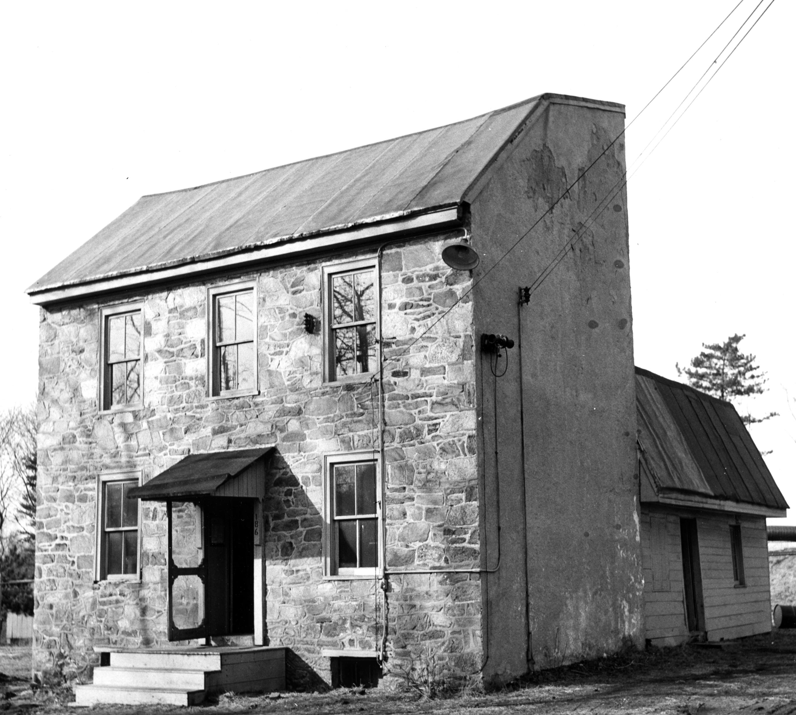
| Description | : | On 27 Aug 1789, Robert Newell, John Vanneman, Samuel Lodge, Paul Bright, Edward Barton, Michael Turner and John Drummond of the Methodist Episcopal Society of Clonmell bought one-quarter acre of land for five shillings for a Preaching House and graveyard. A local deacon Benjamin Weatherby organized people to put a house on wheels and move it to Gibbstown. The Church was the frame building behind what was later known as the stone Mullen farm house. There were headstones here but they were removed by 1917. The stone house was used as a Sunday school and Jesse... Read More |
frequently asked questions (FAQ):
-
Where is Clonmell Methodist Episcopal Church Cemetery?
Clonmell Methodist Episcopal Church Cemetery is located at 186 N Repauno Ave (this actual address was renumbered later) Gibbstown, Gloucester County ,New Jersey , 08027-1038USA.
-
Clonmell Methodist Episcopal Church Cemetery cemetery's updated grave count on graveviews.com?
0 memorials
-
Where are the coordinates of the Clonmell Methodist Episcopal Church Cemetery?
Latitude: 39.8330000
Longitude: -75.2940000
Nearby Cemetories:
1. Philadelphia Lazaretto Quarantine Station Burial Ground (Defunct)
Essington, Delaware County, USA
Coordinate: 39.8620000, -75.2994000
2. Saint John the Evangelist Episcopal Church Garden
Essington, Delaware County, USA
Coordinate: 39.8644670, -75.3014820
3. Saint Margaret Mary Alacoque Roman Catholic Church Grounds (Defunct)
Essington, Delaware County, USA
Coordinate: 39.8673935, -75.3008728
4. Saint Pauls Methodist Cemetery
Paulsboro, Gloucester County, USA
Coordinate: 39.8295700, -75.2396900
5. Mount Vernon Cemetery
Gibbstown, Gloucester County, USA
Coordinate: 39.8209100, -75.2414600
6. Cooper Burial Ground
Bridgeport, Gloucester County, USA
Coordinate: 39.8004900, -75.3389900
7. Bridgeport Cemetery
Bridgeport, Gloucester County, USA
Coordinate: 39.8007300, -75.3415900
8. Union American Methodist Episcopal Burial Ground
Chester, Delaware County, USA
Coordinate: 39.8461170, -75.3571060
9. Saint Paul's Burying Ground
Chester, Delaware County, USA
Coordinate: 39.8470650, -75.3581314
10. Christ Church Memorial Garden
Ridley Park, Delaware County, USA
Coordinate: 39.8795400, -75.3223200
11. Prospect Hill Baptist Church Cemetery
Prospect Park, Delaware County, USA
Coordinate: 39.8840065, -75.3063965
12. Ridley Park Presbyterian Church Memorial Garden
Ridley Park, Delaware County, USA
Coordinate: 39.8797000, -75.3255140
13. Solomons Graveyard
Wolfert, Gloucester County, USA
Coordinate: 39.7846985, -75.2636032
14. Old Chester Friends Burial Ground (Defunct)
Chester, Delaware County, USA
Coordinate: 39.8501514, -75.3605738
15. Saint Madeleine's Roman Catholic Church Grounds
Ridley Park, Delaware County, USA
Coordinate: 39.8814087, -75.3251801
16. Saint Michael's Roman Catholic Church Grounds (Defunct)
Chester, Delaware County, USA
Coordinate: 39.8513645, -75.3605057
17. Saint James Episcopal Church Memorial Garden
Prospect Park, Delaware County, USA
Coordinate: 39.8869000, -75.3090000
18. Saint Gabriel's Roman Catholic Church Grounds
Norwood, Delaware County, USA
Coordinate: 39.8895930, -75.2971291
19. Our Lady of Peace Roman Catholic Church Grounds
Milmont, Delaware County, USA
Coordinate: 39.8815600, -75.3352500
20. Old Stephens Cemetery
West Deptford, Gloucester County, USA
Coordinate: 39.8323970, -75.2179240
21. Mickleton Meeting House Graveyard
Mickleton, Gloucester County, USA
Coordinate: 39.7910800, -75.2378900
22. Saint Katharine Drexel Roman Catholic Church Grounds
Chester, Delaware County, USA
Coordinate: 39.8642886, -75.3611001
23. Old Stone Church Cemetery
Swedesboro, Gloucester County, USA
Coordinate: 39.7753067, -75.3191452
24. Saint Michael's Roman Catholic Cemetery
Chester, Delaware County, USA
Coordinate: 39.8627663, -75.3643265