
| Memorials | : | 0 |
| Location | : | Pinson, Jefferson County, USA |
| Coordinate | : | 33.6929950, -86.6864420 |
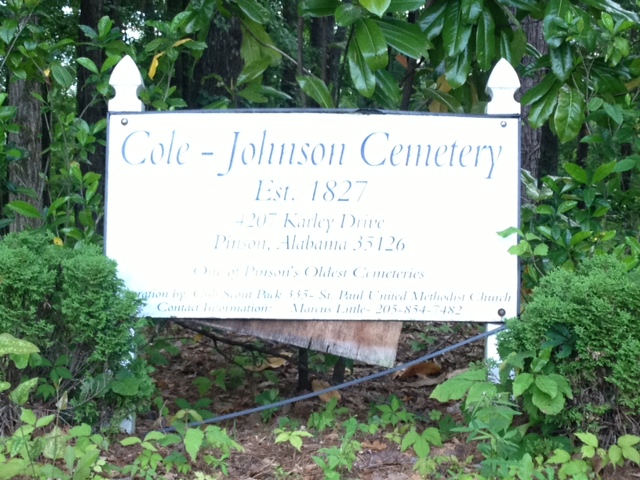
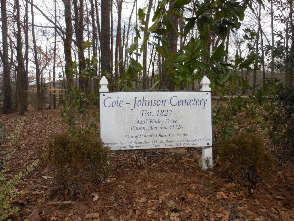
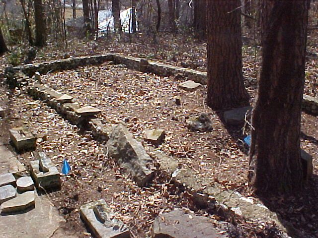
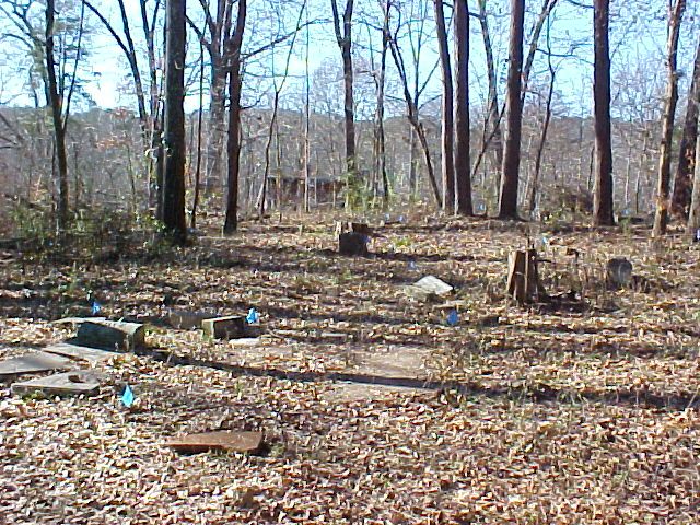
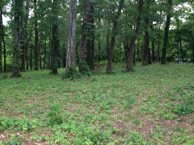
| Description | : | Billed as one of Pinson's Oldest Cemeteries, the Cole-Johnson Cemetery was established in 1827. It is near the bus ramp at Pinson Elementary School on Kaley Dr. In recent years, it was restored by Cub Scout Pack 335 out of St. Paul's United Methodist Church, but has not seen much work since. Many grave markers are missing, not legible or the graves are not properly marked altogether. |
frequently asked questions (FAQ):
-
Where is Cole-Johnson Cemetery?
Cole-Johnson Cemetery is located at 4207 Kaley Drive Pinson, Jefferson County ,Alabama , 35126USA.
-
Cole-Johnson Cemetery cemetery's updated grave count on graveviews.com?
0 memorials
-
Where are the coordinates of the Cole-Johnson Cemetery?
Latitude: 33.6929950
Longitude: -86.6864420
Nearby Cemetories:
1. Marvins Chapel Cemetery
Pinson, Jefferson County, USA
Coordinate: 33.6925011, -86.6761017
2. Hanby Cemetery
Pinson, Jefferson County, USA
Coordinate: 33.7018893, -86.6930818
3. Red Hill Cemetery
Pinson, Jefferson County, USA
Coordinate: 33.7023239, -86.6714859
4. Sunrise Memory Gardens
Birmingham, Jefferson County, USA
Coordinate: 33.6769981, -86.6783981
5. Turkey Creek Missionary Baptist Church Cemetery
Pinson, Jefferson County, USA
Coordinate: 33.7089958, -86.7111588
6. Oak Grove Baptist Church Cemetery
Pinson, Jefferson County, USA
Coordinate: 33.7197390, -86.7237230
7. Dewey Heights Baptist Church Cemetery
Pinson, Jefferson County, USA
Coordinate: 33.7012000, -86.6337570
8. Taylor Cemetery
Chalkville, Jefferson County, USA
Coordinate: 33.6535988, -86.6583023
9. Green Cemetery
Pinson, Jefferson County, USA
Coordinate: 33.6545660, -86.7176840
10. Providence Methodist Church Cemetery
Pinson, Jefferson County, USA
Coordinate: 33.7211990, -86.7354965
11. Chalkville Baptist Church Cemetery
Chalkville, Jefferson County, USA
Coordinate: 33.6377983, -86.6594009
12. McCombs-Donegan Cemetery
Bradford, Jefferson County, USA
Coordinate: 33.7520422, -86.7075942
13. Castle Heights Memorial Gardens
Jefferson County, USA
Coordinate: 33.6985054, -86.7613297
14. Glennwood Baptist Church Cemetery
Morris, Jefferson County, USA
Coordinate: 33.7159004, -86.7632980
15. Hughes Cemetery
Jefferson County, USA
Coordinate: 33.7528000, -86.7313995
16. Clay United Methodist Church Cemetery
Pinson, Jefferson County, USA
Coordinate: 33.7029991, -86.6018982
17. Hopewell Baptist Cemetery
Pinson, Jefferson County, USA
Coordinate: 33.7676010, -86.6817017
18. Reed Cemetery
Grayson Valley, Jefferson County, USA
Coordinate: 33.6186500, -86.6714800
19. Pawnee Missionary Baptist Church Cemetery
Birmingham, Jefferson County, USA
Coordinate: 33.6302170, -86.7480170
20. Creel Family Cemetery
Jefferson County, USA
Coordinate: 33.7596817, -86.7521439
21. New Castle Cemetery
New Castle, Jefferson County, USA
Coordinate: 33.6404300, -86.7732400
22. Cedar Mount Baptist Church Cemetery
Pinson, Jefferson County, USA
Coordinate: 33.7475014, -86.6007996
23. Hopewell United Methodist Church Cemetery
Remlap, Blount County, USA
Coordinate: 33.7719000, -86.6339000
24. Haig-Rogers Cemetery
Morris, Jefferson County, USA
Coordinate: 33.7469220, -86.7735320