
| Memorials | : | 0 |
| Location | : | Bear Branch, Leslie County, USA |
| Coordinate | : | 37.1775400, -83.4891600 |
| Description | : | Latitude 37.17754 Longitude -83.48916 From London (off of Interstate 75, exit 41) you turn right on Hal Rogers Parkway stay on it until you get to highway 66 (This would be Clay County aka Manchester) turn left in front of a store that will take you to Highway 421 about a mile turn towards Hyden There will be a sign Hyden and Manchester turn towards Hyden. When you get into Leslie County turn left on Highway 1482 then go about three miles on the right they'll be a road called Hollins Fork Road turn there about a mile you'll see Collins... Read More |
frequently asked questions (FAQ):
-
Where is Collins Cemetery?
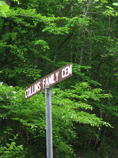
Collins Cemetery is located at Hollins Fork Road Bear Branch, Leslie County ,Kentucky ,USA.
-
Collins Cemetery cemetery's updated grave count on graveviews.com?
0 memorials
-
Where are the coordinates of the Collins Cemetery?
Latitude: 37.1775400
Longitude: -83.4891600
Nearby Cemetories:
1. Abe Couch Cemetery
Leslie County, USA
Coordinate: 37.1739100, -83.4953510
2. Couch Cemetery
Hyden, Leslie County, USA
Coordinate: 37.1692009, -83.4757996
3. Couch Fork Cemetery
Bear Branch, Leslie County, USA
Coordinate: 37.1641200, -83.4915600
4. Henry Collins Cemetery
Bear Branch, Leslie County, USA
Coordinate: 37.1730407, -83.4717405
5. Gibson-Begley Cemetery
Leslie County, USA
Coordinate: 37.1532020, -83.5075410
6. Jones Family Cemetery
Thousandsticks, Leslie County, USA
Coordinate: 37.1877000, -83.4507500
7. Allen-Woods-Ohmit Family Cemetery
Leslie County, USA
Coordinate: 37.2105070, -83.4880690
8. Gibson Branch Cemetery #02
Sizerock, Leslie County, USA
Coordinate: 37.2090680, -83.5013590
9. Gibson Branch Cemetery
Sizerock, Leslie County, USA
Coordinate: 37.2092700, -83.5012090
10. Sizemore-Gibson Cemetery
Bear Branch, Leslie County, USA
Coordinate: 37.1457090, -83.4755050
11. Hensley Cemetery
Bear Branch, Leslie County, USA
Coordinate: 37.1747100, -83.5329400
12. Roberts Cemetery
Bear Branch, Leslie County, USA
Coordinate: 37.1747300, -83.5329500
13. Earl's Family Cemetery
Bear Branch, Leslie County, USA
Coordinate: 37.1442417, -83.4747617
14. Oak Jones Family Cemetery
Thousandsticks, Leslie County, USA
Coordinate: 37.1865000, -83.4456500
15. Hensley-Byrd Cemetery
Sextons Creek, Clay County, USA
Coordinate: 37.1820100, -83.4433990
16. John Davidson Cemetery
Thousandsticks, Leslie County, USA
Coordinate: 37.1684000, -83.4436500
17. Ulysses Creek Cemetery
Bear Branch, Leslie County, USA
Coordinate: 37.1710000, -83.5360000
18. Bige Barnes Family Cemetery
Sizerock, Leslie County, USA
Coordinate: 37.2155650, -83.5005960
19. Davidson Cemetery
Thousandsticks, Leslie County, USA
Coordinate: 37.1692510, -83.4408800
20. Sizemore Cemetery
Leslie County, USA
Coordinate: 37.1577988, -83.4392014
21. Sim Barnes Cemetery
Sizerock, Leslie County, USA
Coordinate: 37.2198010, -83.5098530
22. Farmer-Roberts Cemetery
Bear Branch, Leslie County, USA
Coordinate: 37.1667300, -83.5511800
23. Woods Cemetery
Thousandsticks, Leslie County, USA
Coordinate: 37.1786003, -83.4218979
24. Bowling - Couch Cemetery
Leslie County, USA
Coordinate: 37.1460700, -83.4304500