
| Memorials | : | 2 |
| Location | : | Botto, Clay County, USA |
| Coordinate | : | 37.1098300, -83.6571900 |
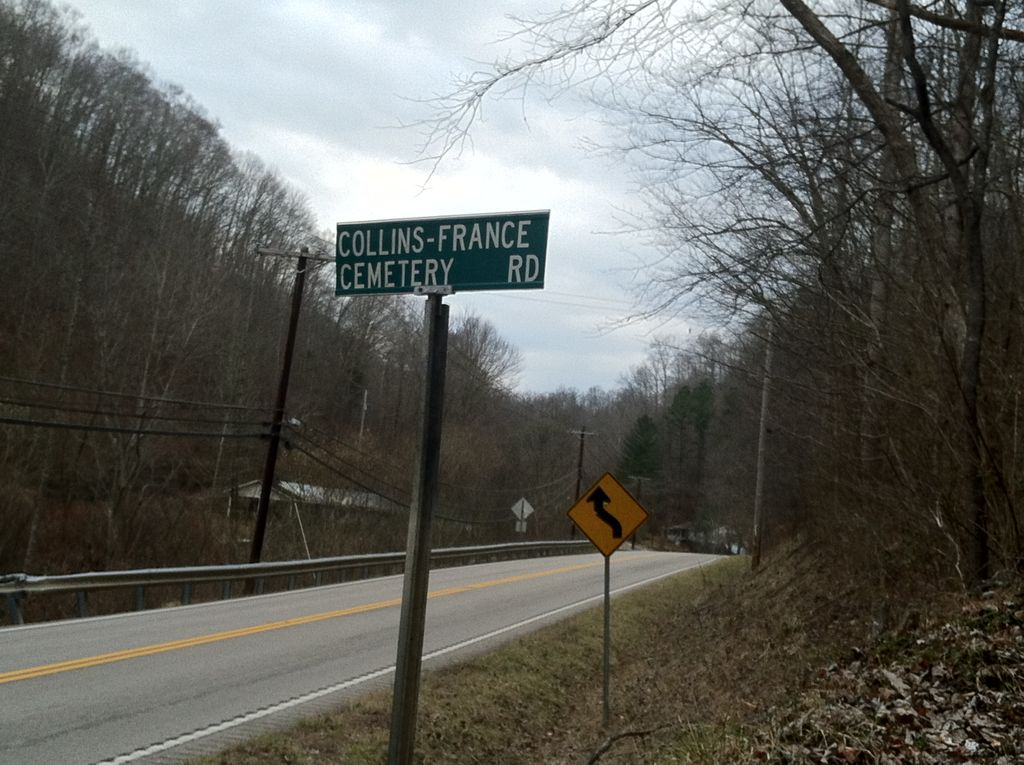
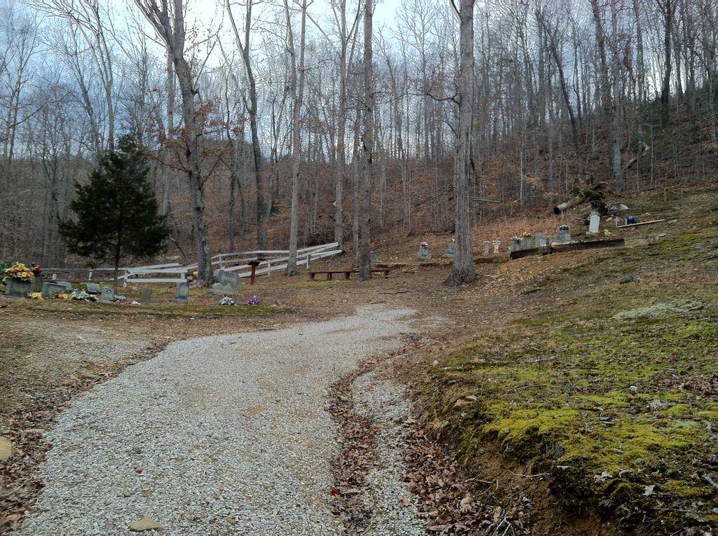
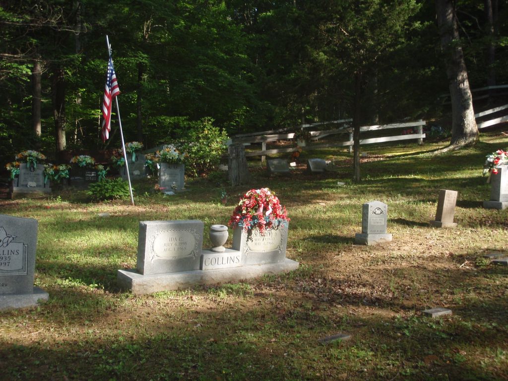
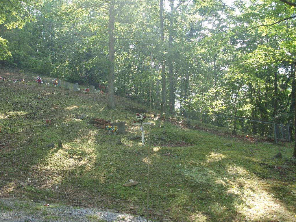
| Description | : | This cemetery is located in the Elk Creek area of Clay County, KY, just off US-421. There is a gravel access road that is marked with a road sign. This road is very steep and can be difficult to travel without an all-wheel drive vehicle. There is a small spot across the road that you can park at in order to walk up to the cemetery, but it is a hike! This cemetery has numerous very old graves that are marked with simple stones, all of which are children. Some where lost in early childhood, but most were lost at... Read More |
frequently asked questions (FAQ):
-
Where is Collins-France Cemetery?
Collins-France Cemetery is located at Collins-France Cemetery Rd Botto, Clay County ,Kentucky ,USA.
-
Collins-France Cemetery cemetery's updated grave count on graveviews.com?
2 memorials
-
Where are the coordinates of the Collins-France Cemetery?
Latitude: 37.1098300
Longitude: -83.6571900
Nearby Cemetories:
1. Nick Marcum Cemetery
Clay County, USA
Coordinate: 37.1078100, -83.6573500
2. Joe B Smith Cemetery
Goose Rock, Clay County, USA
Coordinate: 37.1069600, -83.6624600
3. Al Marcum Cemetery
Botto, Clay County, USA
Coordinate: 37.1058200, -83.6611800
4. Otis Smith Cemetery
Botto, Clay County, USA
Coordinate: 37.1163200, -83.6471200
5. Thomas Marcum Cemetery
Botto, Clay County, USA
Coordinate: 37.1180200, -83.6485000
6. Collins Cemetery #5
Big Creek, Clay County, USA
Coordinate: 37.1110000, -83.6413000
7. Bill Henson Cemetery
Botto, Clay County, USA
Coordinate: 37.0993700, -83.6681700
8. Hoskins Cemetery
Botto, Clay County, USA
Coordinate: 37.0988300, -83.6465200
9. Bart Collins Cemetery
Big Creek, Clay County, USA
Coordinate: 37.1140000, -83.6404800
10. Jones Cemetery
Big Creek, Clay County, USA
Coordinate: 37.0987510, -83.6464560
11. Henson Family Cemetery
Botto, Clay County, USA
Coordinate: 37.0993900, -83.6690500
12. Earnest Henson Cemetery
Botto, Clay County, USA
Coordinate: 37.0981900, -83.6692000
13. Brush Harbor
Goose Rock, Clay County, USA
Coordinate: 37.0949170, -83.6606730
14. Wagers Cemetery
Botto, Clay County, USA
Coordinate: 37.0949100, -83.6606700
15. Mitchell Cemetery
Botto, Clay County, USA
Coordinate: 37.0958300, -83.6646400
16. Mitchell-Combs Cemetery
Botto, Clay County, USA
Coordinate: 37.0946000, -83.6644100
17. Hubbard-Brumley Cemetery
Botto, Clay County, USA
Coordinate: 37.0945000, -83.6659300
18. Henson-Marcum Cemetery
Botto, Clay County, USA
Coordinate: 37.0961500, -83.6695300
19. Daugh Henson Cemetery
Botto, Clay County, USA
Coordinate: 37.0946500, -83.6690700
20. Steve Mitchell Cemetery
Botto, Clay County, USA
Coordinate: 37.0930100, -83.6668400
21. Thompson Family Cemetery
Botto, Clay County, USA
Coordinate: 37.0912660, -83.6730770
22. Smith Cemetery #12
Goose Rock, Clay County, USA
Coordinate: 37.0928400, -83.6804400
23. Gray Family Cemetery
Garrard, Clay County, USA
Coordinate: 37.1225900, -83.6852460
24. Jackson Family Cemetery
Botto, Clay County, USA
Coordinate: 37.0876500, -83.6742500