
| Memorials | : | 0 |
| Location | : | Thorntown, Boone County, USA |
| Coordinate | : | 40.1383591, -86.6240616 |
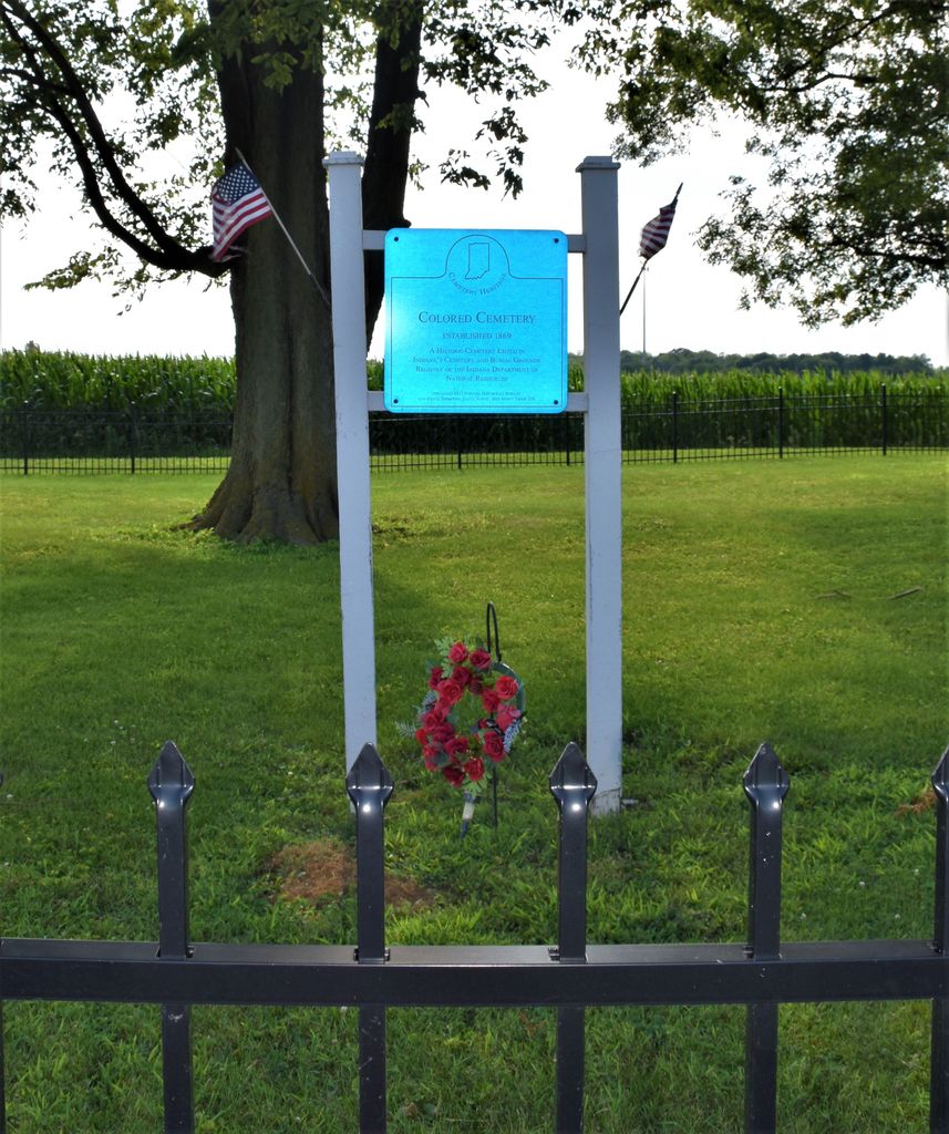
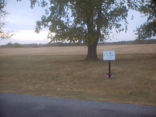
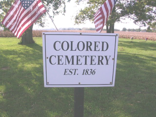
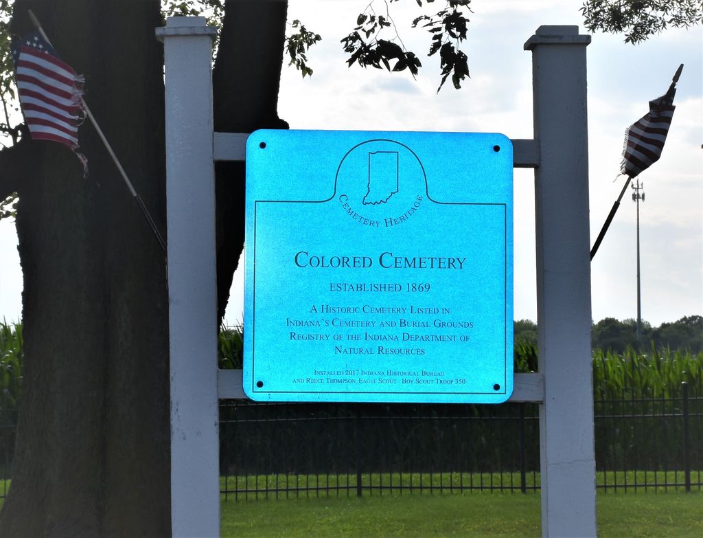
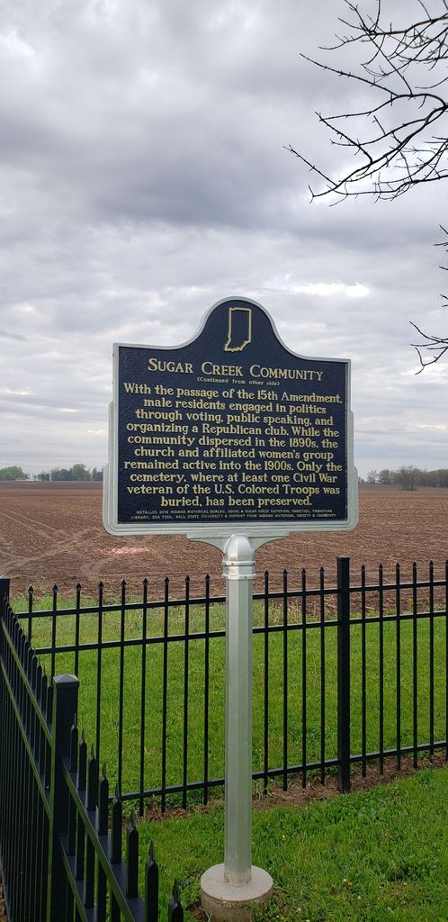
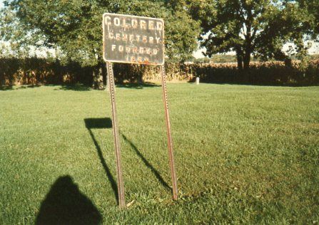
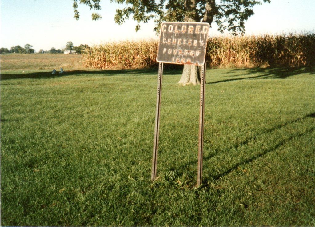
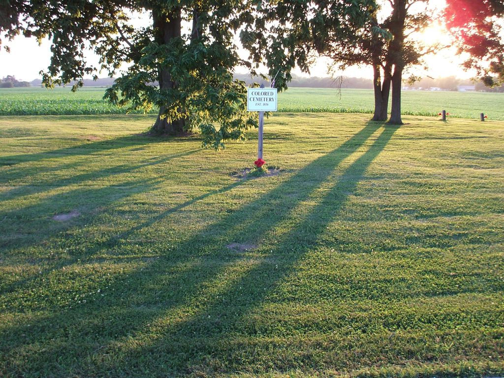
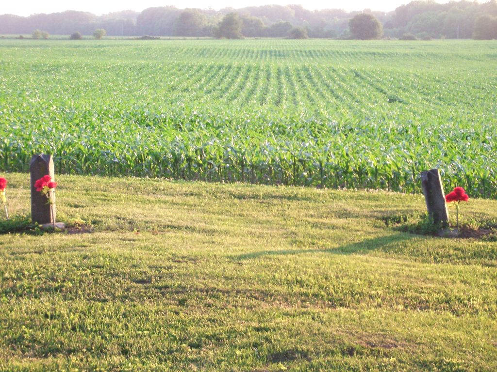
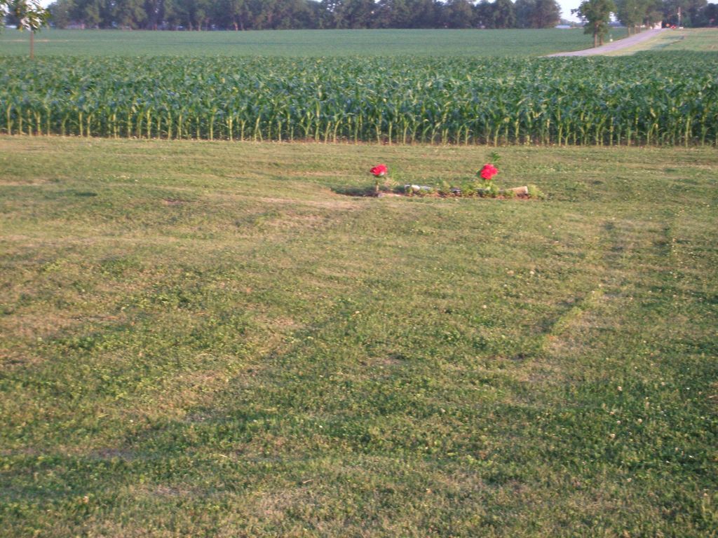
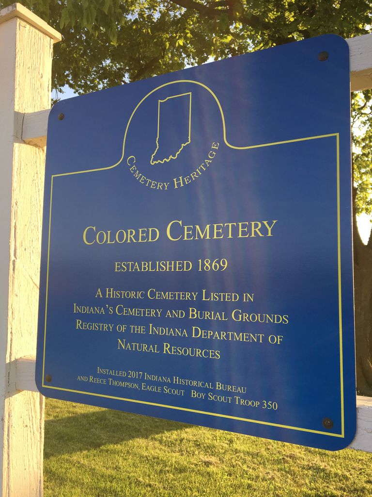
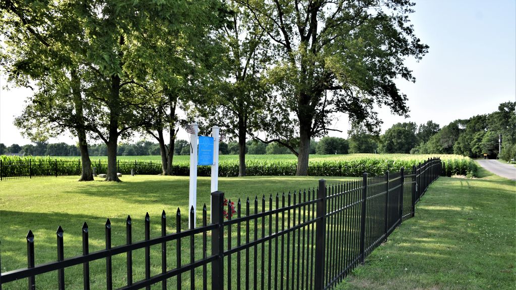
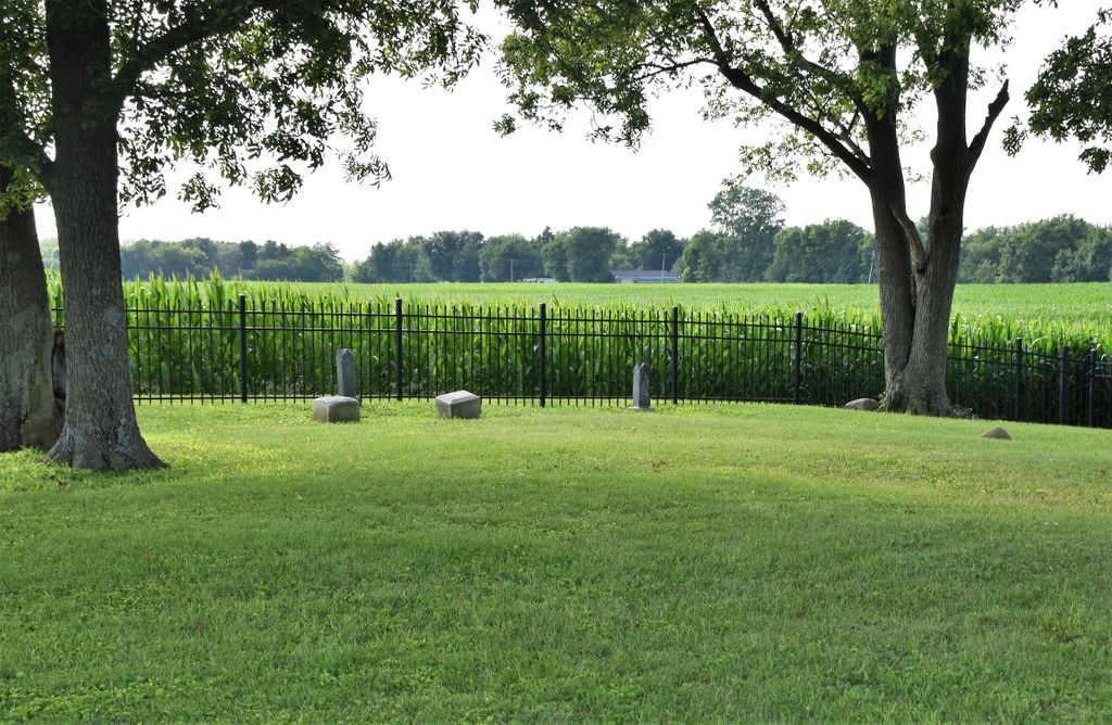
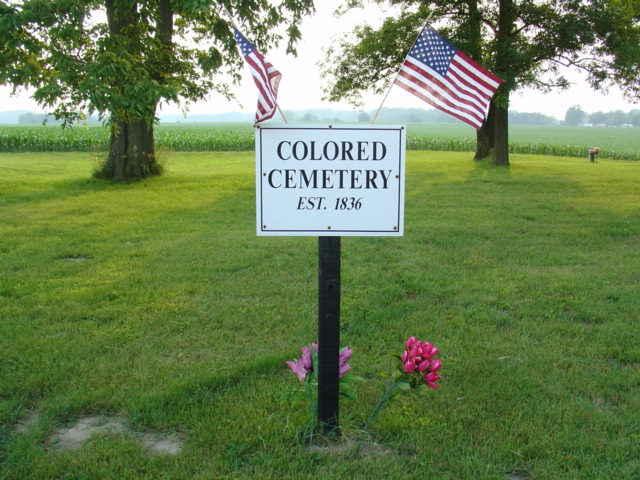
| Description | : | Just on the other side of the Montgomery County/Boone County line and past Sugar Plain Friends Church in Montgomery County, lies Thorntown’s Colored Cemetery. Marked only by a small black and white sign to announce its presence, it is located on the west side of County Road 825 West in Boone County, one-half mile north of State Road 47 on the way to the Old Mill Run Park entrance. The Indiana State Historic Architectural and Archaeological Research Database (SHAARD) https://secure.in.gov/apps/dnr/shaard/welcome.html has useful supporting information available in the form of a history and burial list as well as a ground penetrating radar... Read More |
frequently asked questions (FAQ):
-
Where is Colored Cemetery?
Colored Cemetery is located at Thorntown, Boone County ,Indiana ,USA.
-
Colored Cemetery cemetery's updated grave count on graveviews.com?
0 memorials
-
Where are the coordinates of the Colored Cemetery?
Latitude: 40.1383591
Longitude: -86.6240616

Nearby Cemetories:
1. Sugar Plain Cemetery
Thorntown, Boone County, USA
Coordinate: 40.1302986, -86.6371994
2. Maple Lawn Cemetery
Thorntown, Boone County, USA
Coordinate: 40.1253014, -86.6164017
3. Old Thorntown Cemetery
Thorntown, Boone County, USA
Coordinate: 40.1342812, -86.6038971
4. Curry Cemetery
Thorntown, Boone County, USA
Coordinate: 40.1321678, -86.6028748
5. Miami Indian Cemetery
Thorntown, Boone County, USA
Coordinate: 40.1286926, -86.5941238
6. Gipson Cemetery
Thorntown, Boone County, USA
Coordinate: 40.1567001, -86.5947037
7. Brush Creek Cemetery
Thorntown, Boone County, USA
Coordinate: 40.1697006, -86.5725021
8. Green Cemetery
Thorntown, Boone County, USA
Coordinate: 40.1399078, -86.6903687
9. Cox Cemetery
Dover, Boone County, USA
Coordinate: 40.0882988, -86.6382980
10. Walnut Grove Cemetery
Thorntown, Boone County, USA
Coordinate: 40.1056557, -86.6775055
11. Loveless Cemetery
Colfax, Clinton County, USA
Coordinate: 40.1932983, -86.6346970
12. Catholic Cemetery
Colfax, Clinton County, USA
Coordinate: 40.1880989, -86.6580963
13. Cason Cemetery
Hazelrigg, Boone County, USA
Coordinate: 40.1051979, -86.5611572
14. Bethel Hill Cemetery
Lebanon, Boone County, USA
Coordinate: 40.1343994, -86.5441971
15. Taylor Cemetery
Hazelrigg, Boone County, USA
Coordinate: 40.0835304, -86.5823212
16. Clouser Cemetery
Bowers, Montgomery County, USA
Coordinate: 40.1458015, -86.7213974
17. Mckendra Cemetery
Colfax, Clinton County, USA
Coordinate: 40.1991997, -86.6810989
18. Plainview Cemetery
Colfax, Clinton County, USA
Coordinate: 40.2066231, -86.6715469
19. Wyant Cemetery
Bowers, Montgomery County, USA
Coordinate: 40.1888161, -86.7055054
20. Lane Cemetery
Colfax, Clinton County, USA
Coordinate: 40.2181816, -86.6384811
21. Shiloh Cemetery
Colfax, Clinton County, USA
Coordinate: 40.2152900, -86.6567730
22. Endecott Cemetery
Darlington, Montgomery County, USA
Coordinate: 40.0986900, -86.7167600
23. Deck Cemetery
Darlington, Montgomery County, USA
Coordinate: 40.1228561, -86.7309418
24. Saint James Lutheran Cemetery
Darlington, Montgomery County, USA
Coordinate: 40.1163063, -86.7293396