
| Memorials | : | 0 |
| Location | : | Lumpkin County, USA |
| Coordinate | : | 34.4933120, -83.9128830 |
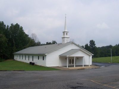
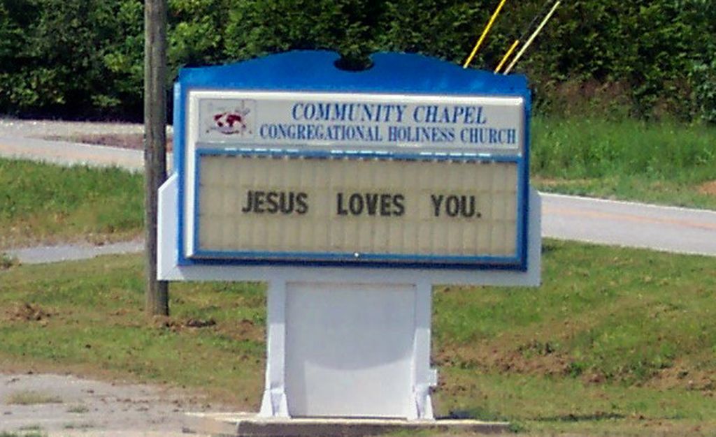
| Description | : | There are two separate cemeteries with almost the same name within a couple of miles of each other: Community Chapel Church Cemetery and Community Chapel Congregational Holiness Church Cemetery, which is the larger of the two. |
frequently asked questions (FAQ):
-
Where is Community Chapel Congregational Holiness Cemetery?
Community Chapel Congregational Holiness Cemetery is located at 1306 Old Dahlonega Highway Lumpkin County ,Georgia ,USA.
-
Community Chapel Congregational Holiness Cemetery cemetery's updated grave count on graveviews.com?
0 memorials
-
Where are the coordinates of the Community Chapel Congregational Holiness Cemetery?
Latitude: 34.4933120
Longitude: -83.9128830
Nearby Cemetories:
1. Ledford Family Cemetery
Dahlonega, Lumpkin County, USA
Coordinate: 34.4931500, -83.9132100
2. Hickory Grove CME Church Cemetery #2
Dahlonega, Lumpkin County, USA
Coordinate: 34.4887060, -83.9036380
3. Mount Olive Baptist Church Cemetery
Dahlonega, Lumpkin County, USA
Coordinate: 34.4804200, -83.8992200
4. Alston-Hollinshead Family Cemetery
Dahlonega, Lumpkin County, USA
Coordinate: 34.5058400, -83.9321800
5. Teal Family Cemetery
Dahlonega, Lumpkin County, USA
Coordinate: 34.4911200, -83.9374600
6. Hickory Grove CME Cemetery #1
Dahlonega, Lumpkin County, USA
Coordinate: 34.4778400, -83.8939100
7. Mount Gilead Baptist Church Historic Cemetery
Dahlonega, Lumpkin County, USA
Coordinate: 34.5158270, -83.9099080
8. Mount Gilead Baptist Cemetery - New
Dahlonega, Lumpkin County, USA
Coordinate: 34.5159690, -83.9074680
9. Stringer Family Cemetery
Dahlonega, Lumpkin County, USA
Coordinate: 34.5220320, -83.9162920
10. Browns Chapel Cemetery
Dahlonega, Lumpkin County, USA
Coordinate: 34.5159600, -83.8905500
11. Tate Family Cemetery
Hall County, USA
Coordinate: 34.4614050, -83.9150530
12. Wahoo Baptist Church Cemetery Old
Lumpkin County, USA
Coordinate: 34.4998200, -83.8712400
13. Hutchinson Family Cemetery
Murrayville, Hall County, USA
Coordinate: 34.4598293, -83.8990615
14. Owens Valley Farm Cemetery
Dahlonega, Lumpkin County, USA
Coordinate: 34.5089099, -83.9549764
15. Cavender-Barnes Family Cemetery
Murrayville, Hall County, USA
Coordinate: 34.4648130, -83.8758100
16. Saint Paul's United Methodist Church Cemetery
Dahlonega, Lumpkin County, USA
Coordinate: 34.4507290, -83.9371170
17. Wahoo Baptist Church Cemetery #2
Dahlonega, Lumpkin County, USA
Coordinate: 34.4951300, -83.8550900
18. Enon Baptist Church Cemetery
Dahlonega, Lumpkin County, USA
Coordinate: 34.4883800, -83.9714500
19. Wahoo Baptist Church Cemetery
Lumpkin County, USA
Coordinate: 34.4934500, -83.8537300
20. Mount Sinai Baptist Church Cemetery
Dahlonega, Lumpkin County, USA
Coordinate: 34.5342870, -83.9530280
21. Bethel United Methodist Church Cemetery
Clermont, Hall County, USA
Coordinate: 34.4668590, -83.8495340
22. Yellow Creek Baptist Church Cemetery
Murrayville, Hall County, USA
Coordinate: 34.4314003, -83.9281006
23. Cavenders Creek Baptist Church Cemetery
Dahlonega, Lumpkin County, USA
Coordinate: 34.5601400, -83.9286900
24. Mount Zion Baptist Church #2 Cemetery
Dahlonega, Lumpkin County, USA
Coordinate: 34.5401820, -83.8525860