
| Memorials | : | 0 |
| Location | : | Dahlonega, Lumpkin County, USA |
| Coordinate | : | 34.5401820, -83.8525860 |
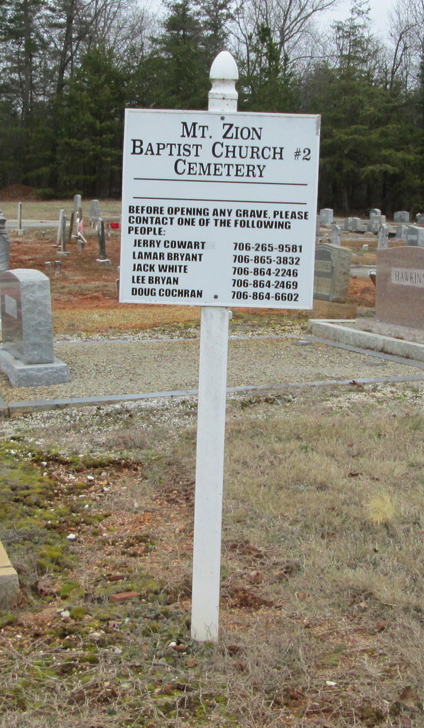
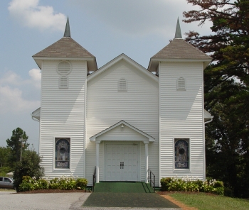
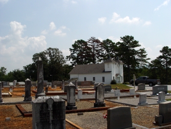
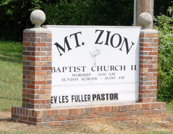
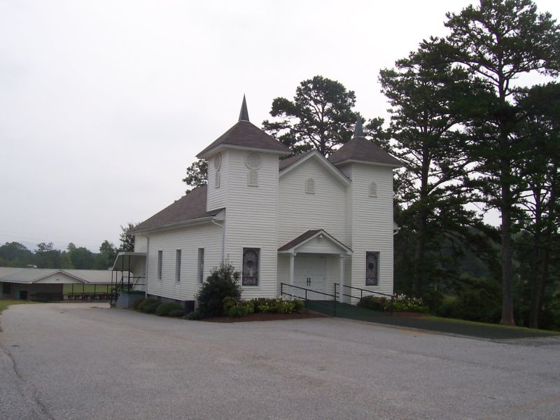
| Description | : | Mount Zion Baptist Church #2 Cemetery is at Mount Zion Baptist Church #2. From Dahlonega Public Square drive east on East Main Street. Turn left at the second traffic light(Morrison Moore Pkwy). Turn right at the first light (GA Hwy 52/115). Follow 9.1 miles before turning left on Mount Zion Church Road. The church and cemetery are 200 yards on the right side of the road. |
frequently asked questions (FAQ):
-
Where is Mount Zion Baptist Church #2 Cemetery?
Mount Zion Baptist Church #2 Cemetery is located at Dahlonega, Lumpkin County ,Georgia ,USA.
-
Mount Zion Baptist Church #2 Cemetery cemetery's updated grave count on graveviews.com?
0 memorials
-
Where are the coordinates of the Mount Zion Baptist Church #2 Cemetery?
Latitude: 34.5401820
Longitude: -83.8525860
Nearby Cemetories:
1. Philippi Baptist Church Cemetery
Dahlonega, Lumpkin County, USA
Coordinate: 34.5596123, -83.8898010
2. Browns Chapel Cemetery
Dahlonega, Lumpkin County, USA
Coordinate: 34.5159600, -83.8905500
3. Wahoo Baptist Church Cemetery Old
Lumpkin County, USA
Coordinate: 34.4998200, -83.8712400
4. Wahoo Baptist Church Cemetery #2
Dahlonega, Lumpkin County, USA
Coordinate: 34.4951300, -83.8550900
5. Wahoo Baptist Church Cemetery
Lumpkin County, USA
Coordinate: 34.4934500, -83.8537300
6. Mount Gilead Baptist Cemetery - New
Dahlonega, Lumpkin County, USA
Coordinate: 34.5159690, -83.9074680
7. Mount Gilead Baptist Church Historic Cemetery
Dahlonega, Lumpkin County, USA
Coordinate: 34.5158270, -83.9099080
8. Cradle Mountain Baptist Church Cemetery
Dahlonega, Lumpkin County, USA
Coordinate: 34.5890510, -83.8783950
9. Stringer Family Cemetery
Dahlonega, Lumpkin County, USA
Coordinate: 34.5220320, -83.9162920
10. Community Chapel Church Cemetery
Dahlonega, Lumpkin County, USA
Coordinate: 34.5943720, -83.8939320
11. Cavenders Creek Baptist Church Cemetery
Dahlonega, Lumpkin County, USA
Coordinate: 34.5601400, -83.9286900
12. Hickory Grove CME Church Cemetery #2
Dahlonega, Lumpkin County, USA
Coordinate: 34.4887060, -83.9036380
13. Community Chapel Congregational Holiness Cemetery
Lumpkin County, USA
Coordinate: 34.4933120, -83.9128830
14. Boyd Family Cemetery
Clermont, Hall County, USA
Coordinate: 34.4982560, -83.7868390
15. Ledford Family Cemetery
Dahlonega, Lumpkin County, USA
Coordinate: 34.4931500, -83.9132100
16. Hickory Grove CME Cemetery #1
Dahlonega, Lumpkin County, USA
Coordinate: 34.4778400, -83.8939100
17. Mount Olive Baptist Church Cemetery
Dahlonega, Lumpkin County, USA
Coordinate: 34.4804200, -83.8992200
18. Wauka Mountain Baptist Church Cemetery
Clermont, Hall County, USA
Coordinate: 34.4824280, -83.8004410
19. Thomason Family Cemetery
Clermont, Hall County, USA
Coordinate: 34.4706220, -83.8277430
20. Bethel United Methodist Church Cemetery
Clermont, Hall County, USA
Coordinate: 34.4668590, -83.8495340
21. Alston-Hollinshead Family Cemetery
Dahlonega, Lumpkin County, USA
Coordinate: 34.5058400, -83.9321800
22. Frogtown Winery Cemetery
Dahlonega, Lumpkin County, USA
Coordinate: 34.6130560, -83.8708330
23. Cavender-Barnes Family Cemetery
Murrayville, Hall County, USA
Coordinate: 34.4648130, -83.8758100
24. Duckett Family Cemetery
Clermont, Hall County, USA
Coordinate: 34.4638600, -83.8190400