
| Memorials | : | 0 |
| Location | : | Chalfont St Giles, Chiltern District, England |
| Coordinate | : | 51.6301590, -0.5754890 |
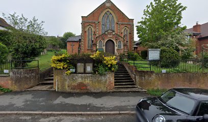
| Description | : | Around 1854 the old meeting house was demolished and was replaced by a plain brick building which was refronted in 1901. and became URC. There was a burial ground near the site of the old meeting house on the south side of the road. |
frequently asked questions (FAQ):
-
Where is Congregational Chapel Burial Ground?
Congregational Chapel Burial Ground is located at Deanway Chalfont St Giles, Chiltern District ,Buckinghamshire ,England.
-
Congregational Chapel Burial Ground cemetery's updated grave count on graveviews.com?
0 memorials
-
Where are the coordinates of the Congregational Chapel Burial Ground?
Latitude: 51.6301590
Longitude: -0.5754890
Nearby Cemetories:
1. St. Giles' Churchyard
Chalfont St Giles, Chiltern District, England
Coordinate: 51.6317080, -0.5696000
2. Deanway United Church
Chalfont St Giles, Chiltern District, England
Coordinate: 51.6346140, -0.5747440
3. Bowstridge Lane Cemetery
Chalfont St Giles, Chiltern District, England
Coordinate: 51.6258711, -0.5687373
4. Holy Trinity Churchyard
Seer Green, Chiltern District, England
Coordinate: 51.6180960, -0.6059000
5. Jordans Friends Burial Ground
Jordans, Chiltern District, England
Coordinate: 51.6096640, -0.5938360
6. Seer Green Cemetery
Seer Green, Chiltern District, England
Coordinate: 51.6152990, -0.6056860
7. Chalfont St. Peter Baptist Chapel Burial Ground
Chalfont St Peter, Chiltern District, England
Coordinate: 51.6074220, -0.5595870
8. St Paul Churchyard
Horn Hill, Chiltern District, England
Coordinate: 51.6223200, -0.5371930
9. St Peter Churchyard
Chalfont St Peter, Chiltern District, England
Coordinate: 51.6077930, -0.5566610
10. Chalfont St. Peter Garden of Rest
Chalfont St Peter, Chiltern District, England
Coordinate: 51.6110110, -0.5427340
11. St Joseph Priory
Chalfont St Peter, Chiltern District, England
Coordinate: 51.5999100, -0.5622200
12. St. Joseph's Churchyard
Gerrards Cross, South Bucks District, England
Coordinate: 51.5997700, -0.5629150
13. GreenAcres Chiltern
Jordans, Chiltern District, England
Coordinate: 51.6014230, -0.6060130
14. Stanley Hill Cemetery
Amersham, Chiltern District, England
Coordinate: 51.6657100, -0.5962700
15. All Saints Churchyard
Coleshill, Chiltern District, England
Coordinate: 51.6469400, -0.6318000
16. St Thomas of Canterbury Churchyard
West Hyde, Three Rivers District, England
Coordinate: 51.6181760, -0.5130960
17. Chilterns Crematorium
Amersham, Chiltern District, England
Coordinate: 51.6594970, -0.6273680
18. St. Mary the Virgin Churchyard
Amersham, Chiltern District, England
Coordinate: 51.6670010, -0.6161300
19. The Platt Cemetery
Amersham, Chiltern District, England
Coordinate: 51.6654600, -0.6195700
20. King's Churchyard
Amersham, Chiltern District, England
Coordinate: 51.6655250, -0.6195040
21. Shepherds Lane Cemetery
Beaconsfield, South Bucks District, England
Coordinate: 51.6044380, -0.6345890
22. Bethesda Chapel Burial Ground
Beaconsfield, South Bucks District, England
Coordinate: 51.6028180, -0.6375190
23. St Mary and All Saints Churchyard
Beaconsfield, South Bucks District, England
Coordinate: 51.6009660, -0.6370800
24. St James Churchyard
Gerrards Cross, South Bucks District, England
Coordinate: 51.5812960, -0.5567610