
| Memorials | : | 0 |
| Location | : | Seer Green, Chiltern District, England |
| Coordinate | : | 51.6152990, -0.6056860 |
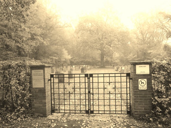
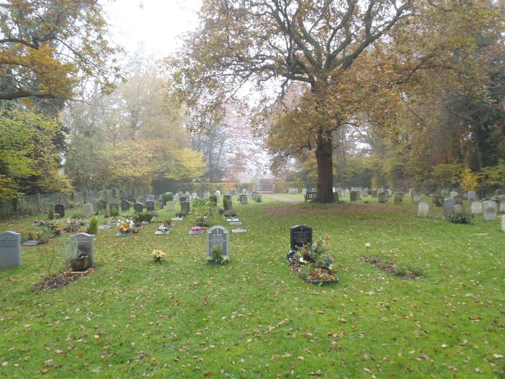
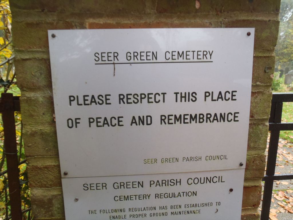
| Description | : | Seer Green Cemetery is in the Chiltern district of Buckinghamshire, England, about a mile east of Beaconsfield and a mile south-west of Chalfont St Giles. Green Wood was purchased by the Parish Council from the DuPre estate, expressly for the purpose of providing a burial ground in the village since there was no further space in the Holy Trinity Churchyard. Green Wood covers 4.4 acres with the cemetery taking 0.45 acres of this area. There have been two applications to extend the cemetery, one in 1989 and the second in 1991 (to extend by another 0.25 acres), both were refused... Read More |
frequently asked questions (FAQ):
-
Where is Seer Green Cemetery?
Seer Green Cemetery is located at School Lane Seer Green, Chiltern District ,Buckinghamshire , HP9 2QJEngland.
-
Seer Green Cemetery cemetery's updated grave count on graveviews.com?
0 memorials
-
Where are the coordinates of the Seer Green Cemetery?
Latitude: 51.6152990
Longitude: -0.6056860
Nearby Cemetories:
1. Holy Trinity Churchyard
Seer Green, Chiltern District, England
Coordinate: 51.6180960, -0.6059000
2. Jordans Friends Burial Ground
Jordans, Chiltern District, England
Coordinate: 51.6096640, -0.5938360
3. GreenAcres Chiltern
Jordans, Chiltern District, England
Coordinate: 51.6014230, -0.6060130
4. Shepherds Lane Cemetery
Beaconsfield, South Bucks District, England
Coordinate: 51.6044380, -0.6345890
5. Bethesda Chapel Burial Ground
Beaconsfield, South Bucks District, England
Coordinate: 51.6028180, -0.6375190
6. Congregational Chapel Burial Ground
Chalfont St Giles, Chiltern District, England
Coordinate: 51.6301590, -0.5754890
7. St Mary and All Saints Churchyard
Beaconsfield, South Bucks District, England
Coordinate: 51.6009660, -0.6370800
8. Bowstridge Lane Cemetery
Chalfont St Giles, Chiltern District, England
Coordinate: 51.6258711, -0.5687373
9. Deanway United Church
Chalfont St Giles, Chiltern District, England
Coordinate: 51.6346140, -0.5747440
10. St. Giles' Churchyard
Chalfont St Giles, Chiltern District, England
Coordinate: 51.6317080, -0.5696000
11. Chalfont St. Peter Baptist Chapel Burial Ground
Chalfont St Peter, Chiltern District, England
Coordinate: 51.6074220, -0.5595870
12. St. Joseph's Churchyard
Gerrards Cross, South Bucks District, England
Coordinate: 51.5997700, -0.5629150
13. St Joseph Priory
Chalfont St Peter, Chiltern District, England
Coordinate: 51.5999100, -0.5622200
14. St Peter Churchyard
Chalfont St Peter, Chiltern District, England
Coordinate: 51.6077930, -0.5566610
15. All Saints Churchyard
Coleshill, Chiltern District, England
Coordinate: 51.6469400, -0.6318000
16. St Marys Churchyard
Hedgerley, South Bucks District, England
Coordinate: 51.5765630, -0.6006320
17. Chalfont St. Peter Garden of Rest
Chalfont St Peter, Chiltern District, England
Coordinate: 51.6110110, -0.5427340
18. Holtspur Cemetery
Beaconsfield, South Bucks District, England
Coordinate: 51.5964280, -0.6663890
19. St Paul Churchyard
Horn Hill, Chiltern District, England
Coordinate: 51.6223200, -0.5371930
20. St James Churchyard
Gerrards Cross, South Bucks District, England
Coordinate: 51.5812960, -0.5567610
21. Chilterns Crematorium
Amersham, Chiltern District, England
Coordinate: 51.6594970, -0.6273680
22. Holy Trinity Churchyard
Penn, Chiltern District, England
Coordinate: 51.6310240, -0.6774510
23. Parkside Cemetery
Gerrards Cross, South Bucks District, England
Coordinate: 51.5669090, -0.5829160
24. Stanley Hill Cemetery
Amersham, Chiltern District, England
Coordinate: 51.6657100, -0.5962700