
| Memorials | : | 45 |
| Location | : | Leigh, Tewkesbury Borough, England |
| Phone | : | 01242 512271 |
| Coordinate | : | 51.9438860, -2.1631660 |
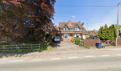
| Description | : | Coombe Hill Methodist Church was founded in 1888 but closed in the late 20th century. There is a small cemetery in front and to the right hand (north) side of the Church. Before the cemetery was opened some members of the church were burried at the local parish church - St Catherines, The Leigh |
frequently asked questions (FAQ):
-
Where is Coombe Hill Methodist Church?
Coombe Hill Methodist Church is located at 24 Bisley Road, Cheltenham Leigh, Tewkesbury Borough ,Gloucestershire , GL51 6ADEngland.
-
Coombe Hill Methodist Church cemetery's updated grave count on graveviews.com?
45 memorials
-
Where are the coordinates of the Coombe Hill Methodist Church?
Latitude: 51.9438860
Longitude: -2.1631660
Nearby Cemetories:
1. St Catherines Churchyard
Leigh, Tewkesbury Borough, England
Coordinate: 51.9301080, -2.1966690
2. Holy Trinity Churchyard
Apperley, Tewkesbury Borough, England
Coordinate: 51.9510043, -2.2029317
3. Stoke Orchard Cemetery
Stoke Orchard, Tewkesbury Borough, England
Coordinate: 51.9522350, -2.1212140
4. St. Mary's Churchyard
Deerhurst, Tewkesbury Borough, England
Coordinate: 51.9679540, -2.1899710
5. Tewkesbury Cemetery
Tewkesbury, Tewkesbury Borough, England
Coordinate: 51.9862920, -2.1607700
6. St. Michael and All Angels Churchyard
Tirley, Tewkesbury Borough, England
Coordinate: 51.9552600, -2.2341600
7. Tewkesbury Abbey
Tewkesbury, Tewkesbury Borough, England
Coordinate: 51.9902520, -2.1604280
8. Saint Nicholas Churchyard
Swindon, Cheltenham Borough, England
Coordinate: 51.9228800, -2.0956000
9. Baptist Burial Ground 1655
Tewkesbury, Tewkesbury Borough, England
Coordinate: 51.9915680, -2.1614440
10. St. Mary the Virgin Churchyard
Forthampton, Tewkesbury Borough, England
Coordinate: 51.9912630, -2.2072860
11. Cheltenham Racecourse
Cheltenham, Cheltenham Borough, England
Coordinate: 51.9203900, -2.0674400
12. St Philips and St James
Up Hatherley, Cheltenham Borough, England
Coordinate: 51.8853307, -2.1223815
13. St Lawrence Churchyard
Sandhurst, Tewkesbury Borough, England
Coordinate: 51.9083260, -2.2489570
14. St Michael & All Angels Church
Bishop's Cleeve, Tewkesbury Borough, England
Coordinate: 51.9476200, -2.0594800
15. Christ Church
Cheltenham, Cheltenham Borough, England
Coordinate: 51.8988860, -2.0889160
16. St Peters Churchyard
Bushley, Malvern Hills District, England
Coordinate: 52.0076000, -2.1834000
17. St. Nicholas Church
Ashchurch, Tewkesbury Borough, England
Coordinate: 51.9991000, -2.1068200
18. St. Matthew's Cemetery
Twigworth, Tewkesbury Borough, England
Coordinate: 51.8936090, -2.2307820
19. St Mary with St Matthew Churchyard
Cheltenham, Cheltenham Borough, England
Coordinate: 51.9013790, -2.0765460
20. Holy Trinity Churchyard
Badgeworth, Tewkesbury Borough, England
Coordinate: 51.8715360, -2.1444640
21. St Philip and St James Churchyard
Leckhampton, Cheltenham Borough, England
Coordinate: 51.8885652, -2.0821259
22. St Mary's Churchyard
Prestbury, Cheltenham Borough, England
Coordinate: 51.9143880, -2.0451090
23. St. Mary Magdalene's Churchyard
Twyning, Tewkesbury Borough, England
Coordinate: 52.0230800, -2.1561800
24. Hartpury Methodist Churchyard
Hartpury, Forest of Dean District, England
Coordinate: 51.9196444, -2.2883000