
| Memorials | : | 0 |
| Location | : | Stephens County, USA |
| Coordinate | : | 34.5971985, -97.8677979 |
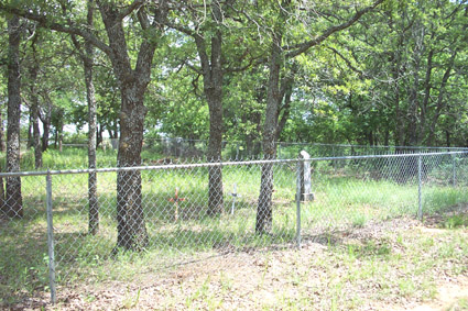
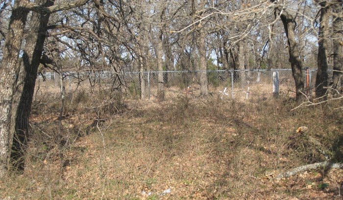
| Description | : | Directions to cemetery: From Marlow, travel east on Oklahoma Highway 29 to Cason Road and turn south and go 3 miles to Lakeside Grocery at Medcalf Road. Turn east and travel 4/10 mile to a pasture gate on the north side of the road. Hanging from the fence is a "U. S. Government" sign. From the gate the cemetery is northeast across a pasture about 1/10 - 2/10 mile. The cemetery is surrounded by chainlink fence and is hard to see as it is located in a group of trees. |
frequently asked questions (FAQ):
-
Where is Cooper Cemetery?
Cooper Cemetery is located at Stephens County ,Oklahoma ,USA.
-
Cooper Cemetery cemetery's updated grave count on graveviews.com?
0 memorials
-
Where are the coordinates of the Cooper Cemetery?
Latitude: 34.5971985
Longitude: -97.8677979


Nearby Cemetories:
1. Oak Grove Cemetery
Marlow, Stephens County, USA
Coordinate: 34.6023900, -97.9028100
2. Hope Cemetery
Marlow, Stephens County, USA
Coordinate: 34.5688460, -97.8401610
3. Upchurch Farm Cemetery
Marlow, Stephens County, USA
Coordinate: 34.6151900, -97.8097700
4. Colbert Cemetery
Duncan, Stephens County, USA
Coordinate: 34.5654400, -97.8075000
5. Folsom-Foster Cemetery
Duncan, Stephens County, USA
Coordinate: 34.5506874, -97.9534471
6. Cruce Cemetery
Stephens County, USA
Coordinate: 34.5311110, -97.7938880
7. Resthaven Memorial Gardens
Duncan, Stephens County, USA
Coordinate: 34.5516700, -97.9651800
8. Old Duncan Cemetery
Duncan, Stephens County, USA
Coordinate: 34.5181900, -97.9258300
9. Marlow Cemetery
Marlow, Stephens County, USA
Coordinate: 34.6616707, -97.9483337
10. All Saints Episcopal Church Cemetery
Duncan, Stephens County, USA
Coordinate: 34.5116400, -97.9568600
11. First Christian Church Columbarium
Duncan, Stephens County, USA
Coordinate: 34.5027890, -97.9591140
12. Owens Prairie Cemetery
Stephens County, USA
Coordinate: 34.5797005, -97.7161026
13. Bailey Cemetery
Bailey, Grady County, USA
Coordinate: 34.7104634, -97.7992996
14. Duncan Municipal Cemetery
Duncan, Stephens County, USA
Coordinate: 34.4963989, -97.9738998
15. Bear Creek Cemetery
Stephens County, USA
Coordinate: 34.6279200, -97.7087300
16. Henderson-Harris Cemetery
Duncan, Stephens County, USA
Coordinate: 34.4716988, -97.9460983
17. Stoner Cemetery
Stephens County, USA
Coordinate: 34.4343987, -97.8606033
18. Killgore Cemetery
Cox City, Grady County, USA
Coordinate: 34.7182999, -97.7033005
19. Tucker Cemetery
Comanche, Stephens County, USA
Coordinate: 34.4139000, -97.9159400
20. Carnes Family Cemetery
Cox City, Grady County, USA
Coordinate: 34.7542820, -97.7384110
21. Stewart Family Cemetery
Velma, Stephens County, USA
Coordinate: 34.4519000, -97.7151000
22. Passmore Cemetery
Velma, Stephens County, USA
Coordinate: 34.4693985, -97.6892014
23. Rush Springs Cemetery
Rush Springs, Grady County, USA
Coordinate: 34.7857200, -97.9491560
24. Ridley Cemetery
Grady County, USA
Coordinate: 34.7538986, -98.0205994