
| Memorials | : | 1 |
| Location | : | Corindi, Coffs Harbour City, Australia |
| Coordinate | : | -30.0299590, 153.1761930 |
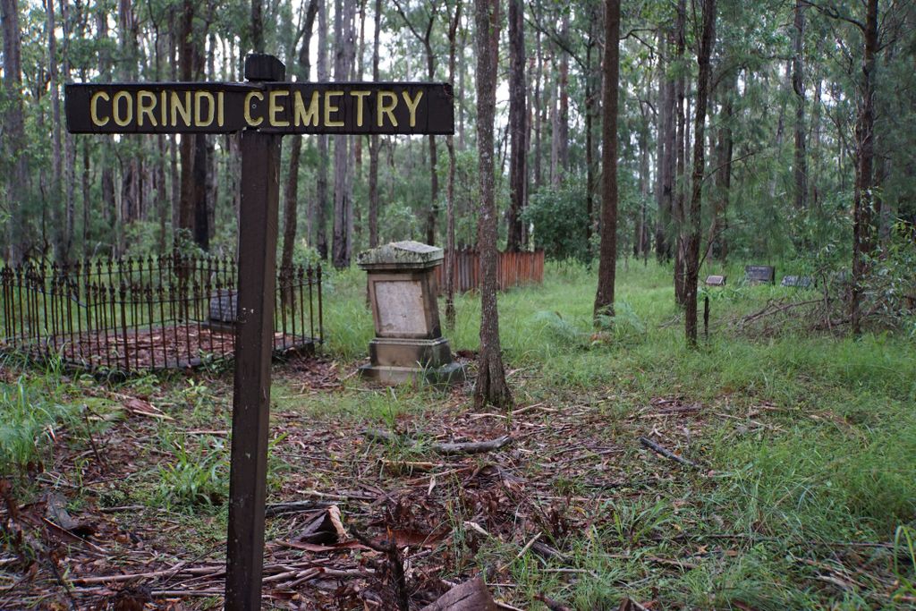
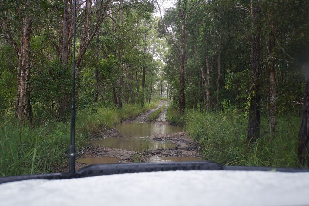
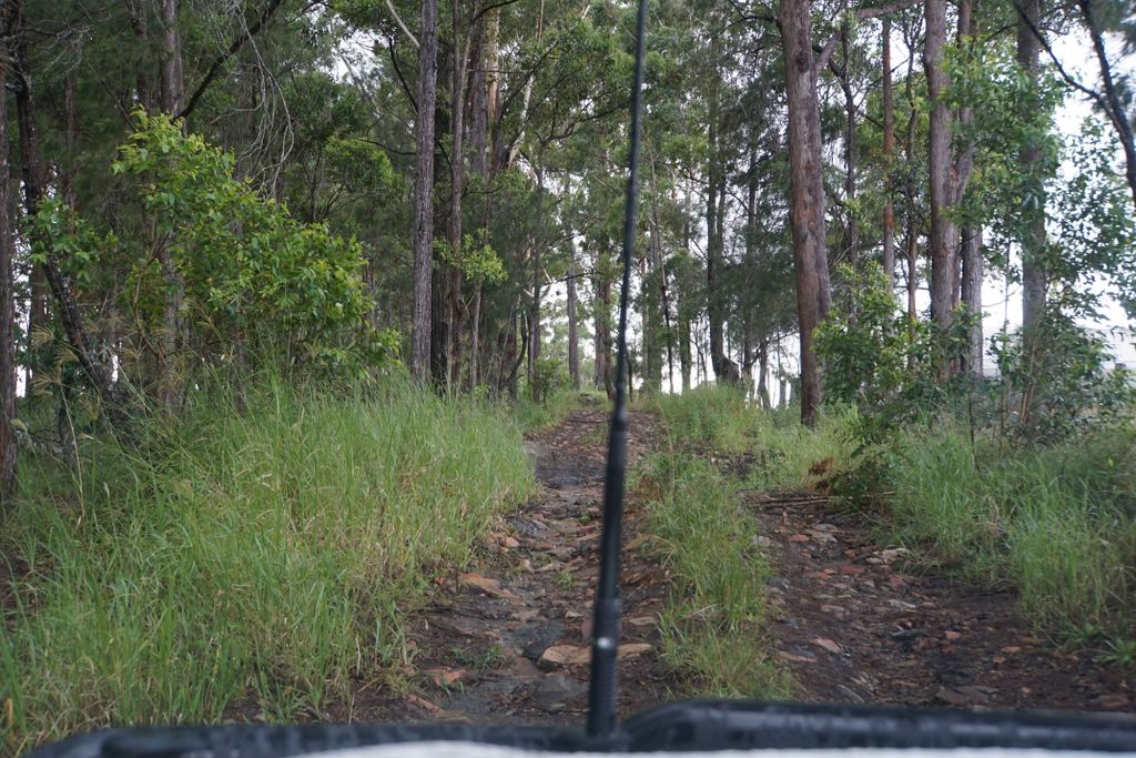
| Description | : | Corindi Cemetery is a very small and isolated bush cemetery which falls under the Coffs Harbour City Council jurisdiction. The Council indicates on its website that there are only 7 marked burials,that no new burials are being accepted, and they took control for maintenance in 2004. The council can be contacted via [email protected] or via telephone 02 6648 4000 The road in is only sealed for a small part of the Kangaroo Trail Road before it changes into a small one-laned track overhung with trees. After rain there are deep puddles along this track and slippery rocks on the... Read More |
frequently asked questions (FAQ):
-
Where is Corindi Cemetery?
Corindi Cemetery is located at Kangaroo Trail Road Corindi, Coffs Harbour City ,New South Wales , 2456Australia.
-
Corindi Cemetery cemetery's updated grave count on graveviews.com?
1 memorials
-
Where are the coordinates of the Corindi Cemetery?
Latitude: -30.0299590
Longitude: 153.1761930
Nearby Cemetories:
1. Woolgoolga Monumental & Lawn Cemetery
Woolgoolga, Coffs Harbour City, Australia
Coordinate: -30.1006600, 153.1946500
2. Bucca Cemetery
Bucca, Coffs Harbour City, Australia
Coordinate: -30.1563310, 153.0905443
3. Glenreagh Cemetery
Glenreagh, Clarence Valley Council, Australia
Coordinate: -30.0686470, 152.9795610
4. Coramba Cemetery
Coramba, Coffs Harbour City, Australia
Coordinate: -30.2166670, 153.0166670
5. Coffs Harbour Lawn Cemetery
Karangi, Coffs Harbour City, Australia
Coordinate: -30.2547550, 153.0513360
6. Coffs Harbour Historic Cemetery
Coffs Harbour, Coffs Harbour City, Australia
Coordinate: -30.2984638, 153.1229401
7. Hogbin Drive Crematorium & Memorial Gardens
Coffs Harbour, Coffs Harbour City, Australia
Coordinate: -30.3238230, 153.0926100
8. Coutts Crossing Cemetery
Coutts Crossing, Clarence Valley Council, Australia
Coordinate: -29.8312440, 152.8871770
9. Clarence Lawn Cemetery
South Grafton, Clarence Valley Council, Australia
Coordinate: -29.7673420, 152.9293470
10. St. Matthews Church Columbarium
South Grafton, Clarence Valley Council, Australia
Coordinate: -29.7181690, 152.9350340
11. South Grafton General Cemetery
South Grafton, Clarence Valley Council, Australia
Coordinate: -29.7169130, 152.9341400
12. Ulmarra General Cemetery
Ulmarra, Clarence Valley Council, Australia
Coordinate: -29.6521510, 153.0688990
13. Nymboida Cemetery
Nymboida, Clarence Valley Council, Australia
Coordinate: -29.9700150, 152.7278440
14. Grafton General Cemetery
Grafton, Clarence Valley Council, Australia
Coordinate: -29.6774440, 152.9488920
15. Bellingen General Cemetery
Bellingen, Bellingen Shire, Australia
Coordinate: -30.4393310, 152.9006330
16. Urunga Museum - Thrower Headstone
Urunga, Bellingen Shire, Australia
Coordinate: -30.4969460, 153.0219490
17. Fernmount Cemetery
Fernmount, Bellingen Shire, Australia
Coordinate: -30.4729595, 152.9407959
18. Mylneford-Eatonsville Cemetery
Eatonsville, Clarence Valley Council, Australia
Coordinate: -29.6330180, 152.8391270
19. Urunga Cemetery
Urunga, Bellingen Shire, Australia
Coordinate: -30.5107589, 153.0196292
20. Ramornie Cemetery
Ramornie Works, Clarence Valley Council, Australia
Coordinate: -29.6465110, 152.8021110
21. Dorrigo General Cemetery
Dorrigo, Bellingen Shire, Australia
Coordinate: -30.3484990, 152.7178950
22. Lawrence Cemetery
Lawrence, Clarence Valley Council, Australia
Coordinate: -29.4825760, 153.0937960
23. Maclean Lawn Cemetery
Maclean, Clarence Valley Council, Australia
Coordinate: -29.4704800, 153.2247700
24. Copmanhurst Cemetery
Copmanhurst, Clarence Valley Council, Australia
Coordinate: -29.5833850, 152.7780100