
| Memorials | : | 6 |
| Location | : | Cheeks Township, Orange County, USA |
| Coordinate | : | 36.1041985, -79.1782990 |
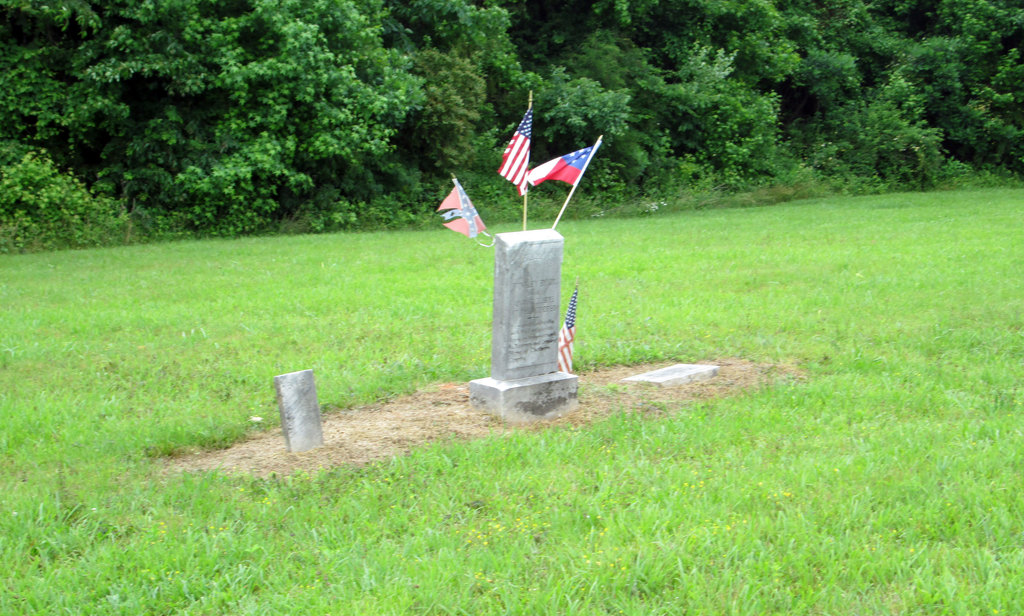
| Description | : | Location: At the NW corner of the Efland-Cedar Grove Road (SR-1004) intersection with Lebanon Road (SR-1306), about 1-1/2 miles north of Efland. Additional information: The Orange County Home/Poor House was established in 1823 and closed in 1941. Over those years, many persons lived there and the available records indicate a number died there. It is unknown how many of these persons were buried in the Home cemetery, as apparently no burial records were kept. The 1880 Census Mortality Schedule mentions nearly 100 deaths at the County Home from 1858 to 1880, but none of these entries stated the person was buried... Read More |
frequently asked questions (FAQ):
-
Where is County Home Cemetery?
County Home Cemetery is located at Cheeks Township, Orange County ,North Carolina ,USA.
-
County Home Cemetery cemetery's updated grave count on graveviews.com?
0 memorials
-
Where are the coordinates of the County Home Cemetery?
Latitude: 36.1041985
Longitude: -79.1782990
Nearby Cemetories:
1. John Paul Family Cemetery
Cheeks Township, Orange County, USA
Coordinate: 36.1112000, -79.1808000
2. Efland United Methodist Memorial Cemetery
Cheeks Township, Orange County, USA
Coordinate: 36.1008000, -79.1653000
3. Saint Lukes Christian Church Cemetery
Cheeks Township, Orange County, USA
Coordinate: 36.1025620, -79.1921890
4. Gaines Chapel Memorial Garden
Cheeks Township, Orange County, USA
Coordinate: 36.1039000, -79.1928000
5. White Cross AME Church Cemetery
Cheeks Township, Orange County, USA
Coordinate: 36.1050000, -79.1928000
6. Thompson - Efland Family Cemetery
Efland, Orange County, USA
Coordinate: 36.0897000, -79.1653000
7. Fairfield Presbyterian Church Cemetery
Cheeks Township, Orange County, USA
Coordinate: 36.1233000, -79.1742000
8. Efland Presbyterian Church Cemetery
Efland, Orange County, USA
Coordinate: 36.0815000, -79.1742830
9. Cool Springs Baptist Church Cemetery
Efland, Orange County, USA
Coordinate: 36.0803000, -79.1833000
10. Efland Methodist Church Cemetery
Efland, Orange County, USA
Coordinate: 36.0808000, -79.1681000
11. Orange County Poor House Cemetery
Efland, Orange County, USA
Coordinate: 36.0816630, -79.1653213
12. Wade Temple Holiness Church Cemetery
Efland, Orange County, USA
Coordinate: 36.0754000, -79.1801000
13. Bryant-Faucette Mills Graves
Cheeks Township, Orange County, USA
Coordinate: 36.1032000, -79.1416000
14. Tinnin Slave Cemetery
Cedar Grove Township, Orange County, USA
Coordinate: 36.1386000, -79.1650000
15. Orange Crossroads Baptist Church Cemetery
Cheeks Township, Orange County, USA
Coordinate: 36.1161000, -79.1358000
16. Lebanon United Methodist Church Cemetery
Cheeks Township, Orange County, USA
Coordinate: 36.1117000, -79.2250000
17. Julius Davis Family Cemetery
Cedar Grove Township, Orange County, USA
Coordinate: 36.1400000, -79.1608000
18. Walker Memory Garden
Miles, Orange County, USA
Coordinate: 36.0838580, -79.2218970
19. Faith Baptist Church Cemetery
Cheeks Township, Orange County, USA
Coordinate: 36.0691490, -79.2039210
20. Hunter's Chapel A M E Church Cemetery
Miles, Orange County, USA
Coordinate: 36.0837000, -79.2224000
21. Mayo Family Cemetery
Hillsborough Township, Orange County, USA
Coordinate: 36.0751000, -79.1314000
22. Rosewood Cemetery
Hillsborough, Orange County, USA
Coordinate: 36.0806007, -79.1256027
23. Daye Family Cemetery
Hillsborough Township, Orange County, USA
Coordinate: 36.0935000, -79.1186000
24. Jones Memorial Garden of Hillsborough
Hillsborough Township, Orange County, USA
Coordinate: 36.0897000, -79.1189000