
| Memorials | : | 466 |
| Location | : | Cheeks Township, Orange County, USA |
| Coordinate | : | 36.1117000, -79.2250000 |
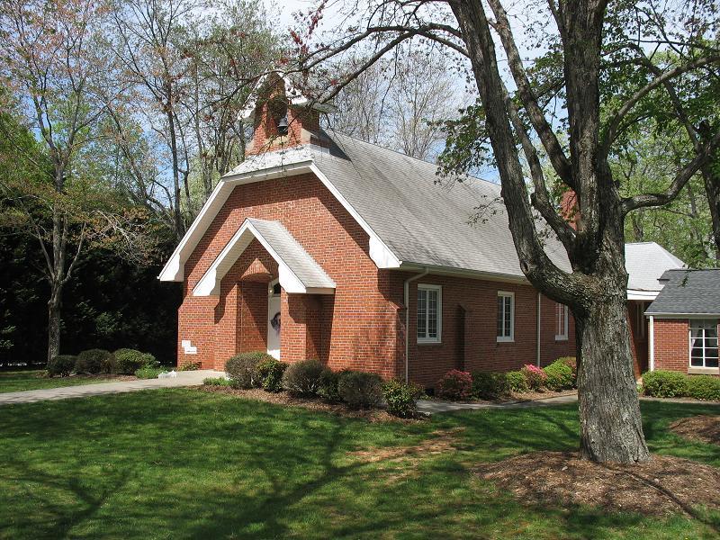
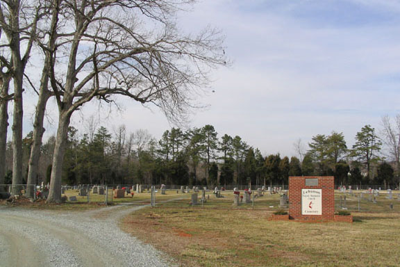
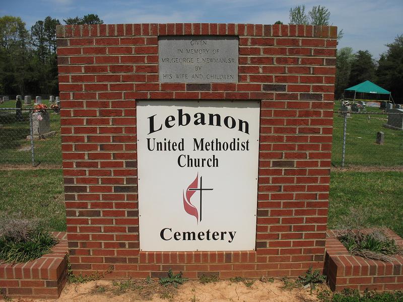
| Description | : | Location: Northwest of Efland at 6101 Lebanon Road (SR-1306), on the north side of Lebanon Road (SR-1306), about 0.75 miles west of the intersection of Lebanon Road with Frazier Road (SR-1310 & SR-1342). The cemetery is behind the church at the end of Foxfire Drive. Additonal information: When this cemetery was survey in 1972, there were 257 marked graves and 106 unmarked graves. |
frequently asked questions (FAQ):
-
Where is Lebanon United Methodist Church Cemetery?
Lebanon United Methodist Church Cemetery is located at Cheeks Township, Orange County ,North Carolina ,USA.
-
Lebanon United Methodist Church Cemetery cemetery's updated grave count on graveviews.com?
23 memorials
-
Where are the coordinates of the Lebanon United Methodist Church Cemetery?
Latitude: 36.1117000
Longitude: -79.2250000
Nearby Cemetories:
1. People's Church Cemetery
Cheeks Township, Orange County, USA
Coordinate: 36.0928000, -79.2392000
2. J. Whitaker Grave Site
Cheeks Township, Orange County, USA
Coordinate: 36.1086000, -79.2533000
3. Mebane Memorial Gardens
Mebane, Orange County, USA
Coordinate: 36.0876390, -79.2394480
4. White Cross AME Church Cemetery
Cheeks Township, Orange County, USA
Coordinate: 36.1050000, -79.1928000
5. Gaines Chapel Memorial Garden
Cheeks Township, Orange County, USA
Coordinate: 36.1039000, -79.1928000
6. Victor Carl Walters Family Cemetery
Cedar Grove Township, Orange County, USA
Coordinate: 36.1385000, -79.2341000
7. Walker Memory Garden
Miles, Orange County, USA
Coordinate: 36.0838580, -79.2218970
8. Pettigrew-Rice Family Cemetery
Cheeks Township, Orange County, USA
Coordinate: 36.1278000, -79.2534000
9. Saint Lukes Christian Church Cemetery
Cheeks Township, Orange County, USA
Coordinate: 36.1025620, -79.1921890
10. Hunter's Chapel A M E Church Cemetery
Miles, Orange County, USA
Coordinate: 36.0837000, -79.2224000
11. Oakwood Cemetery
Mebane, Orange County, USA
Coordinate: 36.0928001, -79.2605972
12. John Paul Family Cemetery
Cheeks Township, Orange County, USA
Coordinate: 36.1112000, -79.1808000
13. County Home Cemetery
Cheeks Township, Orange County, USA
Coordinate: 36.1041985, -79.1782990
14. Lighthouse Baptist Church Cemetery
Cheeks Township, Orange County, USA
Coordinate: 36.0719000, -79.2327000
15. Fairfield Presbyterian Church Cemetery
Cheeks Township, Orange County, USA
Coordinate: 36.1233000, -79.1742000
16. First Hawfields Burying Ground
Cheeks Township, Orange County, USA
Coordinate: 36.0748530, -79.2544390
17. Faith Baptist Church Cemetery
Cheeks Township, Orange County, USA
Coordinate: 36.0691490, -79.2039210
18. Cool Springs Baptist Church Cemetery
Efland, Orange County, USA
Coordinate: 36.0803000, -79.1833000
19. Rice Family Cemetery
Cedar Grove Township, Orange County, USA
Coordinate: 36.1513000, -79.2568000
20. Mebane First Presbyterian Church Cemetery
Mebane, Alamance County, USA
Coordinate: 36.0970600, -79.2822300
21. Efland United Methodist Memorial Cemetery
Cheeks Township, Orange County, USA
Coordinate: 36.1008000, -79.1653000
22. Kimes Chapel Baptist Church Cemetery
Mebane, Alamance County, USA
Coordinate: 36.1399330, -79.2770590
23. Efland Presbyterian Church Cemetery
Efland, Orange County, USA
Coordinate: 36.0815000, -79.1742830
24. Wade Temple Holiness Church Cemetery
Efland, Orange County, USA
Coordinate: 36.0754000, -79.1801000