
| Memorials | : | 0 |
| Location | : | Lancaster, Lancaster County, USA |
| Coordinate | : | 34.7232400, -80.7258500 |
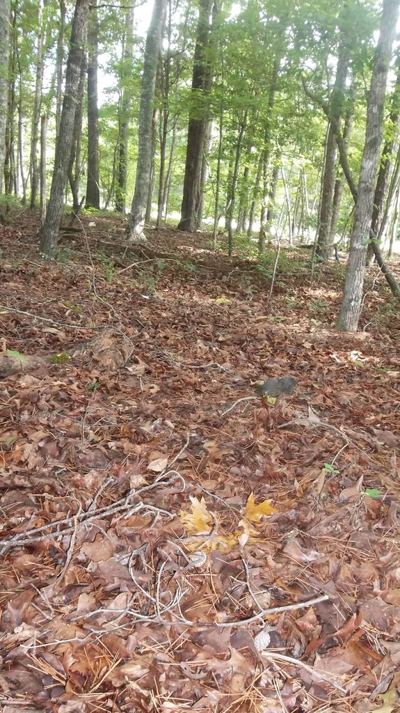
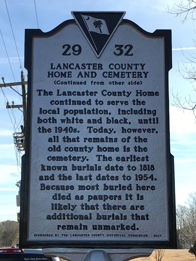
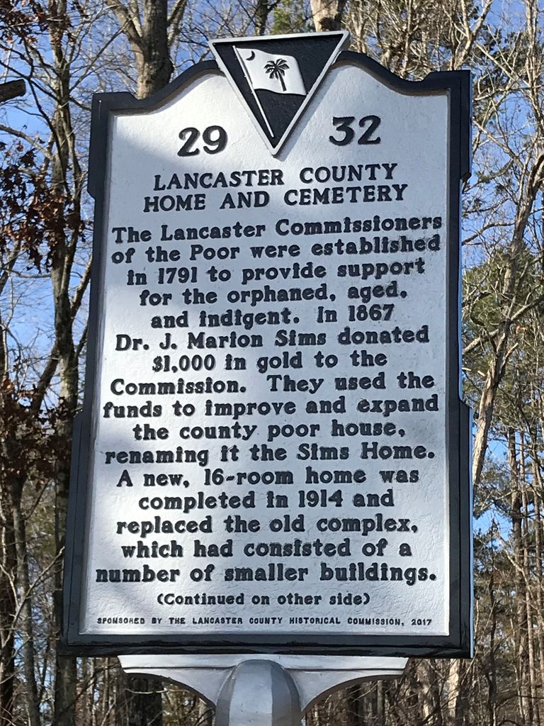
| Description | : | This is an inactive cemetery - all burials are Unmarked. The cemetery was also referred to as "Potter's Field". Last known burials took place in 1943. ============================================= The Lancaster County Home was also known as "County Poor House" and "Sims House". The home was used for homeless, aged persons without means, invalids and orphans. On February 19, 1791 the SC legislature passed an act setting up Commissions of the Poor in districts which as yet had no count courts. The number of commissioners were not to exceed five. On November 20, 1817, the Board of Commissioners of the Poor for Lancaster... Read More |
frequently asked questions (FAQ):
-
Where is County Home Cemetery?
County Home Cemetery is located at Location: Pageland Hwy - Corner of Hwy 9 & Old Dixie School Road Lancaster, Lancaster County ,South Carolina , 29720USA.
-
County Home Cemetery cemetery's updated grave count on graveviews.com?
0 memorials
-
Where are the coordinates of the County Home Cemetery?
Latitude: 34.7232400
Longitude: -80.7258500
Nearby Cemetories:
1. Centenniel A.M.E. Zion Church Cemetery
Lancaster, Lancaster County, USA
Coordinate: 34.7082970, -80.7257430
2. Gills Creek Cemetery
Lancaster County, USA
Coordinate: 34.7300000, -80.7047000
3. Pleasant Dale Baptist Church Cemetery
Pleasant Dale, Lancaster County, USA
Coordinate: 34.7319740, -80.6920230
4. Saint Paul Methodist Cemetery
Lancaster, Lancaster County, USA
Coordinate: 34.7231800, -80.7654770
5. Clinton Memorial Cemetery
Lancaster, Lancaster County, USA
Coordinate: 34.7268982, -80.7671967
6. Fellowship Bible Church
Lancaster, Lancaster County, USA
Coordinate: 34.6914920, -80.7422720
7. Olde Presbyterian Church Cemetery
Lancaster, Lancaster County, USA
Coordinate: 34.7168999, -80.7735977
8. First Presbyterian Church of Lancaster Columbarium
Lancaster, Lancaster County, USA
Coordinate: 34.7278800, -80.7756800
9. Witherspoon Cemetery
Lancaster, Lancaster County, USA
Coordinate: 34.7229170, -80.7768560
10. West Side Cemetery
Lancaster, Lancaster County, USA
Coordinate: 34.7216988, -80.7774963
11. Shaver Family Cemetery
Elgin, Lancaster County, USA
Coordinate: 34.6794680, -80.7173810
12. Camp Creek Baptist Church Cemetery
Lancaster, Lancaster County, USA
Coordinate: 34.7592720, -80.6943690
13. Antioch Baptist Church Cemetery
Antioch, Lancaster County, USA
Coordinate: 34.7053185, -80.6746674
14. Saint Luke UMC Cemetery
Lancaster, Lancaster County, USA
Coordinate: 34.6728310, -80.7204780
15. Zion United Methodist Church Cemetery
Lancaster, Lancaster County, USA
Coordinate: 34.7734060, -80.7377770
16. Christ Episcopal Church Cemetery
Lancaster, Lancaster County, USA
Coordinate: 34.7245950, -80.7988530
17. Lancaster Memorial Park
Lancaster, Lancaster County, USA
Coordinate: 34.7016983, -80.7944031
18. Deliverance Church of God in Jesus Christ
Lancaster County, USA
Coordinate: 34.7754480, -80.7677200
19. Hopewell United Methodist Church Cemetery
Lancaster, Lancaster County, USA
Coordinate: 34.7385150, -80.6498510
20. New Hope AME Zion Church Cemetery
Lancaster, Lancaster County, USA
Coordinate: 34.7569220, -80.6586460
21. Mount Calvary AME Zion Church Cemetery
Lancaster County, USA
Coordinate: 34.6586740, -80.7130700
22. Mount Tabor AME Zion Church Cemetery
Lancaster County, USA
Coordinate: 34.7772250, -80.7721730
23. Mahaffey Hill Baptist Church
Lancaster County, USA
Coordinate: 34.7108510, -80.8066430
24. Mount Nebo AME Zion Church
Lancaster, Lancaster County, USA
Coordinate: 34.7905820, -80.7134230